| Main | Births etc |
|---|
| Battle | |
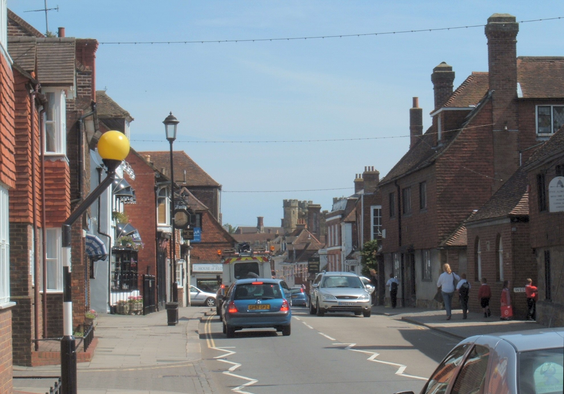 View along the high street towards the abbey |
|
Battle | |
| Area | [1] |
|---|---|
| Population | 6,171 (2007)[1] |
| - Density | |
| OS grid reference | |
| - London | 48 miles (77 km) NNW |
| District | Rother |
| Shire county | East Sussex |
| Region | South East |
| Country | England |
| Sovereign state | United Kingdom |
| Post town | BATTLE |
| Postcode district | TN33 |
| Dialling code | 01424 |
| Police | Sussex |
| Fire | East Sussex |
| Ambulance | South East Coast |
| EU Parliament | South East England |
| UK Parliament | Bexhill and Battle |
| Website | Town Council |
| List of places: UK • England • East Sussex | |
Battle is a small town and civil parish in the local government district of Rother in East Sussex, England. It lies 49 miles (79 km) south southeast of London, 28.5 miles (46 km) east of Brighton and 21 miles (34 km) east of the county town of Lewes. Nearby towns include Hastings to the southeast and Bexhill-On-Sea to the south. Battle is where British rock band Keane originated.
It is the site of the Battle of Hastings, where William, Duke of Normandy, defeated King Harold II to become William I in 1066. The population of the civil parish was 6,048 according to the 2001 census. Battle has two senior schools, Claverham and Battle Abbey.
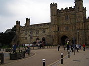
The Abbey[]

Battle Abbey
Battle Abbey was founded to commemorate the battle, and dedicated in 1095. The high altar of the Abbey church was reputedly on the spot where Harold died. The Abbey gateway is still the dominant feature of the south end of the main street, although little remains of the rest of the Abbey buildings. The remaining cloisters, part of the west range, were leased to Battle Abbey School shortly after World War I, and the school remains in occupancy to this day.
The abbey at Battle has been known for centuries as Battle Abbey. It and the abbey church were initially dedicated to Saint Martin, sometimes known as "the Apostle of the Gauls", and named in his honour.
The town[]


A modern shopping development designed to blend in with the town.
The town of Battle was gradually built around the Abbey, and later developed a reputation for the quality of the gunpowder produced in the area. In the mid 18th century, the town supported five watchmakers in the High Street. Today, Battle is known as a tourist destination.
The local bonfire society, Battel Bonfire Boyes, is claimed to be the oldest of the Sussex Bonfire Societies[2]. The importance of Bonfire Night in Battle is that it is located in the wooded Weald of Sussex. Most of the area was heavily wooded, which provided oak and other timbers for Navy Shipyards, power for making cannons (shipped to Portsmouth or Chatham), cannon balls and gunpowder.
Battle was a refuge in World War I, and tunnels still exist, leading from various fields and cellars to Battle Abbey itself. However, they are deemed unsafe and are now closed.
Gunpowder works[]
The first gunpowder mill in Battle was built in 1676 when John Hammond was granted permission to build a mill on land owned by the Abbey. A gunpowder works was located in Powdermill Lane - the remains of which have been converted into a hotel. In 1722 Daniel Defoe described the town as being "remarkable for little now, but for making the finest gun-powder, and the best perhaps in Europe".[3] The Duke of Cleveland refused to renew the licence in 1847 after many mishaps[4], including one occasion in 1798 on which more than 15 tonnes of gunpowder were left in the oven for too long and exploded.
Governance[]
Battle is governed at the lowest level by Battle Town Council, consisting of seventeen elected councillors who meet on the third Tuesday of each month. The council is responsible for street lighting, allotments and recreational areas. It provides a local voice to the district and county councils.[5] The council is split into four wards: Marley, Netherfield, Telham and Watch Oak. Marley ward was the only one of these contested in the 2007 election.[6] The vacant seats in the remaining wards have subsequently been filled by co-option.
Rother District council provides the next level of government with services such as refuse collection, planning consent, leisure amenities and council tax collection. The parish of Battle falls within three wards. The main town of Battle makes up Battle town ward. The south eastern area of the parish, which includes the village of Telham, lies within Crowhurst ward. The north western area, which includes the village of Netherfield, lies within Darwell ward. Crowhurst ward provides a single councillor, the other two wards provide two councillors to Rother District council. In the May 2007 election, Battle town ward elected two Liberal Democrats[7], Darwell ward elected one Conservative and one independent councillor.[8] Crowhurst ward was won by the Conservative candidate.[9]
East Sussex county council is the third tier of government, providing education, libraries and highway maintenance. Battle falls within the Battle and Crowhurst ward. Kathryn Margaret Field, Liberal Democrat, was elected in the May 2005 election with 48.8% of the vote.[10]
The UK Parliament constituency for Battle is Bexhill and Battle. Gregory Barker was re-elected in the May 2005 election. Gregory Barker was then re-elected in the May 6th 2010 election, in which the Conservative party now covers the whole of East Sussex, except for Lewes and Eastbourne, which are both Liberal Democrat, and Brighton Pavilion, which is Green.
At European level, Battle is represented by the South-East region, which holds ten seats in the European Parliament. The June 2004 election returned four Conservatives, two Liberal Democrats, two UK Independence, one Labour and one Green, none of whom lives in East Sussex.[11]
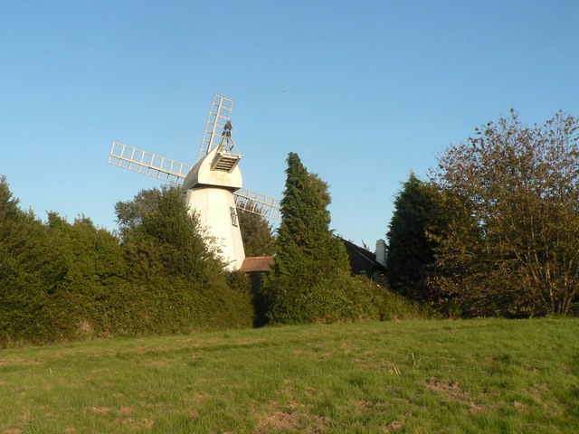
Landmarks[]

The windmill
Telham Hill is c. one mile south-east of Senlac Hill, in East Sussex, England. It was from Telham Hill that William the Conqueror's army first caught sight of the English army forming up on Senlac Hill, for the battle of Hastings, 14 October 1066.
There are three Sites of Special Scientific Interest within the parish.
Blackhorse Quarry, a site of palaeontological interest which has produced many fossil bones and teeth including Iguanodon and crocodiles.[12]
Hemingfold Meadow is a site of biological interest consisting of two meadows with nationally rare grassland species.[13]
Darwell Wood is partially within the parish which is another site of biological importance as an example of hornbeam coppice with oak standards.[14]
Transport[]
Battle is linked to Hastings and London by the A2100 (A21). This section of the A2100 was the original A21.
Battle railway station (designed by William Tress) lies on the Hastings Line, north of Crowhurst and south of Robertsbridge. There was once a station known as Mountfield Halt between Battle and Robertsbridge but this closed on 6 October 1969.
The station is managed by and the services are provided by Southeastern.
Sources[]
- ^ a b "East Sussex in Figures". East Sussex County Council. http://www.eastsussexinfigures.org.uk/webview/. Retrieved 26 April 2008.
- ^ Battel Bonfire Boyes
- ^ Defoe, Daniel (1959). A tour through England and Wales. J.M. Dent and Sons Ltd, London. http://www.visionofbritain.org.uk/text/chap_page.jsp?t_id=Defoe&c_id=7&cpub_id=0#pn_48.
- ^ Guy Fawkes
- ^ "About Battle Town Council". Battle Town Council. http://212.104.140.187/index.cfm?articleid=2378. Retrieved 24 November 2008.
- ^ "Declaration of Result of Poll—Battle Town Council Marley Ward". Rother District Council. 5 May 2005. http://www.rother.gov.uk/index.cfm?articleid=2866. Retrieved 20 November 2008.
- ^ "Declaration of Result of Poll—Battle town". Rother District Council. 5 May 2005. http://www.rother.gov.uk/index.cfm?articleid=2845. Retrieved 20 November 2008.
- ^ "Declaration of Result of Poll—Darwell". Rother District Council. 5 May 2005. http://www.rother.gov.uk/index.cfm?articleid=2854. Retrieved 20 November 2008.
- ^ "Declaration of Result of Poll—Crowhurst". Rother District Council. 5 May 2005. http://www.rother.gov.uk/index.cfm?articleid=2857. Retrieved 24 November 2008.
- ^ "County Council election". Rother District Council. 5 May 2005. http://www.eastsussex.gov.uk/yourcouncil/localelections/electionmap/results.aspx#battlecrowhurst. Retrieved 19 November 2008.
- ^ "UK MEP's". UK Office of the European Parliament. http://www.europarl.org.uk/uk_meps/MembersMain.htm. Retrieved 25 January 2007.
- ^ "Natural England - SSSI (Blackhorse Quarry)". English Nature. http://www.english-nature.org.uk/special/sssi/sssi_details.cfm?sssi_id=1005748. Retrieved 3 October 2008.
- ^ "Natural England - SSSI (Heingfold Meadow)". English Nature. http://www.english-nature.org.uk/special/sssi/sssi_details.cfm?sssi_id=1001586. Retrieved 3 October 2008.
- ^ "Natural England - SSSI (Darwell Wood)". English Nature. http://www.english-nature.org.uk/special/sssi/sssi_details.cfm?sssi_id=1002162. Retrieved 3 October 2008.
See also[]
External links[]
| |||||||||||
| ||||||||||||||||||||
| This page uses content from the English language Wikipedia. The original content was at Battle, East Sussex. The list of authors can be seen in the page history. As with this Familypedia wiki, the content of Wikipedia is available under the Creative Commons License. |