| Main | Births etc |
|---|
| Burleigh Heads Gold Coast, | |||||||||||||
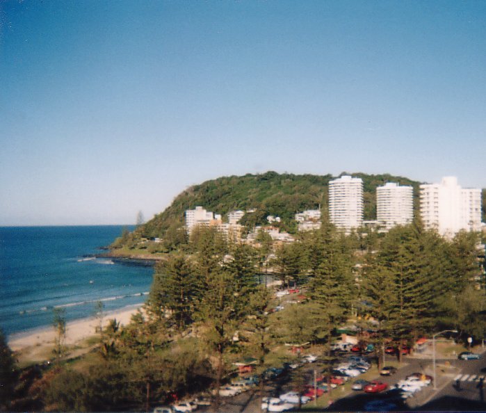 View of Burleigh Heads from the north of the headland | |||||||||||||
| Population: | 9,188 (2011) [1] | ||||||||||||
| Postcode: | 4220 | ||||||||||||
| LGA: | Gold Coast City | ||||||||||||
| State District: | Burleigh | ||||||||||||
| Federal Division: | McPherson | ||||||||||||
| |||||||||||||
Burleigh Heads is a suburb on the Gold Coast in Queensland, Australia. At the 2011 Census, Burleigh Heads had a population of 9,188.
Burleigh Heads is renowned for its surf break, and is an alternative to the more tourist ridden towns of the Gold Coast. The centre of neighborhood is James Street, a village consisting of cafes, delis, hairdressers, retailers, chemists, restaurants and charity stores.
The suburb boundary extends as far north as Miami Headland, Miami, and as far south as Tallebudgera Creek, Palm Beach. To the west, is the township of West Burleigh, with its shopping mecca, and thriving industrial area, and Burleigh Waters, a quiet suburbia, beautified by a man made lake and many council parks and gardens.
The headland of Burleigh, locally known as "The Point", is a favourite for weekend barbecues, cricket, and if the surf is up, spectators appear. On a Sunday afternoon, the local musicians and fire-twirlers come out to the park beside Burleigh SLSC for a jam and dance session.
History[]

View of Burleigh Heads c.1940
The northern section appears to have been subdivided by the mid 1950s, but was the site of extensive sand mining in the following decades. The broad beachfront park is a legacy of that activity.
Burleigh township itself is much older and was the site of early development including restaurants and guest houses to support the increasing interest in bathing that took place in the last years of the 19th century and the first of the 20th century. It has been the centre of beach activities for many years.
Geology[]
The area of Burleigh Head was formed between 20 and 23 million years ago from molten lava due to numerous eruptions of Mount Warning. Flowing lava reached the shore in the area to form Burleigh headland and Point Danger.[2]
Schools[]
There are several schools servicing the Burleigh area including two state primary schools, Caningeraba State School located in Burleigh Waters and Burleigh Heads State School. Burleigh Heads State School was established in 1917 as the Burleigh School, with its name changed to Burleigh Heads State School in 1927. It moved to its present site on the Lower Gold Coast Highway, Burleigh Heads, in 1935.
There are no state high schools in Burleigh Heads with students attending Miami State High School or Elanora State High School.
The largest school in the area is Marymount College, a catholic day school educating both boys and girls from Prep to Year 12. The school has over 2000 students combined across the two campuses, Primary and Secondary, which are located on the corner of West Burleigh Rd and Bermuda St, Burleigh Waters.

Burleigh Heads and Tallebudgera Creek from south of the headland
Burleigh beach[]
The north-east facing beach is protected by the point to the south and offers one of the best swimming, body boarding and surfing beaches on the Gold Coast. A mature stand of Norfolk Island Pines — reputably some of the earliest planted at the coast — form an attractive backdrop and are home to native birds.
Events[]
Burleigh Heads State School is home to The Village Markets.[3] A bi-monthly event that promotes local emerging designers and artists.
Surfing[]
The Quiksilver Pro is often contested at Burleigh Heads when the surf is not contestable at Kirra or Snapper Rocks. The Breaka Burleigh Pro and many other amateur and junior events are also contested each year.
Landmarks[]
- The David Fleay Wildlife Park
- Aboriginal Bora Ring
- Burleigh Head National Park
Sport[]
- Rugby league club - Burleigh Bears
- AFL club - Burleigh Bombers Australian Football Club
- Cricket club - Bullsharks
- Soccer club - Bulldogs
See also[]
- List of Gold Coast suburbs
References[]
- ^ Australian Bureau of Statistics (31 October 2012). "Burleigh Heads (State Suburb)". 2011 Census QuickStats. http://www.censusdata.abs.gov.au/census_services/getproduct/census/2011/quickstat/SSC30272?opendocument&navpos=220. Retrieved 5 April 2013.
- ^ Burleigh Head National Park: Nature, culture and history. Department of National Parks, Recreation, Sport and Racing. Retrieved 5 April 2013.
- ^ Burleigh Tourism Events.
External links[]
| |||||
| This page uses content from the English language Wikipedia. The original content was at Burleigh Heads, Queensland. The list of authors can be seen in the page history. As with this Familypedia wiki, the content of Wikipedia is available under the Creative Commons License. |