| ||||||||||||||
| Cavalier County, North Dakota | |
 Location in the state of North Dakota | |
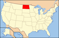
 North Dakota's location in the U.S. | |
| Founded | 1879 |
|---|---|
| Seat | Langdon |
| Area - Total - Land - Water |
1,510 sq mi (3,911 km²) 1,488 sq mi (3,854 km²) 22 sq mi (57 km²), 1.44% |
| Population - (2000) - Density |
4,831 3/sq mi (1/km²) |
Cavalier County is a county located in the U.S. state of North Dakota. As of 2000, the population is 4,831. Its county seat is Langdon6. The city of Cavalier is in nearby Pembina County. The county was created by the 1879 territorial legislature and named for Charles Cavaleer of Pembina, North Dakota ( 1818-1902 ), one of the earliest white settlers. There is no explanation for the difference in the spelling of "Cavalier". The county was organized on July 8, 1884 and Langdon became the county seat.
History[]
Cavalier County was created from the western part of Pembina County in 1873 and named by the Territorial Legislature for Charles Cavileer, a well know fur trader, customs agent and postmaster. The spelling has always been Cavalier.
After petitioning the Territorial Governor for permission to organize the county, Patrick McHugh, W. Hudson Matthews, and L.C. Noracong met for the purpose on July 8, 1884. On July 2,6 the new county officials met for the second time and chose Noracong as Chairman of the Board with William H. Doyle and Matthews as Commissioners. The first Register of Deeds and County Clerk was McHugh. W.J. Mooney became the first Judge of Probate, Charles B. Nelson was the first Cavalier County Supt. of Schools, and Clarence Hawkes the first Sheriff.
The site of the new county seat was chosen at this meeting and named Langdon for Robert Bruce Langdon of Minnesota, a federal railroad official who never visited the town.
Fifteen townships from Pembina County were added to Cavalier County by vote of their residents in May 1885. A census taken at that time revealed 5,029 residence living in nine large townships. The nine townships names used in 1885 are still used. The current boundaries and township names were standardized in 1906.
The first court house was built in the fall of 1884 at a cost of $360.00. It was used briefly and then abandoned for warmer and more centrally located quarters in a downtown bank. A large brick court house was built in 1895 on the present site at a contract cost of $9,099.00. This building served county officials until the current court house was constructed in 1957-58.
Geography[]
According to the U.S. Census Bureau, the county has a total area of 3,911 km² (1,510 sq mi). 3,855 km² (1,488 sq mi) of it is land and 56 km² (22 sq mi) of it (1.44%) is water.
Townships[]
|
|
|
Adjacent counties[]
- Manitoba, Canada (north)
- Pembina County (east)
- Walsh County (southeast)
- Ramsey County (south)
- Towner County (west)
Major highways[]
Demographics[]
As of the census2 of 2000, there were 4,831 people, 2,017 households, and 1,361 families residing in the county. The population density was 1/km² (3/sq mi). There were 2,725 housing units at an average density of 1/km² (2/sq mi). The racial makeup of the county was 98.10% White, 0.14% Black or African American, 0.52% Native American, 0.10% Asian, 0.10% from other races, and 1.03% from two or more races. 0.64% of the population were Hispanic or Latino of any race.
There were 2,017 households out of which 27.50% had children under the age of 18 living with them, 60.80% were married couples living together, 3.80% had a female householder with no husband present, and 32.50% were non-families. 30.80% of all households were made up of individuals and 17.00% had someone living alone who was 65 years of age or older. The average household size was 2.34 and the average family size was 2.93.
In the county the population was spread out with 24.60% under the age of 18, 3.70% from 18 to 24, 21.30% from 25 to 44, 27.50% from 45 to 64, and 22.90% who were 65 years of age or older. The median age was 45 years. For every 100 females there were 98.90 males. For every 100 females age 18 and over, there were 97.60 males.
The median income for a household in the county was $31,868, and the median income for a family was $39,601. Males had a median income of $28,886 versus $19,647 for females. The per capita income for the county was $15,817. About 7.80% of families and 11.50% of the population were below the poverty line, including 16.60% of those under age 18 and 11.90% of those age 65 or over.
Places[]
Cities[]
Note: all incorporated communities in North Dakota are called "cities" regardless of their size.
| |||||||||||||||||||||||
| This page uses content from the English language Wikipedia. The original content was at Cavalier County, North Dakota. The list of authors can be seen in the page history. As with this Familypedia wiki, the content of Wikipedia is available under the Creative Commons License. |