| Claremore, Oklahoma | |
|---|---|
| — City[1][2] — | |
 |
|
| Motto: "New Vision. Clear Opportunities." | |
 |
|
 <div style="position: absolute; top: Expression error: Missing operand for *.%; left: 212.7%; height: 0; width: 0; margin: 0; padding: 0;">
Claremore, Oklahoma |
|
| Country | United States |
| State | Oklahoma |
| County | Rogers |
| Incorporated | 1883 |
| Government | |
| • Mayor | Bill Flanagan |
| Area[3] | |
| • City[1][2] | 15.07 sq mi (39.04 km2) |
| • Land | 14.81 sq mi (38.36 km2) |
| • Water | 0.26 sq mi (0.67 km2) |
| Elevation | 597 ft (182 m) |
| Population (2010) | |
| • City[1][2] | 18,581 |
| • Estimate (2018)[4] | 18,766 |
| • Density | 1,266.86/sq mi (489.15/km2) |
| • Metro | 905,755 |
| Time zone | CST (UTC-6) |
| • Summer (DST) | CDT (UTC-5) |
| ZIP codes | 74017, 74018, 74019 |
| Area code(s) | 539/918 |
| FIPS code | 40-14700[5] |
| GNIS feature ID | 1091382[6] |
| Website | www.claremorecity.com |
Claremore is a city in and the county seat of Rogers County in northeastern Oklahoma, United States.[7] The population was 18,581 at the 2010 census, a 17.1 percent increase from 15,873 at the 2000 census.[8] Located in the Ozark Mountains foothills, the city is part of the Tulsa Metropolitan Area and home to Rogers State University. It is best known as the birthplace and home of early 20th-century entertainer Will Rogers.
This area was part of the territory of the Osage, but they were forced out under a treaty with the United States. During the Indian Removal period and until statehood, this area was a reserve of the Cherokee Nation, which had been removed from its territory in the Southeast United States. This was within what was known as the Cherokee Cooweescoowee District.
History[]


The Will Rogers Memorial overlooks Claremore's position in the foothills of the Ozark Mountains.
Around 1802, bands of Osage Indians settled in this area of what is now northeastern Oklahoma. Black Dog was the chief of a band that settled at Pasona, where the city of Claremore later developed. He shared power with chiefs Clermont (aka Claremore), and Pawhuska. Clermont, named by French traders, settled with his band in a village known as Pasuga, meaning "Big Cedar", which was located on an ancient platform earthwork mound in this area.
The Osage village of Pasuga was destroyed by Cherokee in June 1817, during the Battle of Claremore Mound, also known as the Battle of the Strawberry Moon.[9][10] These Western Cherokee had moved into the region from the southeastern United States and were perpetually competing with the Osage, who looked down on them. At the time of the attack, most of the men were out of the villages to hunt bison on the plains. The Cherokee killed the men in the village, and took more than 100 women and children captive, selling them to eastern Cherokee. Accounts differ as to whether chief Clermont was killed in the raid.
After the Indian Removal Act of 1830 was passed by Congress, this area was designated as part of Indian Territory and the Cherokee Nation were assigned much of this territory. Claremore and the mound ere within a part of the Cooweescoowee District in the northwestern part of the Cherokee Nation.
The Rogers family, for whom the county is named, were among the first European-American settlers. Clem Rogers, father of the famous entertainer Will Rogers, moved to the county in 1856. He acquired lands for his Dog Iron Ranch that eventually consisted of more than 60,000 acres (240 km2). The Clem Rogers home (Will Rogers' birthplace), still stands outside Oologah, and is considered an important historical site.[lower-alpha 1] Clem Rogers was a major advocate of Oklahoma statehood; he was the oldest delegate to the state's Constitutional Convention in 1907 at age 69. He and other members of his family were buried at the Will Rogers Memorial.
A post office was established on June 25, 1874. The coming of railways to Indian Territory was the driving factor in Claremore's early growth. Two early lines intersected in the center of town. The town changed the spelling of its name from Clermont to Claremore on September 19, 1882. A clerk recording the town as having a post office had spelled the name incorrectly, and it stuck. The city was incorporated in the Cherokee Nation on May 2, 1903.[10] Claremore's newspaper, the Claremore Daily Progress, was founded in 1893 by cowboy Joe Klein and is still published daily. It is the oldest business in Rogers County.
Claremore's growth was aided by the popularity of sulphur springs among Americans in the late 19th and early 20th centuries. They believed bathing in such springs to have medical benefits. George Eaton had settled with his family in the Claremore area in 1874, and conducted farming and cattle raising. He later branched into the mercantile business, real estate, and oil exploration. While drilling just east of Claremore in 1903, Easton struck an underground pool of water that smelled of sulfur. Local physician Dr. W. G. Williams tested the water and marketed it as a cure. Known as "Radium Water", it contained no radium, but hydrogen sulfide and sulfur compounds that were believed to make it medically useful. Eaton built a bath house and promoted the pool area as Radium Town.[12] Radium Town was centered on 9th Street between Seminole and Dorothy. Bath houses were built by promoters all over this area of Claremore, and for a time attracted travelers and tourists for the waters. Only one was still standing as of 2008.[13] Claremore's first hospital was established in the early 1900s along what is now known as Will Rogers Boulevard, or Oklahoma State Highway 20. The building is standing but has been abandoned and boarded up.
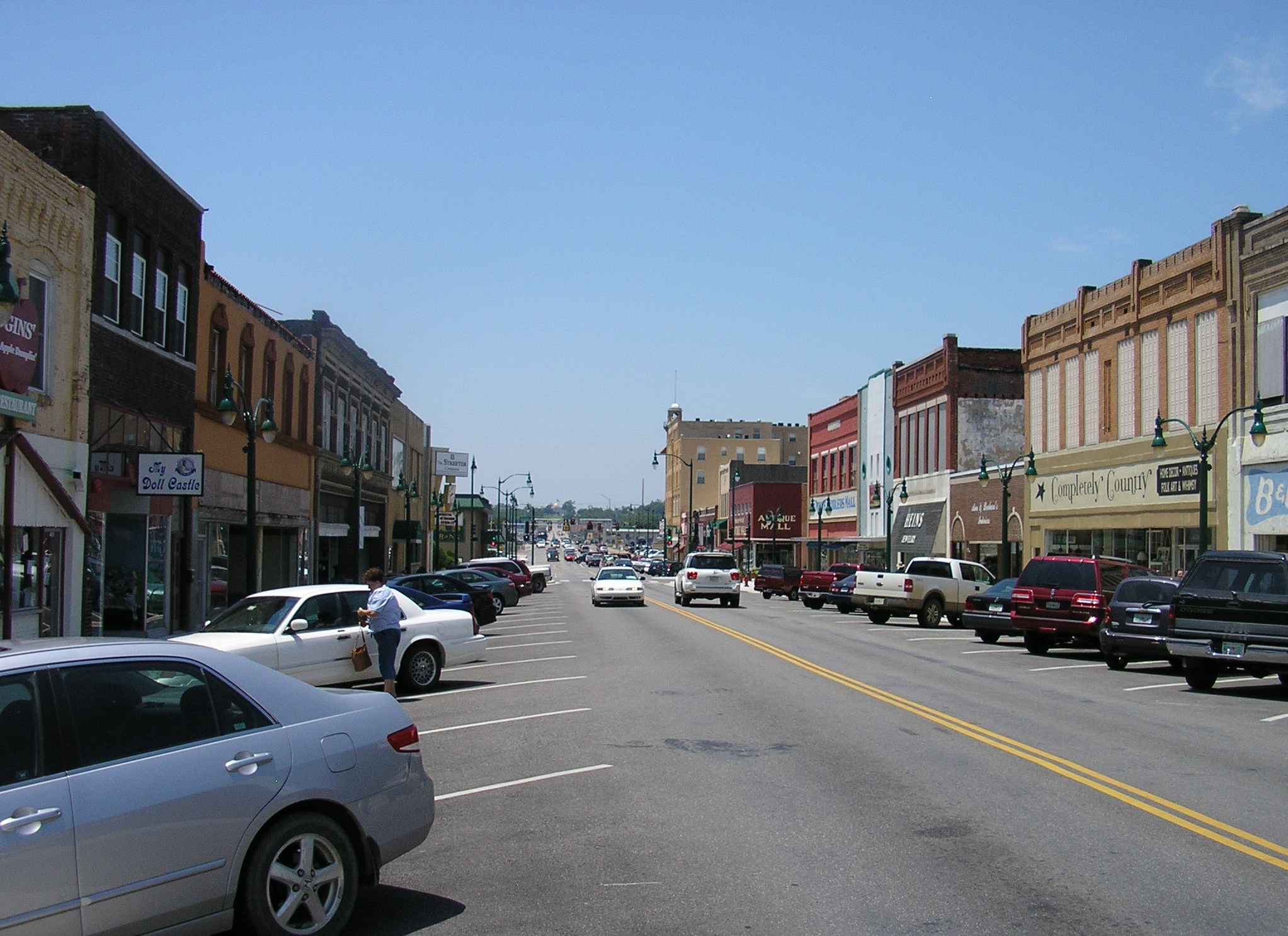
The city has many historic homes and other buildings, with several located in the old business district. In 2002, Claremore received a grant from the state's Oklahoma Main Street program to redevelop its business district with improved urban design and enhancement of historic properties. Renovation work on the downtown was completed in 2007.
In popular culture[]
The Rodgers and Hammerstein musical Oklahoma! is set in Claremore and the surrounding area, in 1906 (the year before Oklahoma became a State). The Quantum Leap (TV series) episode "8½ Months" is also set near Claremore. The movie Where the Heart Is starring Natalie Portman and Ashley Judd fictionally portrays Rogers County and the area surrounding Claremore.
Geography[]
Claremore is located at (36.315181, -95.612784).[14] According to the United States Census Bureau, the city has a total area of 12.3 square miles (32 km2), of which, 12.0 square miles (31 km2) of it is land and 0.2 square miles (0.52 km2) of it (1.96%) is water.
The city is located in Green Country, a popular nickname for northeast Oklahoma that stems from the region's green vegetation and relatively high number of hills and lakes compared to central and western areas of Oklahoma.[15] Claremore lies near the Verdigris River with undulating terrain producing hills and valleys. The city's primary water sources are Claremore and Oologah Lake, both within the drainage basin of the Verdigris River.
Climate[]
Claremore experiences a humid subtropical climate with cold winters and hot summers.
| Climate data for Claremore, Oklahoma | |||||||||||||
|---|---|---|---|---|---|---|---|---|---|---|---|---|---|
| Month | Jan | Feb | Mar | Apr | May | Jun | Jul | Aug | Sep | Oct | Nov | Dec | Year |
| Average high °F (°C) | 44.8 (7.1) |
50.3 (10.2) |
60.2 (15.7) |
71.2 (21.8) |
78.3 (25.7) |
86.3 (30.2) |
92.8 (33.8) |
92.0 (33.3) |
83.6 (28.7) |
73.6 (23.1) |
60.5 (15.8) |
48.8 (9.3) |
70.2 (21.2) |
| Average low °F (°C) | 21.2 (−6.0) |
26.1 (−3.3) |
35.7 (2.1) |
46.8 (8.2) |
55.7 (13.2) |
64.9 (18.3) |
69.5 (20.8) |
67.3 (19.6) |
60.4 (15.8) |
47.2 (8.4) |
36.5 (2.5) |
26.0 (−3.3) |
46.4 (8.0) |
| Precipitation inches (mm) | 1.6 (41) |
2.0 (51) |
3.6 (91) |
3.6 (91) |
4.6 (117) |
4.6 (117) |
3.0 (76) |
3.1 (79) |
4.5 (114) |
3.6 (91) |
3.2 (81) |
2.2 (56) |
39.4 (1,001) |
| Source #1: weather.com | |||||||||||||
| Source #2: Weatherbase.com [16] | |||||||||||||
Transportation[]

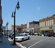
Downtown Claremore
Claremore is a major intersection of heavily traveled highways. Interstate 44 crosses the city to its southeast. State Highway 66 (historic US-66) was designated along one of the main east-west roads of the city. he town. State Highway 88 and State Highway 20 intersect within the city limits.
Two railroads, the St. Louis, Iron Mountain, and Southern Railway (now controlled by Union Pacific) and the St. Louis-San Francisco Railway or "Frisco" (now controlled by BNSF), intersect in Claremore. The traffic problems resulting from the intersection of two major national rail lines has led to discussion among city officials about how best to improve traffic flow.
Demographics[]
| Historical populations | |||
|---|---|---|---|
| Census | Pop. | %± | |
| 1900 | 855 | ||
| 1910 | 2,866 | 235.2% | |
| 1920 | 3,435 | 19.9% | |
| 1930 | 3,720 | 8.3% | |
| 1940 | 4,134 | 11.1% | |
| 1950 | 5,494 | 32.9% | |
| 1960 | 6,639 | 20.8% | |
| 1970 | 9,084 | 36.8% | |
| 1980 | 12,085 | 33.0% | |
| 1990 | 13,280 | 9.9% | |
| 2000 | 15,873 | 19.5% | |
| 2010 | 18,581 | 17.1% | |
| Est. 2018 | 18,766 | [4] | 18.2% |
| Sources:[5][17][18][2][19][20] | |||
As of the census[5] of 2000, there were 15,873 people, 6,283 households, and 4,165 families residing in the city. The population density was 1,319.4 people per square mile (509.4/km²). There were 6,784 housing units at an average density of 563.9 per square mile (217.7/km²). The racial makeup of the city was 75.69% White, 1.99% African American, 14.31% Native American, 0.44% Asian, 0.03% Pacific Islander, 1.12% from other races, and 6.42% from two or more races. Hispanic or Latino of any race were 3.02% of the population.
There were 6,283 households out of which 33.6% had children under the age of 18 living with them, 49.6% were married couples living together, 12.4% had a female householder with no husband present, and 33.7% were non-families. 29.7% of all households were made up of individuals and 13.8% had someone living alone who was 65 years of age or older. The average household size was 2.43 and the average family size was 3.02.
In the city, the population was spread out with 26.7% under the age of 18, 9.0% from 18 to 24, 27.6% from 25 to 44, 19.8% from 45 to 64, and 16.9% who were 65 years of age or older. The median age was 36 years. For every 100 females, there were 89.5 males. For every 100 females age 18 and over, there were 86.1 males.
The median income for a household in the city was $34,547, and the median income for a family was $45,810. Males had a median income of $36,227 versus $21,742 for females. The per capita income for the city was $17,853. About 8.9% of families and 11.9% of the population were below the poverty line, including 15.4% of those under the age of 18 and 15.0% of those 65 and older.
Education[]

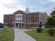
Stratton Taylor Library at Rogers State University.
Claremore is home to the main campus of Rogers State University, which grants a master's degree and bachelor's and associate's degrees. The university serves more than 4,300 students. It is the only public four-year university in the Tulsa Metropolitan Area.
Claremore is also home to Northeast Technology Center, a vocational training campus which serves over 200 students and offers both full-time and short-term classes.[21]
Public school districts serving Claremore are the Claremore Independent School District and Sequoyah Public Schools (named for the Cherokee man who developed the written Cherokee language in the early 19th century). CISD consists of Claremore High School, Will Rogers Junior High, Catalayah Elementary, Westside Elementary, Claremont Elementary, Stuart Roosa Elementary, and the Alternative Learning Center.[22] Sequoyah Public Schools consists of Sequoyah High School, Sequoyah Mid High School, Sequoyah Junior High School, and Sequoyah Elementary School.[23]
The first school in the Claremore area was opened to students in 1870. Claremore's first major high school was built in 1919; it was the most expensive public school building in the state of Oklahoma at the time. The building was used as a school for almost 80 years, until 1999. The increasing costs of maintenance of the old building forced its closure.
Economy[]
Claremore's economy is diversified. Baker Hughes, an oil field services company, has a large presence in the city. Together with several other large companies, it is located in Claremore Industrial Park. This is only a few miles from the Tulsa Port of Catoosa, located on the Verdigris and Arkansas rivers. Coal mining is also an important industry; strip-style mines are operating on both the north and south sides of the town.
Media[]
Claremore has a popular website called moreClaremore.com, which focuses on positive community journalism. It was launched in April 2013 and centers on community events, local businesses, people, and schools. It also features the central community calendar for the area. The site has an average 40,000 visitors per month and has an active social media presence, with more than 29,000 followers on Facebook. Claremore's daily newspaper (and one of the oldest ongoing businesses in the county) is the Claremore Daily Progress, first published as a weekly in 1892 and as a daily in 1893.[24]
Attractions[]


J.M. Davis Arms & Historical Museum
- J. M. Davis Arms and Historical Museum
- Will Rogers Memorial Museum
- Will Rogers Downs
- Oklahoma Military Academy Museum[25]
- Claremore Museum of History
- The Historic Belvidere Mansion
National Register of Historic Places[]
- The Belvidere Mansion - the 1907 Victorian-style built by the Bayless family (John M and Mary Bayless) who moved to Indian Territory from Cassville, Missouri. Much of the trim and woodwork used in the mansion were brought from the 1904 World's Fair in St. Louis.
- Claremore Auto Dealership - now called "Claremore Tire," an old auto dealer in the central business district
- Eastern University Preparatory School - administration building of Rogers State University
- Mendenhall's Bath House - a historic building in "Radium Town"
- Maurice Meyer Barracks - a building on the campus of Rogers State University, contains OMA Museum
- Will Rogers Hotel - a hotel in downtown Claremore, now renovated for usage as apartments for senior citizens
Notable people[]
- Levy Adcock, football player
- Brad Carson, former U.S. Congressman[26]
- Rotnei Clarke, basketball player
- Patti Page, singer and entertainer
- Dave Rader, baseball player
- Paul G Buckner, author
- Lynn Riggs, playwright[27]
- Will Rogers, entertainer, comedian, and actor
- Kywin Supernaw, NFL player
- Stuart Roosa, astronaut[28]
- Helen Walton, philanthropist and wife of Walmart founder Sam Walton[29]
- Madison Whitekiller, 2017-18 Miss Cherokee
- Mercedes Lackey, author
Town twinning[]
 Muravlenko[30]
Notes[]
References[]
- ^ luke. "ok.org". luke. http://ok.com. Retrieved 2013.
- ^ a b "Number of Inhabitants: Oklahoma". 18th Census of the United States. U.S. Census Bureau. http://www2.census.gov/prod2/decennial/documents/37749197v1p38ch2.pdf. Retrieved November 22, 2013.
- ^ "2018 U.S. Gazetteer Files". United States Census Bureau. https://www2.census.gov/geo/docs/maps-data/data/gazetteer/2018_Gazetteer/2018_gaz_place_40.txt. Retrieved Feb 12, 2020.
- ^ a b "Population and Housing Unit Estimates". https://www.census.gov/programs-surveys/popest/data/tables.2018.html. Retrieved June 4, 2019.
- ^ a b c "American FactFinder". United States Census Bureau. Archived from the original on September 11, 2013. https://web.archive.org/web/20130911234518/http://factfinder2.census.gov/. Retrieved 2008-01-31.
- ^ "US Board on Geographic Names". United States Geological Survey. 2007-10-25. http://geonames.usgs.gov. Retrieved 2008-01-31.
- ^ "Find a County". National Association of Counties. Archived from the original on May 31, 2011. https://web.archive.org/web/20110531210815/http://www.naco.org/Counties/Pages/FindACounty.aspx. Retrieved 2011-06-07.
- ^ MuniNet Guide:Claremore, Oklahoma Archived January 27, 2012, at the Wayback Machine
- ^ on D. May, "Claremore Mound, Battle of," Encyclopedia of Oklahoma History and Culture Accessed December 31, 2011.
- ^ a b Maxine Bamburg, "Claremore," Encyclopedia of Oklahoma History and Culture. Retrieved December 31, 2011.
- ^ "Will Rogers Memorial Commission Transferred To Oklahoma Historical Society", News on 6, 07 March 2016.] Accessed April 9, 2016.
- ^ Rhea, John M. "Rachel Caroline Eaton: The First Professional Indigenous Woman Historian," in A Field of Their Own: Women and American Indian History, 1830–1941, University of Oklahoma Press, 2016. Partially available on Google Books. Accessed July 24, 2016.
- ^ "Radium Town, the Smell of Success". Claremore Daily Progress. http://moreclaremore.com/2014/01/15/radium-town-smell-success/. Retrieved January 22, 2019.
- ^ "US Gazetteer files: 2010, 2000, and 1990". United States Census Bureau. 2011-02-12. https://www.census.gov/geo/www/gazetteer/gazette.html. Retrieved 2011-04-23.
- ^ Clapman, Leah (2004-09-24). "Key Races: Oklahoma Senate". PBS. https://www.pbs.org/newshour/vote2004/key-races/ok_profile.html. Retrieved 2007-04-30.
- ^ "Historical Weather for Claremore, Oklahoma, United States". http://www.weatherbase.com/weather/weatherall.php3?s=828143&refer=.
- ^ "Population-Oklahoma". U.S. Census 1910. U.S. Census Bureau. http://www2.census.gov/prod2/decennial/documents/36894832v3ch3.pdf. Retrieved November 22, 2013.
- ^ "Population-Oklahoma". 15th Census of the United States. U.S. Census Bureau. http://www2.census.gov/prod2/decennial/documents/03815512v1ch08.pdf. Retrieved November 27, 2013.
- ^ "Oklahoma: Population and Housing Unit Counts". U.S. Census Bureau. https://www.census.gov/prod/cen1990/cph2/cph-2-38.pdf. Retrieved November 22, 2013.
- ^ "Incorporated Places and Minor Civil Divisions Datasets: Subcounty Population Estimates: April 1, 2010 to July 1, 2012". U.S. Census Bureau. Archived from the original on June 17, 2013. https://www.webcitation.org/6HQu4Spqa?url=http://www.census.gov/popest/data/cities/totals/2012/SUB-EST2012.html. Retrieved November 25, 2013.
- ^ "Claremore Campus". Northeast Technology Center. http://www.netech.edu/vnews/display.v/SEC/District%7CCampus%20Locations%3E%3EClaremore%20Campus. Retrieved September 9, 2015.
- ^ "Claremore Public Schools". claremore.k12.ok.us. Archived from the original on August 23, 2015. https://web.archive.org/web/20150823041801/http://www.claremore.k12.ok.us/schools. Retrieved September 9, 2015.
- ^ "SEQUOYAH SCHOOLS". sequoyaheagles.net. http://www.sequoyaheagles.net/vnews/display.v/SEC/Sequoyah%20Schools. Retrieved September 9, 2015.
- ^ Bob Burke; Eric Dabney (2010). HISTORIC ROGERS COUNTY: An Illustrated History. HPN Books. p. 11. ISBN 978-1-935377-11-5. https://books.google.com/books?id=-lXzIfTwYVQC&pg=PA11.
- ^ "OMA Museum". Rogers State University. https://www.rsu.edu/alumni/oklahoma-military-academy/oma-museum/. Retrieved January 10, 2019.
- ^ University of Tulsa Collins College of Business Archived November 13, 2011, at the Wayback Machine
- ^ Lynn Riggs: An Oklahoma Treasure Archived October 4, 2011, at the Wayback Machine, Friends of Libraries in Oklahoma Archived October 4, 2011, at the Wayback Machine
- ^ NASA Biographical Data
- ^ Porter, Eduardo (April 21, 2007). "Helen Walton, Matriarch of Wal-Mart Family, Dies at 87". The New York Times. https://www.nytimes.com/2007/04/21/business/21walton.html. Retrieved December 27, 2010.
- ^ "Russian group treated to Claremore hospitality while on Sister City trip", Claremore Daily Progress, October 30, 2011.
External links[]
- City of Claremore
- Claremore Chamber of Commerce
- Claremore Convention & Visitors Bureau
- Claremore Museum of History
- Claremore information, photos and videos on TravelOK.com Official travel and tourism website for the State of Oklahoma
- Claremore, Oklahoma gallery at Wikimedia
- Encyclopedia of Oklahoma History and Culture - Claremore (City)
Template:Tulsa metro
| |||||||||||||||||||||||

| |||||
|