| Main | Births etc |
|---|
| ||||||||||||||

| Cluj | |||
|---|---|---|---|
| — County (Judeţ) — | |||
 |
|||
|
|||
 |
|||
| Country | |||
| Development region | Nord-Vest | ||
| Historical region | Transylvania | ||
| County seat | Cluj-Napoca | ||
| Government | |||
| • Type | County Council | ||
| • President of the County Council | Pǎunel Tişe (PD) | ||
| • Prefect2 | Florin Vasile Stamatian | ||
| Area | |||
| • County (Judeţ) | 6,674 km2 (2,577 sq mi) | ||
| Area rank | 12th in Romania | ||
| Elevation | 1,842 - 227 m (6,043 - 745 ft) | ||
| Population (2002) | |||
| • County (Judeţ) | 702,755 | ||
| • Rank | 7th in Romania | ||
| • Density | 105/km2 (270/sq mi) | ||
| • Urban | 464,377 | ||
| Time zone | EET (UTC+2) | ||
| • Summer (DST) | EEST (UTC+3) | ||
| Postal Code | 40wxyz3 | ||
| Area code(s) | +40 x644 | ||
| Car Plates | CJ5 | ||
| GDP | US$ 7.65 billion (2008) | ||
| GDP/capita | US$ 11,177 (2008) | ||
| Website | County Board County Prefecture |
||
| 2 as of 2007, the Prefect is not a politician, but a public functionary. He (or she) is not allowed to be a member of a political party, and is banned to have any political activity in the first six months after the resignation (or exclusion) from the public functionary corps 3w, x, y, and z are digits that indicate the city, the street, part of the street, or even the building of the address 4x is a digit indicating the operator: 2 for the former national operator, Romtelecom, and 3 for the other ground telephone networks 5used on both the plates of the vehicles that operate only in the county limits (like utility vehicles, ATVs, etc.), and the ones used outside the county |
|||
Cluj (Romanian pronunciation: [ˈkluʒ]; Hungarian: Kolozs); is a county (județ) of Romania, in Transylvania, with the capital city at Cluj-Napoca.
Demographics[]
In 2007, it had a population of 692,316 and a population density of 104/km².
- Romanians - 80%[1]
- Hungarians - 17.5%
- Gypsies - 2.5%
| Year | County population[2] |
|---|---|
| 1948 | 520,073 |
| 1956 | 580,344 |
| 1966 | 629,746 |
| 1977 | 715,507 |
| 1992 | 736,301 |
| 2002 | 702,755 |
Geography[]

This county has a total area of 6,674 km². About 1/3 of this surface are mountains—the Apuseni Mountains, with heights up to 1800 m and located in the Southwest part of the county. The rest of the surface is the North side of the Transylvanian Plateau, a hilly region with deep and wide valleys.
The main rivers in the county are Someşul Mic, Arieş, and Crişul Repede.
Neighbours[]
- Bihor County to the West.
- Mureş County and Bistriţa-Năsăud County to the East.
- Sălaj County and Maramureş County to the North.
- Alba County to the South.
Economy[]
Cluj County has one of the most dynamic economies in Romania. It is a region with one of the highest ratings of foreign investments. In addition, Cluj-Napoca is home to one of Romania's important IT and financial services centers.
The county's main industries are:
- Mechanical components;
- Wood processing;
- Glass manufacturing;
- Pharmaceutics and cosmetics;
- Food stuffs processing;
- Textiles.
Mining and natural gas extraction are also developed.
Tourism[]
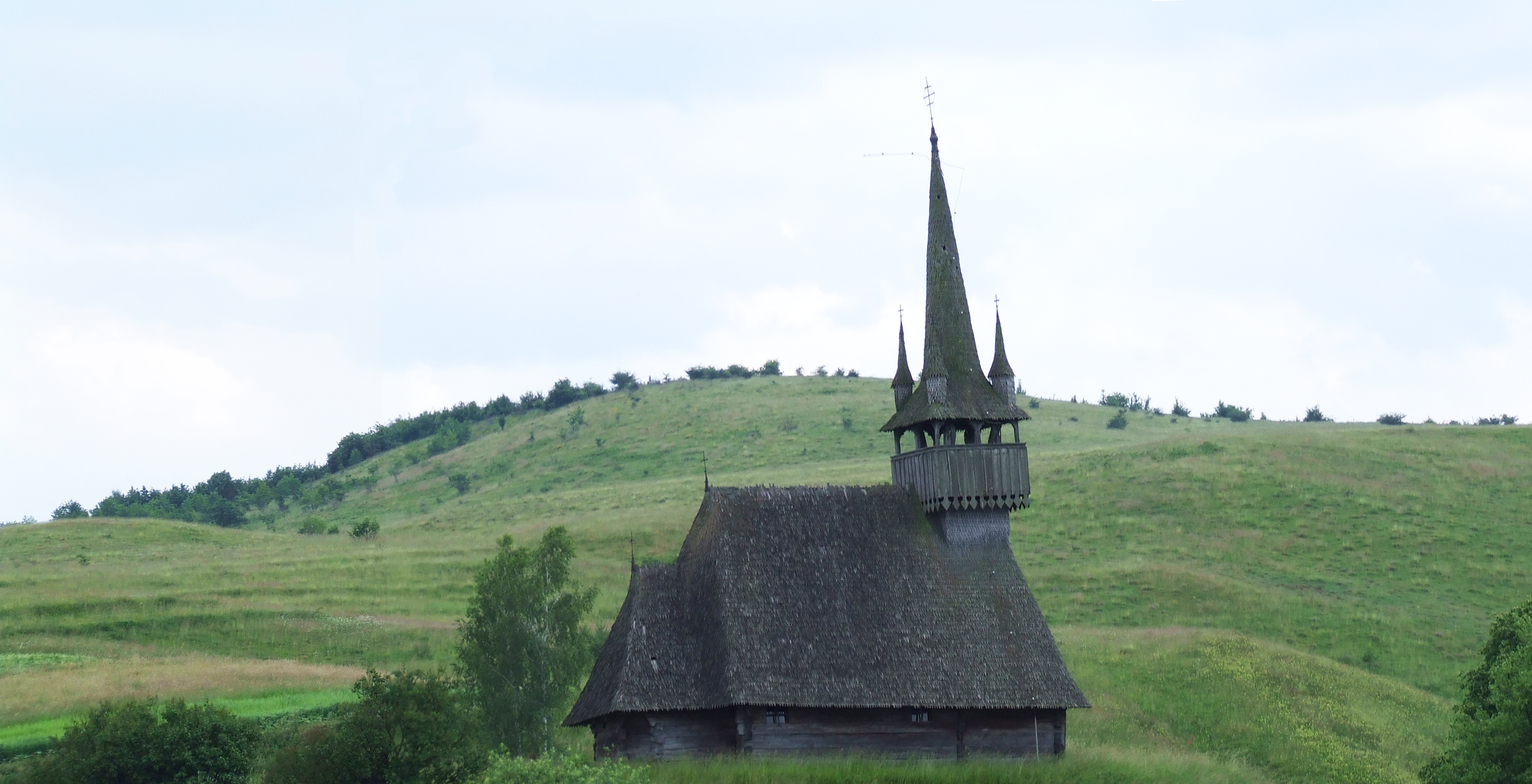
The main tourist destinations in the county are:
- The city of Cluj-Napoca.
- The Apuseni Mountains especially the caves Peştera Mare, Peştera Piatra Ponorului, Peştera Vârfurosu.
- The historical centers of Turda, Dej, Gherla, Ciucea.
- Cheile Turzii
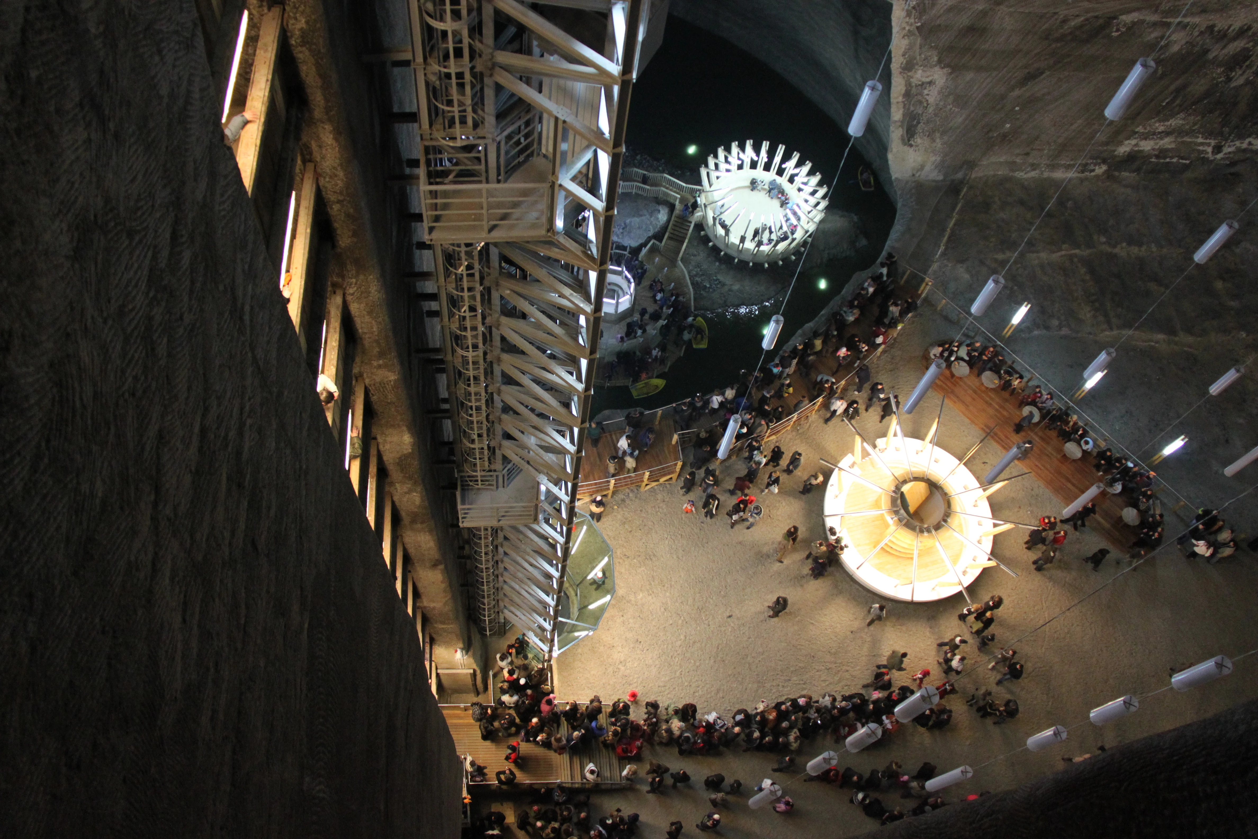
- Turda Salt Mine
- The winter resort of Băişoara
- The lakes of Beliş and Tarniţa
Education[]
Administrative divisions[]
Turda salt mine
Cluj County has 5 municipalities, 1 town and 75 communes.
- Municipalities
- Câmpia Turzii
- Cluj-Napoca - capital city; 310,243 (as of 2007)
- Dej
- Gherla
- Turda
- Towns
- Huedin
|
References[]
- ^ National Institute of Statistics, "Populaţia după etnie"
- ^ National Institute of Statistics, "Populaţia la recensămintele din anii 1948, 1956, 1966, 1977, 1992 şi 2002"
External links[]
- (Romanian) Cluj County map
- (Romanian) (Hungarian) Administrative map of the county
| |||||||
| |||||||||||||