m (Remove the railway stuff) |
m (update from Wikipedia) |
||
| (3 intermediate revisions by the same user not shown) | |||
| Line 1: | Line 1: | ||
| + | {{bdm}} |
||
| − | {{Infobox Australian |
+ | {{Infobox Australian place | type = town |
| name = Coonabarabran |
| name = Coonabarabran |
||
| state = nsw |
| state = nsw |
||
| Line 7: | Line 8: | ||
| longd =149 |longm =16 |longs = |
| longd =149 |longm =16 |longs = |
||
| pushpin_label_position = right |
| pushpin_label_position = right |
||
| − | | lga = |
+ | | lga = Warrumbungle Shire |
| postcode = 2357 |
| postcode = 2357 |
||
| est = |
| est = |
||
| − | | pop = |
+ | | pop = 2609 |
| + | | pop_year = {{CensusAU|2011}} |
||
| + | | pop_footnotes = <ref name="ABS"/> |
||
| elevation= 505 |
| elevation= 505 |
||
| maxtemp = 23.7 |
| maxtemp = 23.7 |
||
| Line 16: | Line 19: | ||
| rainfall = 748.4 |
| rainfall = 748.4 |
||
| stategov = [[Electoral district of Barwon|Barwon]] |
| stategov = [[Electoral district of Barwon|Barwon]] |
||
| − | | fedgov = [[Division of |
+ | | fedgov = [[Division of Parkes|Parkes]] |
| dist1 = 451 |
| dist1 = 451 |
||
| dir1 = NW |
| dir1 = NW |
||
| − | | location1= |
+ | | location1= Sydney |
| dist2 = 161 |
| dist2 = 161 |
||
| dir2 = NE |
| dir2 = NE |
||
| − | | location2= |
+ | | location2= Dubbo |
| dist3 = 182 |
| dist3 = 182 |
||
| dir3 = W |
| dir3 = W |
||
| Line 28: | Line 31: | ||
| dist4 = 120 |
| dist4 = 120 |
||
| dir4 = SW |
| dir4 = SW |
||
| − | | location4= |
+ | | location4= Narrabri |
}} |
}} |
||
| + | '''Coonabarabran''' {{IPAc-en|k|uː|n|ə|ˈ|b|ær|ə|b|r|ə|n}}<ref>''[[Macquarie Dictionary|Macquarie Dictionary, Fourth Edition]]'' (2005). Melbourne, The Macquarie Library Pty Ltd. ISBN 1-876429-14-3</ref> |
||
| − | [[Image:Coonabarabran location map in New South Wales.PNG|thumb|Location of Coonabarabran in New South Wales (red)]] |
||
| − | + | is a town in [[Warrumbungle Shire]] in northern [[New South Wales]], Australia. At the [[Census in Australia#2011|2011 census]], the town had a population of 3,175.<ref name="ABS">{{Census 2006 AUS | id = UCL121400 | name = Coonabarabran (Urban Centre/Locality) | quick = on | accessdate = 2007-06-28}}</ref> |
|
| − | ==History and |
+ | ==History and description== |
Lewis Gordon first proposed a town plan survey for Coonabarabran in 1859 although the area had been opened up by a Government-sponsored expedition in 1817. [[John Oxley]] found Aboriginal people living here the following year 1818 — later identified as the western language reach of the [[Kamilaroi]] clans (Gamilaraay is the spelling used by linguists). Kamilaroi people are still well represented in the region, having occupied Coonabarabran for approximately 7,500 years. |
Lewis Gordon first proposed a town plan survey for Coonabarabran in 1859 although the area had been opened up by a Government-sponsored expedition in 1817. [[John Oxley]] found Aboriginal people living here the following year 1818 — later identified as the western language reach of the [[Kamilaroi]] clans (Gamilaraay is the spelling used by linguists). Kamilaroi people are still well represented in the region, having occupied Coonabarabran for approximately 7,500 years. |
||
| − | + | It seems no one really knows the source and meaning of the word ''Coonabarabran''. It may derive from a person's name or from the [[Gamilaraay language|Kamilaroi language]] word 'gunbaraaybaa' meaning 'excrement', translated earlier as meaning, 'peculiar odour', this possibly is a [[Expurgation|bowdlerisation]]. Another meaning is derived from an Aboriginal word for 'inquisitive person'. 'Coolabarabran' was the name of a station owned by James Weston in 1848.<ref>{{NSW GNR|id = JPckWyKmuj|title = Coonabarabran|accessdate = 3 August 2013}} The GNB quotes ''Place Names of NSW their origins & Meanings'' by A.W. Reed and also Appleton 1992 which presumably refers to the ''Cambridge Dictionary of Australian Places'', Richard & Barbara Appleton, 1992.</ref> |
|
| + | |||
| − | that it is the Aboriginal for 'Inquisitive person'. 'Coolabarabran' was the name of a station owned by James Weston in 1848.<ref>{{cite web|url = http://www.gnb.nsw.gov.au/name_search/extract?id=JPckWyKmuj|title = Geographical Names Register Extract for Coonabarabran|publisher = Geographical Names Board of New South Wales|accessdate = 2008-08-26}} The GNB quotes ''Place Names of NSW their origins & Meanings'' by A.W. Reed and also Appleton 1992 which presumably refers to the ''Cambridge Dictionary of Australian Places'', Richard & Barbara Appleton, 1992.</ref> |
||
| + | Coonabarabran Post Office opened on 1 January 1850.<ref name = "Post Office">{{Cite web | last = Premier Postal History | title = Post Office List | publisher = Premier Postal Auctions | url = https://www.premierpostal.com/cgi-bin/wsProd.sh/Viewpocdwrapper.p?SortBy=NSW&country= | accessdate = 2011-05-26}}</ref> |
||
The township is located on the [[Newell Highway]] and the [[Oxley Highway]], approximately halfway between Melbourne and Brisbane and can be reached in about six hours by car from [[Sydney]]. There are numerous motels, hotels, and caravan parks for travellers. |
The township is located on the [[Newell Highway]] and the [[Oxley Highway]], approximately halfway between Melbourne and Brisbane and can be reached in about six hours by car from [[Sydney]]. There are numerous motels, hotels, and caravan parks for travellers. |
||
| − | Coonabarabran is the gateway to the [[Warrumbungle National Park]] and the [[Pilliga forest|Pilliga Forest]]. A central feature of the town is the Town Clock which is situated in the middle of town at the intersection of John Street and Dalgarno Street. |
+ | Coonabarabran is the gateway to the [[Warrumbungle National Park]] and the [[Pilliga forest|Pilliga Forest]]. A central feature of the town is the Town Clock which is situated in the middle of town at the intersection of John Street and Dalgarno Street. |
| − | Coonabarabran is the closest town to the 3.9-metre [[Anglo-Australian Telescope]], the largest optical telescope in Australia |
+ | Coonabarabran is the closest town to the [[Siding Spring Observatory]] (SSO), which is home to the 3.9-metre [[Anglo-Australian Telescope]], the largest optical telescope in Australia. It is operated by the [[Australian Astronomical Observatory]] (formerly the Anglo-Australian Observatory). A dozen other telescopes are on Siding Spring Mountain, a number of which are operated by the Research School of Astronomy and Astrophysics of the [[Australian National University]]. Siding Spring is also home to the Uppsala Telescope where [[Robert H. McNaught]] discovered his now famous daylight comet C2006 P1 McNaught in August 2006. The [[Mopra Observatory]], which is home to a 22-metre radio telescope owned and operated by the [[CSIRO]] is also near SSO, but is operated remotely from Narrabri. A recent addition to the town was the construction of the World's Largest Virtual Solar System Drive on the roads leading to the observatory. Considered the "astronomy capital of Australia", many of the businesses and government buildings in the town feature astronomically themed information plaques. |
| − | There are aged care facilities in the town, providing hostel, lodge and nursing home facilities. There are also village self-care units. |
+ | There are aged care facilities in the town, providing hostel, lodge and nursing home facilities. There are also village self-care units. |
| − | There are a number of doctors, a dentist and a hospital. |
+ | There are a number of doctors, a dentist, and a hospital. |
| + | |||
| + | Coonabarabran is on a main inland truck route between [[Queensland]] and [[Victoria (Australia)|Victoria]]. |
||
| + | |||
| + | ==Climate== |
||
| + | Coonabarabran has a warm [[Humid subtropical climate|subtropical climate]], with hot summers and cool winters. Temperature extremes have historically ranged from 42.6 C° (108.7 F°) to -9.0 C° (15.8 °F). |
||
| + | <br /><div style="width:75%;"> |
||
| + | {{Weather box |
||
| + | |location = Coonabarabran |
||
| + | |metric first = Yes |
||
| + | |single line = Yes |
||
| + | |Jan record high C = 42.6 |
||
| + | |Feb record high C = 41.3 |
||
| + | |Mar record high C = 37.5 |
||
| + | |Apr record high C = 35.0 |
||
| + | |May record high C = 28.2 |
||
| + | |Jun record high C = 24.6 |
||
| + | |Jul record high C = 23.7 |
||
| + | |Aug record high C = 29.0 |
||
| + | |Sep record high C = 33.6 |
||
| + | |Oct record high C = 38.8 |
||
| + | |Nov record high C = 41.1 |
||
| + | |Dec record high C = 40.5 |
||
| + | |year record high C = 42.6 |
||
| + | |Jan high C = 31.7 |
||
| + | |Feb high C = 30.7 |
||
| + | |Mar high C = 28.2 |
||
| + | |Apr high C = 23.9 |
||
| + | |May high C = 19.3 |
||
| + | |Jun high C = 15.6 |
||
| + | |Jul high C = 14.8 |
||
| + | |Aug high C = 16.8 |
||
| + | |Sep high C = 20.4 |
||
| + | |Oct high C = 24.2 |
||
| + | |Nov high C = 27.8 |
||
| + | |Dec high C = 30.5 |
||
| + | |year high C = 23.7 |
||
| + | |Jan low C = 15.0 |
||
| + | |Feb low C = 14.6 |
||
| + | |Mar low C = 11.8 |
||
| + | |Apr low C = 7.1 |
||
| + | |May low C = 3.3 |
||
| + | |Jun low C = 1.3 |
||
| + | |Jul low C = 0.1 |
||
| + | |Aug low C = 0.9 |
||
| + | |Sep low C = 3.5 |
||
| + | |Oct low C = 7.2 |
||
| + | |Nov low C = 10.6 |
||
| + | |Dec low C = 13.2 |
||
| + | |year low C = 7.4 |
||
| + | |Jan record low C = 3.6 |
||
| + | |Feb record low C = 3.6 |
||
| + | |Mar record low C = 0.6 |
||
| + | |Apr record low C = -3.6 |
||
| + | |May record low C = -6.1 |
||
| + | |Jun record low C = -7.2 |
||
| + | |Jul record low C = -9.0 |
||
| + | |Aug record low C = -7.6 |
||
| + | |Sep record low C = -5.0 |
||
| + | |Oct record low C = -2.2 |
||
| + | |Nov record low C = -0.8 |
||
| + | |Dec record low C = 2.7 |
||
| + | |year record low C = -9.0 |
||
| + | |Jan rain mm = 90.9 |
||
| + | |Feb rain mm = 81.8 |
||
| + | |Mar rain mm = 62.7 |
||
| + | |Apr rain mm = 52.2 |
||
| + | |May rain mm = 54.0 |
||
| + | |Jun rain mm = 57.0 |
||
| + | |Jul rain mm = 55.5 |
||
| + | |Aug rain mm = 52.8 |
||
| + | |Sep rain mm = 49.9 |
||
| + | |Oct rain mm = 59.4 |
||
| + | |Nov rain mm = 65.6 |
||
| + | |Dec rain mm = 71.3 |
||
| + | |Jan rain days = 7.2 |
||
| + | |Feb rain days = 6.3 |
||
| + | |Mar rain days = 5.7 |
||
| + | |Apr rain days = 5.1 |
||
| + | |May rain days = 6.1 |
||
| + | |Jun rain days = 7.7 |
||
| + | |Jul rain days = 7.6 |
||
| + | |Aug rain days = 7.1 |
||
| + | |Sep rain days = 6.7 |
||
| + | |Oct rain days = 7.1 |
||
| + | |Nov rain days = 7.2 |
||
| + | |Dec rain days = 7.3 |
||
| + | |unit rain days = 0.2mm |
||
| + | |source 1 = [[Bureau of Meteorology (Australia)|Bureau of Meteorology]]<ref>{{BoM Aust stats|site_ref=cw_064008_All|site_name=COONABARABRAN (NAMOI STREET)|accessdate=16 May 2013|date=May 2013}}</ref> |
||
| + | |date=May 2013}} |
||
| + | </div> |
||
==Media== |
==Media== |
||
| + | Independently owned and operated, the Coonabarabran Times newspaper circulates throughout the Warrumbungle Shire area. Approximately 2700 copies are printed each Thursday and distributed across the townships of Coonabarabran, Binnaway, Baradine, Coolah, Dunedoo, Mendooran and Mullaley. The Coonabarabran Times was founded in 1927 as an amalgamation of The Bligh Watchman (1877–1927) and The Clarion (1910–1927). It continues to be a solid publication, consisting of local news and issues facing the community, sport, advertisements and events. |
||
| + | |||
The area is currently served by a small community radio station, 2WCR FM. This station broadcasts on 99.5 FM, it has a good broadcasting range but it can be a bit scratchy due to the hill-like terrain. |
The area is currently served by a small community radio station, 2WCR FM. This station broadcasts on 99.5 FM, it has a good broadcasting range but it can be a bit scratchy due to the hill-like terrain. |
||
| + | [[Image:CountryTown0001.jpg|thumb|right|160px|Old Coonabarabran Court House]] |
||
| + | [[Image:CoonabarabranWarMemorial.JPG|thumb|right|160px|War memorial at Coonabarabran]] |
||
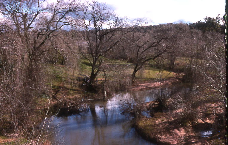
| + | [[Image:Castlereagh River at Coonabarabran.jpg|thumb|right|160px|[[Castlereagh River (New South Wales)|Castlereagh River]]]] |
||
==Schools== |
==Schools== |
||
The town of Coonabarabran is home to three schools: |
The town of Coonabarabran is home to three schools: |
||
| + | |||
===Coonabarabran Public School=== |
===Coonabarabran Public School=== |
||
| − | Coonabarabran Public School is a Government-funded school, located on John Street, on the Oxley highway. It has approximately 350 students, and its educational facilities range from Kindergarten to Year 6. Its Principal is Mr Noel |
+ | Coonabarabran Public School is a Government-funded school, located on John Street, on the Oxley highway. It has approximately 350 students, and its educational facilities range from Kindergarten to Year 6. Its Principal is Mr Noel Willoughby. |
===Coonabarabran High School=== |
===Coonabarabran High School=== |
||
| − | Coonabarabran High School is located on the Oxley highway, is also Government-funded, has approximately 400 students. It has a range of academic and sporting facilities, an Ag-plot, two computer labs, a gym, and a hall. The |
+ | Coonabarabran High School is located on the Oxley highway, is also Government-funded, has approximately 400 students. It has a range of academic and sporting facilities, an Ag-plot, two computer labs, a gym, and a hall. The Principal is Mr Mel Johnston, and the Deputy Principal is Mr Graham Enks. |
===St Lawrence's Catholic School=== |
===St Lawrence's Catholic School=== |
||
| − | St Lawrence's Catholic School is located on Dalgarno Street. It caters for Kindergarten to Year |
+ | St Lawrence's Catholic School is located on Dalgarno Street. It caters for Kindergarten to Year Six and has approximately 150 students. It is not Government-funded{{Citation needed|date=December 2009}}, and education is based around a Catholic lifestyle. It has an ag-plot, a computer lab, recently renewed basketball courts and is across the road from St Lawrence's Catholic Church. The high school part of the school closed at the end of 2009.<ref>ABC Online. http://www.abc.net.au/news/stories/2009/05/15/2571188.htm</ref> |
| − | ==Shops and |
+ | ==Shops and services== |
| − | Being a small country town, Coonabarabran has limited shops. There are two major chain shopping centres, [[Woolworths (supermarket)|Woolworths]] and [[Foodworks (Australia)|Foodworks]] (formerly Coles, Bi-lo, Tuckerbag, Payless and many others over the years), plus the fast food stores [[Subway (restaurant)|Subway]] and [[Eagle Boys Pizza]] |
+ | Being a small country town, Coonabarabran has limited shops. There are two major chain shopping centres, [[Woolworths (supermarket)|Woolworths]] and [[Foodworks (Australia)|Foodworks]] (formerly Coles, Bi-lo, Tuckerbag, Payless, Permewams, and many others over the years), plus the fast food stores [[Subway (restaurant)|Subway]] and [[Eagle Boys Pizza]], it also has other small cafe restaurants. Until 2007 there was an IGA store, run by the Woo family, that supplied most of the town. There is a newsagency, local bakery, catering service, three Chinese restaurants and several hotels. It also has two variety clothing stores [[ADRA]] and a [[Society of Saint Vincent de Paul|St Vincent DePaul]]. Coonabarabran has many churches, the Parish of St Lawrences Catholic Church, the Anglican Church, Presbyterian Church, Uniting Church and the Seventh Day Adventist Church. The Coonabarabran Gym, Action Specific Health and Fitness opened in Dalgarno street in 2011. |
| + | |||
| + | ==Notable residents== |
||
| + | * [[Mary Jane Cain]] |
||
==See also== |
==See also== |
||
| ⚫ | |||
| − | {{Commons category}} |
||
| ⚫ | |||
==References== |
==References== |
||
| Line 75: | Line 177: | ||
==External links== |
==External links== |
||
| ⚫ | |||
* http://www.solarsystemdrive.com/index.html |
* http://www.solarsystemdrive.com/index.html |
||
* http://www.aao.gov.au/ |
* http://www.aao.gov.au/ |
||
| + | * http://www.coonabarabran.com |
||
| + | * http://www.narrabri.atnf.csiro.au/mopra/ |
||
| + | {{s-rail-start}} |
||
| − | {{Coord|31|15|S|149|16|E|region:AU-NSW_type:city(3000)|display=title}} |
||
| + | {{s-rail|title=NSW closed lines}} |
||
| + | {{s-line|system=NSW Country lines|line=Gwabegar|previous=Yearinan|next=Ulamambri}} |
||
| + | {{end}} |
||
[[Category:Towns in New South Wales]] |
[[Category:Towns in New South Wales]] |
||
| + | |||
| ⚫ | |||
| + | {{usedwp|Coonabarabran}} |
||
| + | [[Category:Coonabarabran]] |
||
Latest revision as of 00:37, 8 November 2013
| Main | Births etc |
|---|
| Coonabarabran | |||||||
 Town centre | |||||||

Coonabarabran | |||||||
| Population: | 2609 [1] | ||||||
| Postcode: | 2357 | ||||||
| Elevation: | 505 m (1,657 ft) | ||||||
| Location: | |||||||
| LGA: | Warrumbungle Shire | ||||||
| State District: | Barwon | ||||||
| Federal Division: | Parkes | ||||||
| |||||||
Coonabarabran /kuːnəˈbærəbrən/[2]
is a town in Warrumbungle Shire in northern New South Wales, Australia. At the 2011 census, the town had a population of 3,175.[1]
History and description[]
Lewis Gordon first proposed a town plan survey for Coonabarabran in 1859 although the area had been opened up by a Government-sponsored expedition in 1817. John Oxley found Aboriginal people living here the following year 1818 — later identified as the western language reach of the Kamilaroi clans (Gamilaraay is the spelling used by linguists). Kamilaroi people are still well represented in the region, having occupied Coonabarabran for approximately 7,500 years.
It seems no one really knows the source and meaning of the word Coonabarabran. It may derive from a person's name or from the Kamilaroi language word 'gunbaraaybaa' meaning 'excrement', translated earlier as meaning, 'peculiar odour', this possibly is a bowdlerisation. Another meaning is derived from an Aboriginal word for 'inquisitive person'. 'Coolabarabran' was the name of a station owned by James Weston in 1848.[3]
Coonabarabran Post Office opened on 1 January 1850.[4]
The township is located on the Newell Highway and the Oxley Highway, approximately halfway between Melbourne and Brisbane and can be reached in about six hours by car from Sydney. There are numerous motels, hotels, and caravan parks for travellers.
Coonabarabran is the gateway to the Warrumbungle National Park and the Pilliga Forest. A central feature of the town is the Town Clock which is situated in the middle of town at the intersection of John Street and Dalgarno Street.
Coonabarabran is the closest town to the Siding Spring Observatory (SSO), which is home to the 3.9-metre Anglo-Australian Telescope, the largest optical telescope in Australia. It is operated by the Australian Astronomical Observatory (formerly the Anglo-Australian Observatory). A dozen other telescopes are on Siding Spring Mountain, a number of which are operated by the Research School of Astronomy and Astrophysics of the Australian National University. Siding Spring is also home to the Uppsala Telescope where Robert H. McNaught discovered his now famous daylight comet C2006 P1 McNaught in August 2006. The Mopra Observatory, which is home to a 22-metre radio telescope owned and operated by the CSIRO is also near SSO, but is operated remotely from Narrabri. A recent addition to the town was the construction of the World's Largest Virtual Solar System Drive on the roads leading to the observatory. Considered the "astronomy capital of Australia", many of the businesses and government buildings in the town feature astronomically themed information plaques.
There are aged care facilities in the town, providing hostel, lodge and nursing home facilities. There are also village self-care units.
There are a number of doctors, a dentist, and a hospital.
Coonabarabran is on a main inland truck route between Queensland and Victoria.
Climate[]
Coonabarabran has a warm subtropical climate, with hot summers and cool winters. Temperature extremes have historically ranged from 42.6 C° (108.7 F°) to -9.0 C° (15.8 °F).
| Climate data for Coonabarabran | |||||||||||||
|---|---|---|---|---|---|---|---|---|---|---|---|---|---|
| Month | Jan | Feb | Mar | Apr | May | Jun | Jul | Aug | Sep | Oct | Nov | Dec | Year |
| Record high °C (°F) | 42.6 (108.7) |
41.3 (106.3) |
37.5 (99.5) |
35.0 (95.0) |
28.2 (82.8) |
24.6 (76.3) |
23.7 (74.7) |
29.0 (84.2) |
33.6 (92.5) |
38.8 (101.8) |
41.1 (106.0) |
40.5 (104.9) |
42.6 (108.7) |
| Average high °C (°F) | 31.7 (89.1) |
30.7 (87.3) |
28.2 (82.8) |
23.9 (75.0) |
19.3 (66.7) |
15.6 (60.1) |
14.8 (58.6) |
16.8 (62.2) |
20.4 (68.7) |
24.2 (75.6) |
27.8 (82.0) |
30.5 (86.9) |
23.7 (74.7) |
| Average low °C (°F) | 15.0 (59.0) |
14.6 (58.3) |
11.8 (53.2) |
7.1 (44.8) |
3.3 (37.9) |
1.3 (34.3) |
0.1 (32.2) |
0.9 (33.6) |
3.5 (38.3) |
7.2 (45.0) |
10.6 (51.1) |
13.2 (55.8) |
7.4 (45.3) |
| Record low °C (°F) | 3.6 (38.5) |
3.6 (38.5) |
0.6 (33.1) |
−3.6 (25.5) |
−6.1 (21.0) |
−7.2 (19.0) |
−9 (15.8) |
−7.6 (18.3) |
−5 (23.0) |
−2.2 (28.0) |
−0.8 (30.6) |
2.7 (36.9) |
−9 (15.8) |
| Rainfall mm (inches) | 90.9 (3.579) |
81.8 (3.22) |
62.7 (2.469) |
52.2 (2.055) |
54.0 (2.126) |
57.0 (2.244) |
55.5 (2.185) |
52.8 (2.079) |
49.9 (1.965) |
59.4 (2.339) |
65.6 (2.583) |
71.3 (2.807) |
753.1 (29.65) |
| Avg. rainy days (≥ 0.2mm) | 7.2 | 6.3 | 5.7 | 5.1 | 6.1 | 7.7 | 7.6 | 7.1 | 6.7 | 7.1 | 7.2 | 7.3 | 81.1 |
| Source: Bureau of Meteorology[5] | |||||||||||||
Media[]
Independently owned and operated, the Coonabarabran Times newspaper circulates throughout the Warrumbungle Shire area. Approximately 2700 copies are printed each Thursday and distributed across the townships of Coonabarabran, Binnaway, Baradine, Coolah, Dunedoo, Mendooran and Mullaley. The Coonabarabran Times was founded in 1927 as an amalgamation of The Bligh Watchman (1877–1927) and The Clarion (1910–1927). It continues to be a solid publication, consisting of local news and issues facing the community, sport, advertisements and events.
The area is currently served by a small community radio station, 2WCR FM. This station broadcasts on 99.5 FM, it has a good broadcasting range but it can be a bit scratchy due to the hill-like terrain.


Old Coonabarabran Court House


War memorial at Coonabarabran

Castlereagh River
Schools[]
The town of Coonabarabran is home to three schools:
Coonabarabran Public School[]
Coonabarabran Public School is a Government-funded school, located on John Street, on the Oxley highway. It has approximately 350 students, and its educational facilities range from Kindergarten to Year 6. Its Principal is Mr Noel Willoughby.
Coonabarabran High School[]
Coonabarabran High School is located on the Oxley highway, is also Government-funded, has approximately 400 students. It has a range of academic and sporting facilities, an Ag-plot, two computer labs, a gym, and a hall. The Principal is Mr Mel Johnston, and the Deputy Principal is Mr Graham Enks.
St Lawrence's Catholic School[]
St Lawrence's Catholic School is located on Dalgarno Street. It caters for Kindergarten to Year Six and has approximately 150 students. It is not Government-funded, and education is based around a Catholic lifestyle. It has an ag-plot, a computer lab, recently renewed basketball courts and is across the road from St Lawrence's Catholic Church. The high school part of the school closed at the end of 2009.[6]
Shops and services[]
Being a small country town, Coonabarabran has limited shops. There are two major chain shopping centres, Woolworths and Foodworks (formerly Coles, Bi-lo, Tuckerbag, Payless, Permewams, and many others over the years), plus the fast food stores Subway and Eagle Boys Pizza, it also has other small cafe restaurants. Until 2007 there was an IGA store, run by the Woo family, that supplied most of the town. There is a newsagency, local bakery, catering service, three Chinese restaurants and several hotels. It also has two variety clothing stores ADRA and a St Vincent DePaul. Coonabarabran has many churches, the Parish of St Lawrences Catholic Church, the Anglican Church, Presbyterian Church, Uniting Church and the Seventh Day Adventist Church. The Coonabarabran Gym, Action Specific Health and Fitness opened in Dalgarno street in 2011.
Notable residents[]
- Mary Jane Cain
See also[]
- Coonabarabran Airport
References[]
- ^ a b Australian Bureau of Statistics (25 October 2007). "Coonabarabran (Urban Centre/Locality)". 2006 Census QuickStats. http://www.censusdata.abs.gov.au/ABSNavigation/prenav/LocationSearch?collection=Census&period=2006&areacode=UCL121400&producttype=QuickStats&breadcrumb=PL&action=401. Retrieved 2007-06-28.
- ^ Macquarie Dictionary, Fourth Edition (2005). Melbourne, The Macquarie Library Pty Ltd. ISBN 1-876429-14-3
- ^ "Coonabarabran". Geographical Names Register (GNR) of NSW. Geographical Names Board of New South Wales. http://www.gnb.nsw.gov.au/place_naming/placename_search/extract?id=JPckWyKmuj. Retrieved 3 August 2013. The GNB quotes Place Names of NSW their origins & Meanings by A.W. Reed and also Appleton 1992 which presumably refers to the Cambridge Dictionary of Australian Places, Richard & Barbara Appleton, 1992.
- ^ Premier Postal History. "Post Office List". Premier Postal Auctions. https://www.premierpostal.com/cgi-bin/wsProd.sh/Viewpocdwrapper.p?SortBy=NSW&country=. Retrieved 2011-05-26.
- ^ "COONABARABRAN (NAMOI STREET)". Climate statistics for Australian locations. Bureau of Meteorology. http://www.bom.gov.au/climate/averages/tables/cw_064008_All.shtml. Retrieved 16 May 2013.
- ^ ABC Online. http://www.abc.net.au/news/stories/2009/05/15/2571188.htm
External links[]
 Media related to Coonabarabran, New South Wales at Wikimedia Commons
- http://www.solarsystemdrive.com/index.html
- http://www.aao.gov.au/
- http://www.coonabarabran.com
- http://www.narrabri.atnf.csiro.au/mopra/
| This page uses content from the English language Wikipedia. The original content was at Coonabarabran. The list of authors can be seen in the page history. As with this Familypedia wiki, the content of Wikipedia is available under the Creative Commons License. |