| ||||||||||||||
| Crawford County, Pennsylvania | |||||
 The Crawford County Courthouse in Meadville
| |||||
| |||||
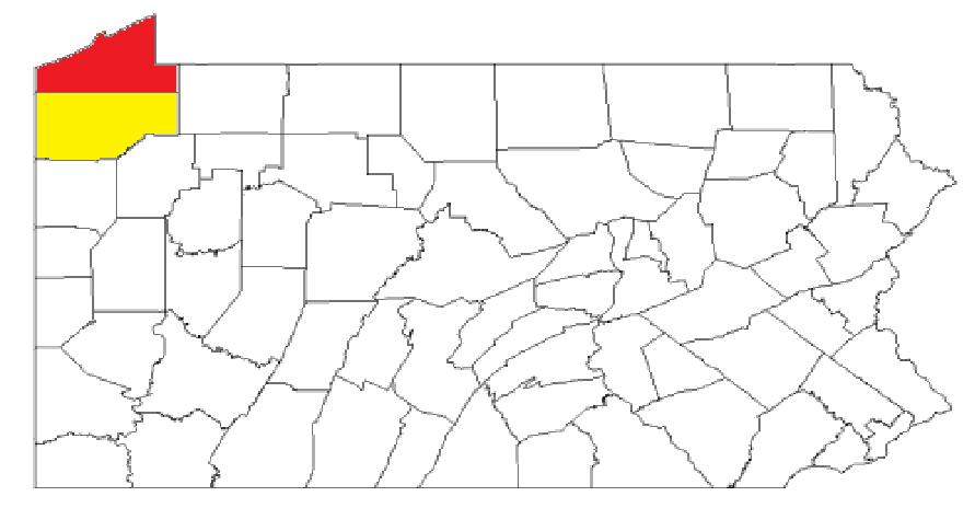
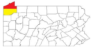
 Location in the state of Pennsylvania | |||||
 Pennsylvania's location in the U.S. | |||||
| Founded | March 12, 1800 | ||||
|---|---|---|---|---|---|
| Named for | William Crawford | ||||
| Seat | Meadville | ||||
| Largest city | Meadville | ||||
| Area - Total - Land - Water |
1,038 sq mi (2,688 km²) 1,012 sq mi (2,621 km²) 25 sq mi (65 km²), 2.4% | ||||
| Population - (2020) - Density |
83,938 84/sq mi (32/km²) | ||||
| Congressional district | 16th | ||||
| Time zone | Eastern: UTC-5/-4 | ||||
| Website | www.crawfordcountypa.net | ||||
Footnotes:
| |||||
Crawford County is a county located in the U.S. state of Pennsylvania. As of the 2020 census, the population was 83,938.[2] Its county seat is Meadville.[3] The county was created on March 12, 1800, from part of Allegheny County and named for Colonel William Crawford.[4]
Crawford County comprises the Meadville, PA Micropolitan Statistical Area, which is also included in the Erie-Meadville, PA Combined Statistical Area.
Geography[]
According to the U.S. Census Bureau, the county has a total area of 1,038 square miles (2,690 km2), of which 1,012 square miles (2,620 km2) is land and 25 square miles (65 km2) (2.4%) is water.[5] It has a warm-summer humid continental climate (Dfb) and average monthly temperatures in Meadville range from 24.9 °F in January to 69.5 °F in July, while in Titusville they range from 24.2 °F in January to 68.8 °F in July. [1]
Adjacent counties[]
- Erie County (north)
- Warren County (east)
- Venango County (southeast)
- Mercer County (south)
- Trumbull County, Ohio (southwest)
- Ashtabula County, Ohio (west)
National protected area[]
- Erie National Wildlife Refuge
State protected area[]
Pymatuning State Park is on Pymatuning Reservoir.
Major highways[]
 I-79
I-79- US 6
- US 19
- US 322
- [[Template:Infobox road/PA/link PA|PA 8]]
- Template:Jct/banner/SH
[[Template:Infobox road/PA/link PA-Truck|Template:Infobox road/PA/abbrev PA-Truck]] - [[Template:Infobox road/PA/link PA|PA 18]]
- [[Template:Infobox road/PA/link PA|PA 27]]
- Template:Jct/banner/SH
[[Template:Infobox road/PA/link PA-Truck|Template:Infobox road/PA/abbrev PA-Truck]] - [[Template:Infobox road/PA/link PA|PA 77]]
- [[Template:Infobox road/PA/link PA|PA 86]]
- [[Template:Infobox road/PA/link PA|PA 89]]
- [[Template:Infobox road/PA/link PA|PA 98]]
- [[Template:Infobox road/PA/link PA|PA 99]]
- [[Template:Infobox road/PA/link PA|PA 102]]
- [[Template:Infobox road/PA/link PA|PA 173]]
- [[Template:Infobox road/PA/link PA|PA 198]]
- [[Template:Infobox road/PA/link PA|PA 285]]
- [[Template:Infobox road/PA/link PA|PA 408]]
- [[Template:Infobox road/PA/link PA|PA 428]]
Demographics[]
| Historical populations | |||
|---|---|---|---|
| Census | Pop. | %± | |
| 1800 | 2,346 | ||
| 1810 | 6,178 | 163.3% | |
| 1820 | 9,397 | 52.1% | |
| 1830 | 16,030 | 70.6% | |
| 1840 | 31,724 | 97.9% | |
| 1850 | 37,849 | 19.3% | |
| 1860 | 48,755 | 28.8% | |
| 1870 | 63,832 | 30.9% | |
| 1880 | 68,607 | 7.5% | |
| 1890 | 65,324 | −4.8% | |
| 1900 | 63,643 | −2.6% | |
| 1910 | 61,565 | −3.3% | |
| 1920 | 60,667 | −1.5% | |
| 1930 | 62,980 | 3.8% | |
| 1940 | 71,644 | 13.8% | |
| 1950 | 78,948 | 10.2% | |
| 1960 | 77,956 | −1.3% | |
| 1970 | 81,342 | 4.3% | |
| 1980 | 88,869 | 9.3% | |
| 1990 | 86,169 | −3.0% | |
| 2000 | 90,367 | 4.9% | |
| 2010 | 88,765 | −1.8% | |
| [6] | |||
As of the 2000 census, there were 90,366 people, 34,678 households, and 23,858 families residing in the county.[7] The population density was 89 people per square mile (34/km2). There were 42,416 housing units at an average density of 42 per square mile (16/km2). The racial makeup of the county was 97.00% White, 1.59% Black or African American, 0.20% Native American, 0.28% Asian, 0.03% Pacific Islander, 0.13% from other races, and 0.77% from two or more races. 0.59% of the population were Hispanic or Latino of any race. 45.1% English or Welsh, 10.9% American, 10.3% were of German, 8.2% Irish, 7.8% Scotch-Irish or Scottish, 3.8% Italian 2.6% Dutch, and 2.3% French ancestry.
There were 34,678 households, out of which 30.40% had children under the age of 18 living with them, 55.60% were married couples living together, 9.20% had a female householder with no husband present, and 31.20% were non-families. 26.20% of all households were made up of individuals, and 11.60% had someone living alone who was 65 years of age or older. The average household size was 2.50 and the average family size was 3.01.
In the county, the population was spread out, with 24.70% under the age of 18, 9.20% from 18 to 24, 26.60% from 25 to 44, 23.90% from 45 to 64, and 15.60% who were 65 years of age or older. The median age was 38 years. For every 100 females, there were 94.80 males. For every 100 females age 18 and over, there were 90.80 males.
Micropolitan Statistical Area[]
The United States Office of Management and Budget[8] has designated Crawford County as the Meadville, PA Micropolitan Statistical Area (µSA). As of the 2010 census[9] the micropolitan area ranked 5th most populous in the State of Pennsylvania and the 52nd most populous in the United States with a population of 88,765. Crawford County is also a part of the Erie-Meadville, PA Combined Statistical Area (CSA), which combines the population of both Crawford County and the Erie County areas. The Combined Statistical Area ranked 7th in the State of Pennsylvania and 102nd most populous in the United States with a population of 369,331.
Map of the Erie-Meadville, PA Combined Statistical Area (CSA), composed of the following parts:
Government[]
| Year | Republican | Democratic | Third party | |||
|---|---|---|---|---|---|---|
| No. | % | No. | % | No. | % | |
| 2020 | 28,561 | 67.82% | 12,924 | 30.69% | 629 | 1.49% |
| 2016 | 24,987 | 66.08% | 10,971 | 29.01% | 1,855 | 4.91% |
| 2012 | 20,901 | 58.75% | 13,883 | 39.02% | 791 | 2.22% |
| 2008 | 20,750 | 54.17% | 16,780 | 43.80% | 777 | 2.03% |
| 2004 | 21,965 | 57.32% | 16,013 | 41.79% | 344 | 0.90% |
| 2000 | 18,858 | 56.58% | 13,250 | 39.76% | 1,220 | 3.66% |
| 1996 | 14,659 | 46.62% | 12,943 | 41.16% | 3,844 | 12.22% |
| 1992 | 14,112 | 40.75% | 12,813 | 37.00% | 7,703 | 22.25% |
| 1988 | 17,249 | 56.32% | 13,021 | 42.51% | 358 | 1.17% |
| 1984 | 20,181 | 60.80% | 12,792 | 38.54% | 222 | 0.67% |
| 1980 | 16,552 | 53.55% | 11,778 | 38.11% | 2,579 | 8.34% |
| 1976 | 15,301 | 49.99% | 14,712 | 48.06% | 597 | 1.95% |
| 1972 | 18,393 | 64.38% | 9,371 | 32.80% | 805 | 2.82% |
| 1968 | 14,991 | 53.11% | 11,345 | 40.19% | 1,890 | 6.70% |
| 1964 | 10,664 | 36.78% | 18,212 | 62.82% | 115 | 0.40% |
| 1960 | 18,754 | 60.68% | 12,050 | 38.99% | 102 | 0.33% |
| 1956 | 18,887 | 66.65% | 9,346 | 32.98% | 104 | 0.37% |
| 1952 | 19,089 | 65.50% | 9,874 | 33.88% | 181 | 0.62% |
| 1948 | 14,161 | 60.69% | 9,174 | 39.31% | 0 | 0.00% |
| 1944 | 15,205 | 61.83% | 9,216 | 37.48% | 170 | 0.69% |
| 1940 | 15,891 | 60.62% | 10,197 | 38.90% | 125 | 0.48% |
| 1936 | 14,463 | 51.31% | 12,788 | 45.37% | 938 | 3.33% |
| 1932 | 10,918 | 51.72% | 9,382 | 44.44% | 811 | 3.84% |
| 1928 | 17,072 | 71.17% | 6,718 | 28.00% | 199 | 0.83% |
| 1924 | 10,918 | 63.09% | 2,969 | 17.16% | 3,418 | 19.75% |
| 1920 | 10,032 | 62.31% | 4,175 | 25.93% | 1,892 | 11.75% |
| 1916 | 5,487 | 44.18% | 5,814 | 46.81% | 1,119 | 9.01% |
| 1912 | 2,497 | 20.56% | 3,908 | 32.17% | 5,742 | 47.27% |
| 1908 | 7,679 | 52.58% | 5,668 | 38.81% | 1,258 | 8.61% |
| 1904 | 7,450 | 59.03% | 3,645 | 28.88% | 1,525 | 12.08% |
| 1900 | 7,705 | 49.97% | 7,000 | 45.40% | 713 | 4.62% |
| 1896 | 7,851 | 47.26% | 8,383 | 50.47% | 377 | 2.27% |
| 1892 | 7,152 | 47.30% | 6,166 | 40.78% | 1,804 | 11.93% |
| 1888 | 8,040 | 53.59% | 5,964 | 39.75% | 999 | 6.66% |
| 1884 | 7,233 | 49.20% | 5,633 | 38.32% | 1,834 | 12.48% |
| 1880 | 7,192 | 48.47% | 5,847 | 39.41% | 1,798 | 12.12% |
As of February 21, 2022, there were 52,493 registered voters in Crawford County.[11]

Chart of Voter Registration
- Democratic: 16,427 (31.29%)
- Republican: 29,575 (56.34%)
- Independent: 4,333 (8.25%)
- Third Party: 2,158 (4.11%)
County Commissioners[]
- Eric Henry - Chairman (R)
- Francis Weiderspahn Jr - Vice Chairman (R)
- J. Christopher Soff - Secretary/Treasurer (D)
Other county officials[]
- John F. Spataro, President Judge of the Court of Common Pleas
- Mark Stevens, Judge of the Court of Common Pleas
- Vacant, Judge of the Court of Common Pleas
- Diana Perry (R), Auditor
- Kathleen Roae (R), Auditor
- Christopher Seeley (D), Auditor
- Patricia Wetherbee (R), Clerk of Courts
- Scott Schell (R), Coroner
- Francis Schultz (R), District Attorney
- Emmy Arnett (R), Prothonotary
- Beth Forbes (R), Register of Wills/Recorder of Deeds
- David L. Powers (R), Sheriff
- Christine Krzysiak (R), Treasurer
Pennsylvania Senate[]
| District | Senator | Party |
|---|---|---|
| 50 | Michele Brooks | Republican |
Pennsylvania House of Representatives[]
| District | Representative | Party |
|---|---|---|
| 6 | Brad Roae | Republican |
| 17 | Parke Wentling | Republican |
| 65 | Kathy Rapp | Republican |
United States House of Representatives[]
| District | Representative | Party |
|---|---|---|
| 16 | Mike Kelly | Republican |
United States Senate[]
| Senator | Party |
|---|---|
| Pat Toomey | Republican |
| Bob Casey | Democrat |
Education[]
Colleges and universities[]
- Allegheny College, located in Meadville
- University of Pittsburgh at Titusville, a branch campus of the University of Pittsburgh, located in Titusville
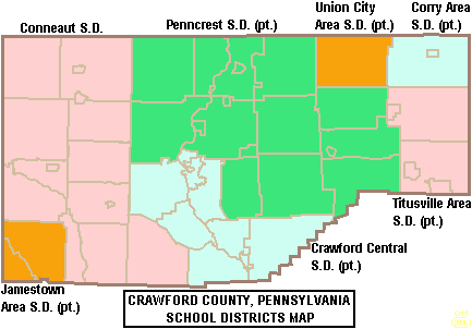

Map of Crawford County, Pennsylvania School Districts
Community, junior and technical colleges[]
- Precision Manufacturing Institute (PMI)[12]
Laurel Technical Institute (LTI)
Public school districts[]
- Conneaut School District
- Corry Area School District
- Crawford Central School District
- Jamestown Area School District
- Penncrest School District
- Titusville Area School District
- Union City Area School District
Communities[]

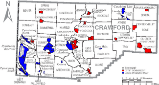
Map of Crawford County, Pennsylvania with Municipal Labels showing Cities and Boroughs (red), Townships (white), and Census-designated places (blue).
Under Pennsylvania law, there are four types of incorporated municipalities: cities, boroughs, townships, and, in at most two cases, towns. The following cities, boroughs, and townships are located in Crawford County:
Cities[]
- Meadville (county seat)
- Titusville
Boroughs[]
- Blooming Valley
- Cambridge Springs
- Centerville
- Cochranton
- Conneaut Lake
- Conneautville
- Hydetown
- Linesville
- Saegertown
- Spartansburg
- Springboro
- Townville
- Venango
- Woodcock
Townships[]
- Athens
- Beaver
- Bloomfield
- Cambridge
- Conneaut
- Cussewago
- East Fairfield
- East Fallowfield
- East Mead
- Fairfield
- Greenwood
- Hayfield
- North Shenango
- Oil Creek
- Pine
- Randolph
- Richmond
- Rockdale
- Rome
- Sadsbury
- South Shenango
- Sparta
- Spring
- Steuben
- Summerhill
- Summit
- Troy
- Union
- Venango
- Vernon
- Wayne
- West Fallowfield
- West Mead
- West Shenango
- Woodcock
Census-designated places[]
Census-designated places are geographical areas designated by the U.S. Census Bureau for the purposes of compiling demographic data. They are not actual jurisdictions under Pennsylvania law.
- Adamsville
- Atlantic
- Canadohta Lake
- Conneaut Lakeshore
- Fredericksburg
- Geneva
- Guys Mills
- Harmonsburg
- Hartstown
- Kerrtown
- Lincolnville
- Pymatuning Central
- Pymatuning North
- Pymatuning South
- Riceville
Unincorporated communities[]
- Buells Corners
- Custards
- Frenchtown
Population ranking[]
The population ranking of the following table is based on the 2010 census of Crawford County.[9]
† county seat
| Rank | City/Town/etc. | Municipal type | Population (2010 Census) |
|---|---|---|---|
| 1 | † Meadville | City | 13,388 |
| 2 | Titusville | City | 5,601 |
| 3 | Cambridge Springs | Borough | 2,595 |
| 4 | Conneaut Lakeshore | CDP | 2,395 |
| 5 | Pymatuning Central | CDP | 2,269 |
| 6 | Cochranton | Borough | 1,136 |
| 7 | Linesville | Borough | 1,040 |
| 8 | Saegertown | Borough | 997 |
| 9 | Conneautville | Borough | 774 |
| 10 | Fredericksburg | CDP | 733 |
| 11 | Conneaut Lake | Borough | 653 |
| 12 | Hydetown | Borough | 526 |
| 13 | Canadohta Lake | CDP | 516 |
| 14 | Pymatuning South | CDP | 479 |
| 15 | Springboro | Borough | 477 |
| 16 | Harmonsburg | CDP | 401 |
| 17 | Blooming Valley | Borough | 337 |
| 18 | Townville | Borough | 323 |
| 19 | Pymatuning North | CDP | 311 |
| T-20 | Spartansburg | Borough | 305 |
| T-20 | Kerrtown | CDP | 305 |
| 21 | Venango | Borough | 239 |
| 22 | Centerville | Borough | 218 |
| 23 | Hartstown | CDP | 201 |
| 24 | Woodcock | Borough | 157 |
| 25 | Guys Mills | CDP | 124 |
| 26 | Geneva | CDP | 109 |
| 27 | Lincolnville | CDP | 96 |
| 28 | Atlantic | CDP | 77 |
| 29 | Riceville | CDP | 68 |
| 30 | Adamsville | CDP | 67 |
Distinguished residents[]
- The abolitionist John Brown lived in Crawford County for 11 years, more than he lived anywhere else. He was the first postmaster of Randolph Township, a position he held from 1828 to 1836, and he carried the mail from Meadville. In 1825 he started the county's first industry, a tannery, today the John Brown Farm, Tannery & Museum. In his barn, an Underground Railroad station, he had a secret, well-ventilated room in which to hide fugitive slaves. One reason he relocated to Crawford County, he said, was that it was a good location for helping them.
See also[]
- National Register of Historic Places listings in Crawford County, Pennsylvania
References[]
- ^ "PHMC Historical Markers Search" (Searchable database). Pennsylvania Historical and Museum Commission. Commonwealth of Pennsylvania. https://www.portal.state.pa.us/portal/server.pt/community/pennsylvania_historical_marker_program/2539/search_for_historical_markers.
- ^ "State & County QuickFacts". United States Census Bureau. https://quickfacts.census.gov/qfd/states/42/42039.html.
- ^ "Find a County". National Association of Counties. http://www.naco.org/Counties/Pages/FindACounty.aspx.
- ^ Gannett, Henry (1905). The Origin of Certain Place Names in the United States. Govt. Print. Off.. pp. 95. https://archive.org/details/bub_gb_9V1IAAAAMAAJ.
- ^ "2010 Census Gazetteer Files". United States Census Bureau. August 22, 2012. http://www2.census.gov/geo/docs/maps-data/data/gazetteer/counties_list_42.txt.
- ^ "Census 2020". https://www.census.gov/quickfacts/fact/table/crawfordcountypennsylvania/PST045219.
- ^ "U.S. Census website". United States Census Bureau. https://www.census.gov.
- ^ "Office of Management and Budget". https://www.whitehouse.gov/omb.
- ^ a b "2010 U.S. Census website". United States Census Bureau. https://www.census.gov/programs-surveys/decennial-census/decade.2010.html.
- ^ Leip, David. "Dave Leip's Atlas of U.S. Presidential Elections". http://uselectionatlas.org/RESULTS.
- ^ "Voter registration statistics by county". Dos.state.pa.us. https://www.dos.pa.gov/VotingElections/OtherServicesEvents/VotingElectionStatistics/Documents/currentvotestats.xls.
- ^ "Precision Manufacturing Institute (PMI)". http://www.pmionline.edu.
External links[]
- Crawford County Official Website
- Crawford County Website archived as of 2013
- Crawford County Historical Society
- History of Townships in Crawford County, PA
- Crawford County's Historic Bridges
- Crawford County Convention and Visitors Bureau


| ||||||||||||||||||||

|
| This page uses content from the English language Wikipedia. The original content was at Crawford County, Pennsylvania. The list of authors can be seen in the page history. As with this Familypedia wiki, the content of Wikipedia is available under the Creative Commons License. |