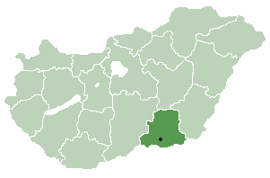
Csongrád is the name of an administrative county (comitatus or megye) in southern Hungary, on the both sides of the river Tisza, on the border with Serbia and Romania. It shares borders with Bács-Kiskun County, Jász-Nagykun-Szolnok County and Békés County. The administrative centre of Csongrád county is Szeged. The county is also part of the Danube-Kris-Mures-Tisa euroregion.
The area of Csongrád county is flat. It has a high number of sunshine hours and excellent soil, which makes it the most important agricultural area of Hungary. Its most famous products are paprika from Szeged and onion from Makó, but grain, vegetables and fruits are also significant. Half of the onion, paprika and vegetables produced in Hungary are from Csongrád. The county is also rich in oil and natural gas.
The highest point is Ásotthalom (125 m), the lowest is Gyálarét (78 m; lowest point of Hungary).
Population[]
After the Ottoman occupation, in 1715 the county was nearly uninhabited, the population density was less than 5 people/km2. In the 18th and 19th century it repopulated by ethnic Hungarians from the relatively overpopulated northern and western counties of the Kingdom of Hungary.[1] Now the county is home for 423,826 people (216,936 people live in urban counties) the population density is 100 people/km2. It's homogeneous with Hungarian majority.[2]
Regional structure[]
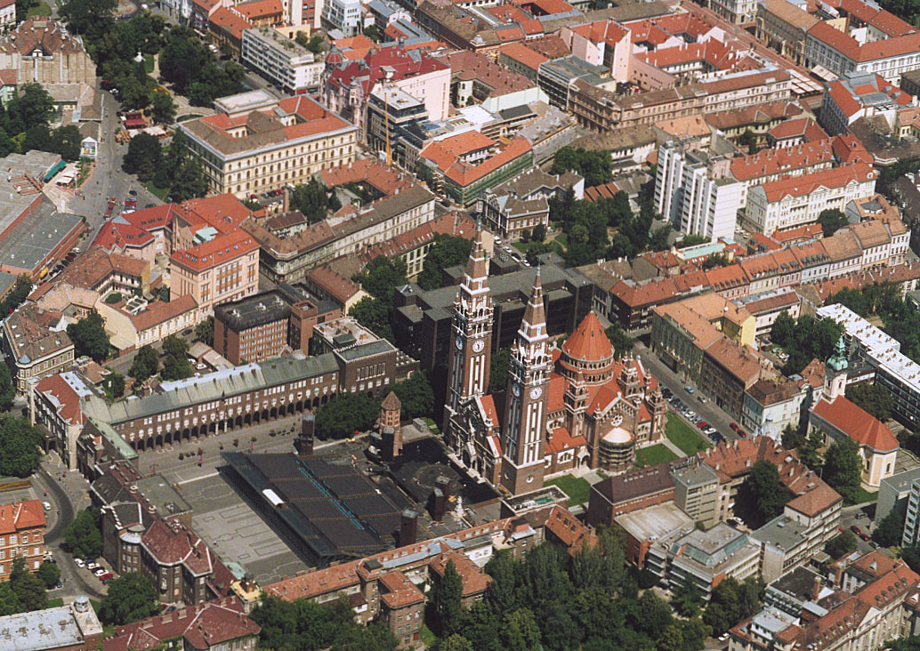
Aerial photography: Szeged
[3]
As a typical Great Plain county, Csongrád has a relatively small number of municipalities. 72.5% of the population lives in cities/towns, so it's one of the most urbanized county in Hungary.
This page uses content from the English language Wikipedia. The original content was at Csongrád County. The list of authors can be seen in the page history. As with this Familypedia wiki, the content of Wikipedia is available under the Creative Commons License.

