| Main | Births etc |
|---|
| Driggs, Idaho | |
|---|---|
| — City — | |
 |
|
| Motto: "The heart of Teton Valley" | |
 |
|
| Coordinates: Coordinates: | |
| Country | United States |
| State | Idaho |
| County | Teton |
| Government | |
| • Mayor | Daniel J. Powers |
| Area[1] | |
| • Total | 2.76 sq mi (7.15 km2) |
| • Land | 2.76 sq mi (7.15 km2) |
| • Water | 0 sq mi (0 km2) |
| Elevation | 6,109 ft (1,862 m) |
| Population (2010)[2] | |
| • Total | 1,660 |
| • Estimate (2012[3]) | 1,627 |
| • Density | 601.4/sq mi (232.2/km2) |
| Time zone | Mountain (MST) (UTC-7) |
| • Summer (DST) | MDT (UTC-6) |
| ZIP code | 83422 |
| Area code(s) | 208 |
| FIPS code | 16-22690 |
| GNIS feature ID | 0380758 |
| Website | driggs.govoffice.com |
| Historical populations | |||
|---|---|---|---|
| Census | Pop. | %± | |
| 1910 | 250 | ||
| 1920 | 683 | 173.2% | |
| 1930 | 719 | 5.3% | |
| 1940 | 1,040 | 44.6% | |
| 1950 | 941 | −9.5% | |
| 1960 | 824 | −12.4% | |
| 1970 | 727 | −11.8% | |
| 1980 | 727 | 0% | |
| 1990 | 846 | 16.4% | |
| 2000 | 1,100 | 30.0% | |
| 2010 | 1,660 | 50.9% | |
| source:[4][5] | |||
Driggs is a city in Teton County, Idaho, United States. It is part of the Jackson, WY-ID Micropolitan Statistical Area, and is located in Teton Valley, the headwaters of the Teton River. The population was 1,660 at the 2010 census, up from 1,100 in 2000.[5] The city is the county seat of Teton County,[6] and was its largest city until recently surpassed by Victor.
History[]
The Teton Valley was discovered by John Colter in 1808, a member of the Lewis and Clark Expedition (1804–06). It became known as Pierre's Hole, and it hosted the well-attended 1832 Rendezvous, which was followed by the Battle of Pierre's Hole.
Driggs was founded in 1888 by Benjamin Woodbury Driggs, Jr. and Don Carlos Driggs, whose descendants later moved to Arizona and founded Western Savings and Loan where most live still, though some remain in Idaho. John Driggs, a descendant of Don Carlos Driggs, later became the mayor of Phoenix, Arizona in the 1970s. In 2007, National Geographic magazine listed Driggs as one of the 10 best outdoor recreation destinations in the U.S.[7]
Geography[]
Driggs is located at (43.725210, -111.106005),[8] at an elevation of 6,109 feet (1,862 m) above sea level.
According to the United States Census Bureau, the city has a total area of 2.76 square miles (7.15 km2), all land.[1]
Climate[]
This climatic region is typified by large seasonal temperature differences, with warm to hot (and often humid) summers and cold (sometimes severely cold) winters. According to the Köppen Climate Classification system, Driggs has a humid continental climate, abbreviated "Dfb" on climate maps.[9]
Demographics[]
2010 census[]
As of the census[2] of 2010, there were 1,660 people, 587 households, and 385 families residing in the city. The population density was 601.4 inhabitants per square mile (232.2 /km2). There were 873 housing units at an average density of 316.3 per square mile (122.1 /km2). The racial makeup of the city was 73.0% White, 0.5% African American, 0.2% Native American, 0.5% Asian, 0.4% Pacific Islander, 23.5% from other races, and 2.0% from two or more races. Hispanic or Latino of any race were 31.6% of the population.
There were 587 households of which 40.7% had children under the age of 18 living with them, 50.6% were married couples living together, 9.5% had a female householder with no husband present, 5.5% had a male householder with no wife present, and 34.4% were non-families. 22.5% of all of the households were made up of individuals and 5.2% had someone living alone who was 65 years of age or older. The average household size was 2.82 and the average family size was 3.40.
The median age in the city was 30.6 years. 29.2% of residents were under the age of 18; 9.1% were between the ages of 18 and 24; 33.9% were from 25 to 44; 20.5% were from 45 to 64; and 7% were 65 years of age or older. The gender makeup of the city was 51.4% male and 48.6% female.
2000 census[]
As of the census[10] of 2000, there were 1,100 people, 386 households, and 252 families residing in the city. The population density was 1,054.5 people per square mile (408.4/km²). There were 449 housing units at an average density of 430.4 per square mile (166.7/km²). The racial makeup of the city was 83.73% White, 0.09% African American, 0.73% Native American, 0.73% Pacific Islander, 13.64% from other races, and 1.09% from two or more races. Hispanic or Latino of any race were 20.55% of the population.
There were 386 households out of which 38.1% had children under the age of 18 living with them, 51.6% were married couples living together, 7.5% had a female householder with no husband present, and 34.5% were non-families. 23.3% of all households were made up of individuals and 7.8% had someone living alone who was 65 years of age or older. The average household size was 2.83 and the average family size was 3.44.
In the city the population was spread out with 30.5% under the age of 18, 10.8% from 18 to 24, 34.6% from 25 to 44, 15.9% from 45 to 64, and 8.2% who were 65 years of age or older. The median age was 30 years. For every 100 females there were 112.4 males. For every 100 females age 18 and over, there were 114.3 males.
The median income for a household in the city was $33,750, and the median income for a family was $40,469. Males had a median income of $30,703 versus $19,722 for females. The per capita income for the city was $14,710. About 7.0% of families and 11.2% of the population were below the poverty line, including 6.8% of those under age 18 and 11.6% of those age 65 or over.
Recreation[]
Located 12 miles (20 km) east of Driggs in Alta, Wyoming, is the Grand Targhee Resort ski area. Teton Valley Trails and Pathways maintains four Nordic ski areas including in Teton Canyon, behind Alta school, in Teton Springs, and in Pioneer Park. Other skiing venues and Nordic ski trails are located near Driggs, including Jackson Hole Mountain Resort, northwest of Jackson.
Driggs is a popular area for mountain biking during the drier months of July through September. Mountain biking trails are publicly accessible in the Big Hole mountains on the west side of the valley and in the Teton mountains (outside of the wilderness area) on the east side of the valley. All biking trails are maintained by the US Forest Service and volunteers organized by Teton Valley Trails and Pathways (a non-profit organization). The Grand Targhee Resort also allows mountain biking on the ski hills and frequently operates the ski lifts during summer months for downhill biking.
Arts[]
Teton Valley is home to many artists who relocated to Driggs, Victor, and Tetonia to paint and photograph the spectacular views, mountains, streams and Teton River. The community of artists created a grassroots arts organization in 1994, called Teton Arts Council, to encourage arts education and support performances. It operates a 2,400-square-foot (220 m2) arts center with a ceramics studio and multi-use arts studio in Driggs. The Teton Arts Council sponsors arts programming for kids, adults and seniors in ceramics, painting, life drawing, music, theatrics, and creative writing.
The Teton Valley Foundation hosts "Music on Main" (series of live, outdoor musical concerts) during the summer months. The performing bands include local talent as well as nationally recognized tours. Types of performances range from bluegrass to jazz to reggae music.
Education[]
The public schools in the county are operated by Teton School District #401, headquartered in Driggs. The county's only traditional high school, Teton High School, is in Driggs, as are the only middle school and upper elementary school.
Transportation[]
Highway[]
 - SH-33 to Victor (south), and Tetonia (north)
Airports[]
- Driggs-Reed Memorial Airport. (IATA: DIJ, ICAO: KDIJ, FAA LID: DIJ)
Commercial flights:
- Jackson Hole Airport (IATA: JAC, ICAO: KJAC, FAA LID: JAC) in Jackson, Wyoming
- Idaho Falls Airport (IATA: IDA, ICAO: KIDA, FAA LID: IDA) in Idaho Falls.
Elected officials[]
Federally, Driggs is part of Idaho's 2nd congressional district, represented by Republican Mike Simpson, first elected in 1998.
In the U.S. Senate, Idaho's senior member is Republican Mike Crapo, first elected in 1998, and the junior member is Republican Jim Risch, elected in 2008.
The Governor of Idaho is Republican Butch Otter, first elected in 2006.
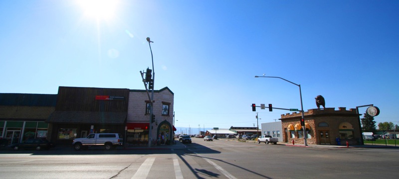
Gallery[]
")
")
")
References[]
- ^ a b "US Gazetteer files 2010". United States Census Bureau. http://www.census.gov/geo/www/gazetteer/files/Gaz_places_national.txt. Retrieved 2012-12-18.
- ^ a b "American FactFinder". United States Census Bureau. http://factfinder2.census.gov/faces/nav/jsf/pages/index.xhtml. Retrieved 2012-12-18.
- ^ "Population Estimates". United States Census Bureau. http://www.census.gov/popest/data/cities/totals/2012/SUB-EST2012.html. Retrieved 2013-06-03.
- ^ Moffatt, Riley. Population History of Western U.S. Cities & Towns, 1850-1990. Lanham: Scarecrow, 1996, 92.
- ^ a b Spokesman-Review - 2010 census - Driggs, Idaho - accessed 2011-12-23
- ^ "Find a County". National Association of Counties. http://www.naco.org/Counties/Pages/FindACounty.aspx. Retrieved 2011-06-07.
- ^ National Geographic Article, National Geographic Adventure. Retrieved on September 21, 2007.
- ^ "US Gazetteer files: 2010, 2000, and 1990". United States Census Bureau. 2011-02-12. http://www.census.gov/geo/www/gazetteer/gazette.html. Retrieved 2011-04-23.
- ^ Climate Summary for Driggs, Idaho
- ^ "American FactFinder". United States Census Bureau. http://factfinder2.census.gov. Retrieved 2008-01-31.
External links[]
- Official website
- Teton Valley Chamber of Commerce
- Teton School District #401
- Teton Arts Council
- Teton Valley Foundation
| |||||||||||
| This page uses content from the English language Wikipedia. The original content was at Driggs, Idaho. The list of authors can be seen in the page history. As with this Familypedia wiki, the content of Wikipedia is available under the Creative Commons License. |