| Ebersberg | |||
|---|---|---|---|
| — District — | |||
|
|||
 |
|||
| Country | |||
| State | Bavaria | ||
| Adm. region | Upper Bavaria | ||
| Capital | Ebersberg | ||
| Area | |||
| • Total | 549 km2 (212 sq mi) | ||
| Population (31 December 2010)[1] | |||
| • Total | 129,199 | ||
| • Density | 240/km2 (610/sq mi) | ||
| Time zone | CET (UTC+1) | ||
| • Summer (DST) | CEST (UTC+2) | ||
| Vehicle registration | EBE | ||
| Website | http://www.lra-ebe.de | ||
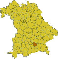
Ebersberg District is a district in Bavaria, Germany. It is bounded by (from the north and clockwise) the districts of Erding, Mühldorf am Inn, Rosenheim and Munich.
History[]
The most important event in the district's history was the battle of Hohenlinden on December 3, 1800, which was a part of the Napoleonic Wars.
Geography[]
The district includes rural areas east of the city of Munich. Despite the vicinity of Munich urbanisation is low. In the north there is a contiguous forest area of 80 km², serving as recreation area for the population of the Bavarian capital. The forest consists of three separate unincorporated areas, Anzinger Forst, Ebersberger Forst, and Eglhartinger Forst.
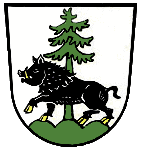
Coat of arms[]

Coat of arms
The arms display both parts of the word "Ebersberg": a boar (German "Eber") standing on a mountain (German "Berg"). These two symbols are part of the arms of the city of Ebersberg as well. In addition the district's arms include a fir, symbolising the forests of the region.
Towns and municipalities[]
| Towns | Municipalities | |
|---|---|---|
|
|
|
Unincorporated Areas
- Anzinger Forst
- Ebersberger Forst
- Eglhartinger Forst
References[]
- ^ "Fortschreibung des Bevölkerungsstandes" (in German). Bayerisches Landesamt für Statistik und Datenverarbeitung. 31 December 2010. https://www.statistikdaten.bayern.de/genesis/online?language=de&sequenz=tabelleErgebnis&selectionname=12411-009r&sachmerkmal=QUASTI&sachschluessel=SQUART04&startjahr=2010&endjahr=2010.
External links[]
- Official website (German)