| Ewenmar New South Wales | |||||||||||||
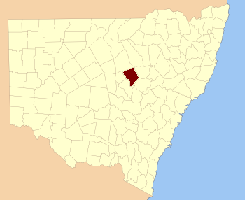 Location in New South Wales | |||||||||||||
| |||||||||||||
Ewenmar County is one of the 141 Cadastral divisions of New South Wales. It is located between the Macquarie River on the west, and the Castlereagh River on the east. This is the area between Warren and Gilgandra.
Ewenmar is believed to be derived from a local Aboriginal word.[1]
Parishes within this county[]
A full list of parishes found within this county; their current LGA and mapping coordinates to the approximate centre of each location is as follows:
| Parish | LGA | Coordinates |
|---|---|---|
| Allamurgoola | Gilgandra Shire Council | |
| Armatree | Coonamble Shire Council | |
| Balladoran | Gilgandra Shire Council | |
| Beemunnel | Warren Shire Council | |
| Berida | Gilgandra Shire Council | |
| Bobarah | Gilgandra Shire Council | |
| Boebung | Gilgandra Shire Council | |
| Bourbah | Warren Shire Council | |
| Breelong | Gilgandra Shire Council | |
| Bugabada | Narromine Shire Council | |
| Bullagreen | Warren Shire Council | |
| Bundemar | Warren Shire Council | |
| Bundijoe | Warren Shire Council | |
| Bundilla | Warren Shire Council | |
| Bundobering | Gilgandra Shire Council | |
| Bungey | Gilgandra Shire Council | |
| Buramilong | Gilgandra Shire Council | |
| Burroway | Narromine Shire Council | |
| Carrigan | Narromine Shire Council | |
| Cobboco | Gilgandra Shire Council | |
| Collemburrawang | Warren Shire Council | |
| Collie | Warren Shire Council | |
| Connibong | Gilgandra Shire Council | |
| Coolbaggie | Narromine Shire Council | |
| Coradgerie | Warren Shire Council | |
| Driel | Warren Shire Council | |
| Drillwarrina | Gilgandra Shire Council | |
| Eiraban | Gilgandra Shire Council | |
| Emogandry | Narromine Shire Council | |
| Emu | Gilgandra Shire Council | |
| Eumungerie | Gilgandra Shire Council | |
| Eura | Gilgandra Shire Council | |
| Eurombedah | Narromine Shire Council | |
| Gewah | Warren Shire Council | |
| Gulargambone | Coonamble Shire Council | |
| Healy | Warren Shire Council | |
| Kickabil | Gilgandra Shire Council | |
| Killendoon | Warren Shire Council | |
| Merrigal | Warren Shire Council | |
| Meryon | Warren Shire Council | |
| Milda | Gilgandra Shire Council | |
| Milpulling | Gilgandra Shire Council | |
| Moonul | City of Dubbo | |
| Narroweema | Warren Shire Council | |
| Tacklebang | Gilgandra Shire Council | |
| Tenandra | Warren Shire Council | |
| Umangla | Warren Shire Council | |
| Urobula | Warren Shire Council | |
| Wambianna | Warren Shire Council | |
| Warrie | Coonamble Shire Council | |
| Wemabung | Warren Shire Council | |
| Wirrigai | Narromine Shire Council | |
| Wonbobbie | Warren Shire Council |
References[]
| This page uses content from the English language Wikipedia. The original content was at Ewenmar County. The list of authors can be seen in the page history. As with this Familypedia wiki, the content of Wikipedia is available under the Creative Commons License. |