| Abberley | |

|
|

Abberley | |
| Population | 830 |
|---|---|
| OS grid reference | |
| - London | 112 miles (180 km) |
| District | Malvern Hills |
| Shire county | Worcestershire |
| Region | West Midlands |
| Country | England |
| Sovereign state | United Kingdom |
| Post town | WORCESTER |
| Postcode district | WR6 |
| Dialling code | 01299 |
| Police | West Mercia |
| Fire | Hereford and Worcester |
| Ambulance | West Midlands |
| EU Parliament | West Midlands |
| List of places: UK • England • Worcestershire | |
Abberley is a picturesque village in north west Worcestershire, England. It is situated on the northern slopes of Abberley Hill (height 283 metres (928 ft)), between the River Severn and River Teme. The village had a population of 830 in 2001.[1]
Location[]
Abberley lies halfway between Worcester and Tenbury, at the junction with the road from Worcester to Cleobury Mortimer. At the latest census, it had the youngest population of any Worcestershire village.[2]
The village[]
Abberley is a village of three distinct parts. The oldest part, known as The Village, clusters round the 12th century and 13th century parish church of St. Michael's and The Manor Arms. To the west, and divided from the village by farmland and the Cleobury road, is The Common, where the largest part of the population lives, new housing is being added, and there is a village shop cum post office. Between the village and the common, on the Cleobury road, are the Parochial VC primary school [3] and the Village Hall.[4]
A little to the north, across the Green (developed as a Millennium project) from the village, is the large Victorian St. Mary's church, built in 1852 to replace St. Michael's church when the latter fell into disrepair, though the chancel of St. Michael's was later restored and is still used for some services.
Overlooking the Village is the third part of Abberley, The Hill, with scattered farms, houses and cottages across the steep slopes of Abberley Hill.
On the opposite side of Abberley Hill to the village, to the south of the Worcester-Tenbury road, lies Abberley Hall. Abberley Hill forms part of the Abberley and Malvern Hills Geopark. The Hill lies on the path of the Worcestershire Way,[5] a well-used long-distance hiking trail.
Abberley has two churches, a primary school, a modern village hall, a traditional village pub at its centre, The Manor Arms, and nearby a country hotel and restaurant, The Elms.

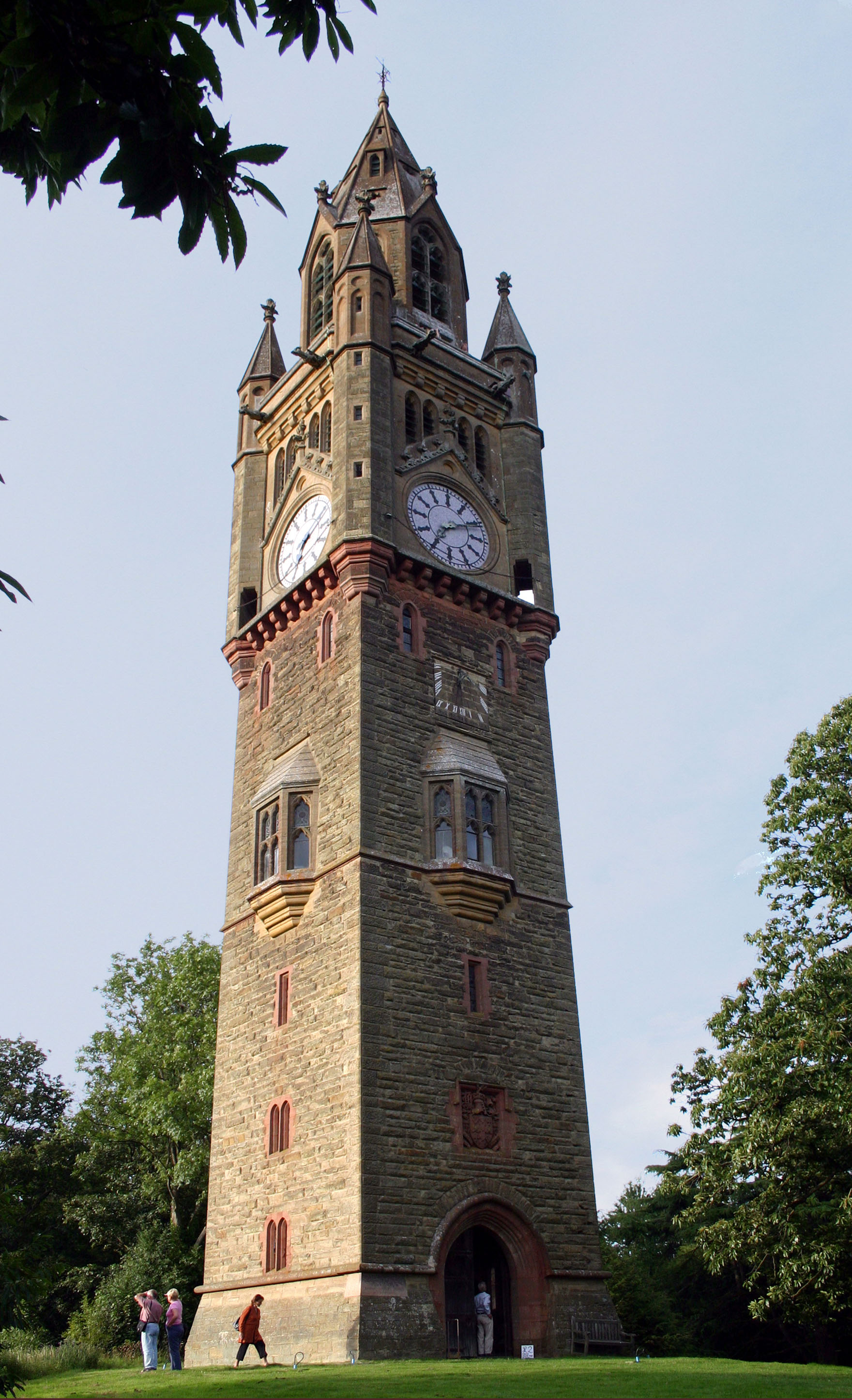
Abberley Clock Tower
Abberley is home to Abberley Hall School, a preparatory school set in the grounds of Abberley Hall, which also contain the Abberley Clock Tower, the setting for the children's book by Gene Kemp, The Clock Tower Ghost.[6]
History[]
The name Abberley probably relates to the 6th century Saxon chief Eobald, by way of Eobaldelega, then Eobaldsleigh.[7] Abberley is recorded in the Domesday Book of 1086-7 as Edboldelege, when it was held by Ralph de Tosny.[8]
In 1405 Abberley Hill was at the centre of a protracted stand-off between two major medieval armies, that of Henry IV camped on Abberley Hill itself and the primarily Welsh army of Owain Glyndŵr (Owen Glendower) camped on nearby Woodbury Hill. Eventually, cut off from their supply line, the Welsh withdrew, never again to penetrate so far into England.
")
")
")
References[]
- ^ "Worcestershire County Council : 2001 Census Worcestershire County Population Report". Worcestershire County Council. http://worcestershire.whub.org.uk/home/cs-research-census-populationreport.pdf. Retrieved 2007-09-01.
- ^ Aslet, Clive (2006-06-03). "Telegraph Property 3 June 2006 : Village voice: history written in stone". London: Telegraph.co.uk. http://www.telegraph.co.uk/property/main.jhtml?xml=/property/2006/06/03/pvillage03.xml. Retrieved 2007-08-24.
- ^ "Abberley Parochial VC Primary School : Web site". Abberley Parochial VC Primary School. http://www.abberley.ik.org/. Retrieved 2007-08-25.
- ^ Sheila Mawby. "Abberley Village Hall : Web site". Abberley Village Hall. Archived from the original on 2009-10-24. http://www.webcitation.org/5klWGHTij. Retrieved 2007-08-25.
- ^ "The Worcestershire Way : Web site". Worcestershire County Council. http://www.worcestershire.gov.uk/cms/environment-and-planning/countryside/explore-the-countryside/waymarked-walks/long-distance-trails/the-worcestershire-way.aspx.
- ^ "The Clock Tower Ghost : Book details". Faber.co.uk. Archived from the original on 2007-09-27. http://web.archive.org/web/20070927043159/http://www.faber.co.uk/book_detail.html?bid=8930. Retrieved 2007-08-25.
- ^ "Parishes: Abberley', A History of the County of Worcester: volume 4 (1924)". British History Online. http://www.british-history.ac.uk/report.asp?compid=42884/. Retrieved 2007-08-25.
- ^ Williams, Ann; G H Martin. Domesday Book: A Complete Translation. London: Penguin. pp. 486; 1303. ISBN 978-0-14-143994-5.
'Parishes: Abberley', A History of the County of Worcester: volume 4 (1924), pp. 220–24. Date accessed: 23 August 2007
External links[]
- Abberley Parochial Primary School
- Abberley Hall and Clock Tower
- The Clock Tower Ghost
- Abberley & Malvern Hills Geopark
- The Worcestershire Way
- Abberley Village Homepage
Template:Malvern Hills
| This page uses content from the English language Wikipedia. The original content was at Abberley. The list of authors can be seen in the page history. As with this Familypedia wiki, the content of Wikipedia is available under the Creative Commons License. |