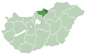
Nógrád is famous for its historic architecture of ancient Gothic churches and stone castles dated back to the 13th century. Other historic landmark includes the baroque buildings constructed in the 18th century and the Vay, Teleki. [1]. Much of the northern border of the county is formed by the river Ipoly. The mountain ranges Börzsöny, Cserhát and Mátra lie partly in the county.
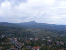
Due to the mountains, the county is characterised by small villages nestled in the valleys. The two largest settlements are Balassagyarmat, the former county seat, and Salgótarján, which has become a center of industry in the early 20th century due to coalmines nearby.
Nógrád (-Hungarian, in Latin: comitatus Neogradiensis, in German: Neuburg or Neograd, in Slovak: Novohrad) was also the name of a historic administrative county (comitatus) of the Kingdom of Hungary. Its territory is presently in southern Slovakia and in northern present-day Hungary. The name Novohrad is still used in Slovakia as an informal designation of the corresponding territory. The name stems from the former Nógrád (Novohrad) castle in present-day Hungary.


")
")
")
")
")
")
")
")
")
")
")
