| Main | Births etc |
|---|
| Brunswick, Maine | |||
|---|---|---|---|
 |
|||
|
|||
| Motto: "Beautifully balanced" | |||

Brunswick |
|||
| Coordinates: | |||
| Country | United States | ||
| State | Maine | ||
| County | Cumberland | ||
| Settled | 1628 | ||
| Incorporated (town) | 1739 | ||
| Area[1] | |||
| • Total | 54.34 sq mi (140.74 km2) | ||
| • Land | 46.73 sq mi (121.03 km2) | ||
| • Water | 7.61 sq mi (19.71 km2) | ||
| Population (2010)[2] | |||
| • Total | 20,278 | ||
| • Estimate (2012[3]) | 20,329 | ||
| • Density | 433.9/sq mi (167.5/km2) | ||
| Time zone | Eastern (UTC-5) | ||
| • Summer (DST) | Eastern (UTC-4) | ||
| ZIP code | 04011 | ||
| Website | brunswickme.org | ||
Brunswick is a town in Cumberland County in southwestern Maine, United States. The population was 20,278 at the 2010 census. Part of the Portland-South Portland-Biddeford metropolitan area, Brunswick is home to Bowdoin College, the Bowdoin College Museum of Art, the Peary-MacMillan Arctic Museum, The Theater Project, and the Maine State Music Theatre. It is also home to Mid Coast Hospital, one of Maine's newest full-service hospitals; and Parkview Adventist Medical Center. It was home to Naval Air Station Brunswick which permanently closed on May 31, 2011.
History[]

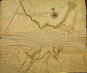
Map of Brunswick, May 29, 1795
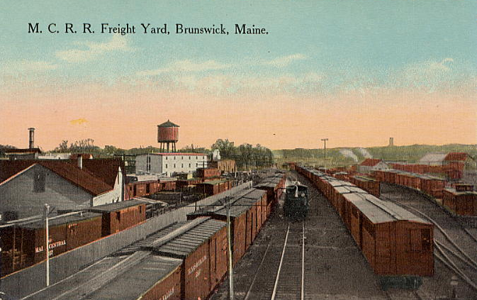

The rail yard at Brunswick, ca. 1910
Settled in 1628 by Thomas Purchase and other fishermen, the area was called by its Indian name, Pejepscot, meaning "the long, rocky rapids part [of the river]". In 1639, Purchase placed his settlement under protection of the Massachusetts Bay Colony. During King Philip's War in 1676, Pejepscot was burned and abandoned, although a garrison called Fort Andros was built on the ruins during King William's War. During the war, in Major Benjamin Church's second expedition a year later, he arrived on 11 September 1690 with 300 men at Casco Bay. He went up the Androscoggin River to the English Fort Pejepscot (present day Brunswick, Maine).[4] From there he went 40 miles up-river and attacked a native village. Three or four native men were shot in retreat; when Church discovered 5 English captives in the wigwams, six or seven prisoners were butchered as an example;[5] and nine prisoners were taken. A few days later, in retaliation, the natives attacked Church at Cape Elizabeth on Purpooduc Point, killing 7 of his men and wounding 24 others.[6] On September 26, Church returned to Portsmouth, New Hampshire.
The 1713 Treaty of Portsmouth brought peace to the region between the Abenaki Indians and the English colonists.[7]
In 1714, a consortium from Boston and Portsmouth bought the land, thereafter called the Pejepscot Purchase. The Massachusetts General Court constituted the township in 1717, naming it Brunswick in honor of the House of Brunswick and its scion, King George I. A stone fort called Fort George was built in 1715 near the falls. But during Dummer's War on July 13, 1722, Abenaki warriors from Norridgewock burned the village. Consequently, Governor Samuel Shute declared war on the Abenakis. In 1724, 208 English troops left Fort Richmond and sacked Norridgewock during Dummer's War. Brunswick was rebuilt again in 1727, and in 1739 incorporated as a town. It became a prosperous seaport, where Bowdoin College was chartered in 1794.[7]
The Androscoggin River falls in three successive stages for a total vertical drop of 41 feet (12 m), providing water power for industry. Brunswick became a major producer of lumber, with as many as 25 sawmills. Some of the lumber went into shipbuilding. Other firms produced paper, soap, flour, marble and granite work, carriages and harness, plows, furniture, shoes and confections. The town was site of the first cotton mill in Maine, the Brunswick Cotton Manufactory Company, built in 1809 to make yarn. Purchased in 1812, the mill was enlarged by the Maine Cotton & Woolen Factory Company.[8] In 1857, the Cabot Manufacturing Company was established to make cotton textiles. It bought the failed Worumbo Mill and expanded the brick factory along the falls. Needing even more room, the company in 1890 persuaded the town to move Maine Street.[9]
Brunswick today has a number of historic districts recognized on the National Register of Historic Places, including the Pennellville Historic District preserving shipbuilders' and sea captains' mansions built in the Federal, Greek Revival and Italianate architectural styles. Principal employers for Brunswick include L.L. Bean, Bath Iron Works, as well as companies that produce fiberglass construction material and electrical switches. A number of health services providers serving Maine's mid-coast area are located in Brunswick.[10] The former Naval Air Station Brunswick was a major employer in Brunswick prior to its closure.
The book Uncle Tom's Cabin was written by Harriet Beecher Stowe while she was living in Brunswick, because her husband was a professor at Bowdoin. She got a key vision for the book in the First Parish Church.[11] A scene in the 1993 movie The Man Without a Face was filmed in the town.[10]
Geography[]
According to the United States Census Bureau, the town has a total area of 54.34 square miles (140.74 km2), of which 46.73 square miles (121.03 km2) is land and 7.61 square miles (19.71 km2) is water.[1] Brunswick is located at the north end of Casco Bay, as well as the head of tide and head of navigation on the Androscoggin River.
Climate[]
| Climate data for Brunswick, Maine | |||||||||||||
|---|---|---|---|---|---|---|---|---|---|---|---|---|---|
| Month | Jan | Feb | Mar | Apr | May | Jun | Jul | Aug | Sep | Oct | Nov | Dec | Year |
| Record high °F (°C) | 61 (16) |
59 (15) |
73 (23) |
84 (29) |
94 (34) |
100 (38) |
98 (37) |
104 (40) |
95 (35) |
85 (29) |
74 (23) |
68 (20) |
100 (38) |
| Average high °F (°C) | 31 (−1) |
34 (1) |
43 (6) |
54 (12) |
65 (18) |
74 (23) |
79 (26) |
78 (26) |
70 (21) |
59 (15) |
47 (8) |
36 (2) |
55.8 (13.2) |
| Average low °F (°C) | 10 (−12) |
14 (−10) |
23 (−5) |
33 (1) |
44 (7) |
53 (12) |
59 (15) |
58 (14) |
50 (10) |
38 (3) |
30 (−1) |
18 (−8) |
36 (2.1) |
| Record low °F (°C) | −49 (−45) |
−25 (−32) |
−10 (−23) |
13 (−11) |
27 (−3) |
34 (1) |
37 (3) |
37 (3) |
28 (−2) |
18 (−8) |
1 (−17) |
−21 (−29) |
−49 (−45) |
| Precipitation inches (mm) | 3.72 (94.5) |
3.55 (90.2) |
4.37 (111) |
4.74 (120.4) |
4.52 (114.8) |
4.17 (105.9) |
4.00 (101.6) |
3.30 (83.8) |
4.23 (107.4) |
4.94 (125.5) |
5.62 (142.7) |
4.07 (103.4) |
51.23 (1,301.2) |
| Source: weather.com[12] | |||||||||||||
Neighboring cities and towns[]

|
Durham | Topsham | Bath |
|
| Durham | West Bath | |||
 Brunswick | ||||
| Freeport | Harpswell | Phippsburg |
Infrastructure & services[]
Education[]
Brunswick High School
The Brunswick School Department operates public schools.
- Brunswick High School
- Children's School of Arts & Science
- Saint John's Catholic School [1]
- Bowdoin College
Transportation[]
The town is served by Interstate 295, U.S. Routes 1 and 201, and Maine State Route 24, Maine State Route 123 and Maine State Route 196.
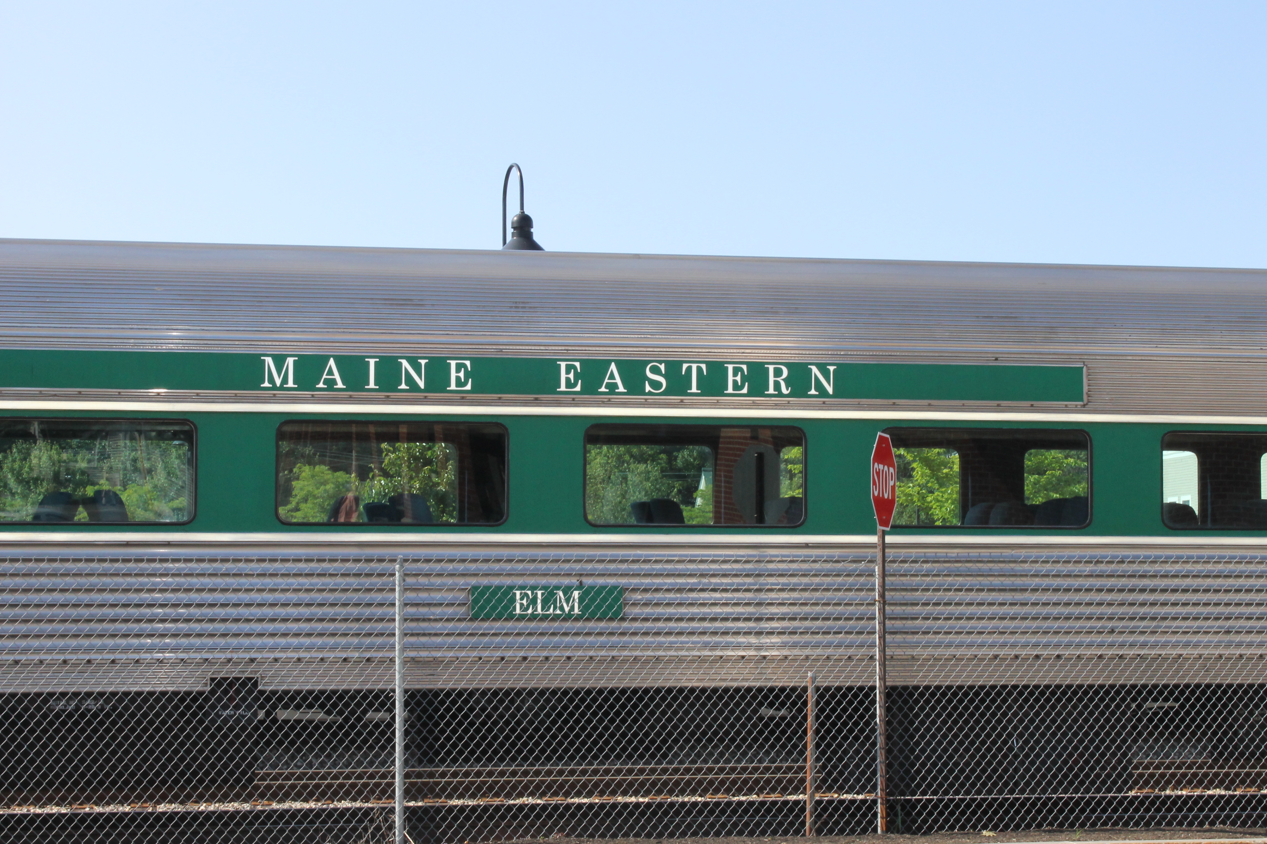
Maine Eastern Railroad train at the Amtrak station in Brunswick
Amtrak's Downeaster train service terminates at Brunswick Maine Street Station and connects the town to the Portland Transportation Center and Boston's North Station.
Demographics[]
| Historical populations | |||
|---|---|---|---|
| Census | Pop. | %± | |
| 1790 | 1,357 | ||
| 1800 | 1,809 | 33.3% | |
| 1810 | 2,682 | 48.3% | |
| 1820 | 2,931 | 9.3% | |
| 1830 | 3,547 | 21.0% | |
| 1840 | 4,259 | 20.1% | |
| 1850 | 4,977 | 16.9% | |
| 1860 | 4,723 | −5.1% | |
| 1870 | 4,687 | −0.8% | |
| 1880 | 5,384 | 14.9% | |
| 1890 | 6,012 | 11.7% | |
| 1900 | 6,806 | 13.2% | |
| 1910 | 6,621 | −2.7% | |
| 1920 | 7,261 | 9.7% | |
| 1930 | 7,604 | 4.7% | |
| 1940 | 8,658 | 13.9% | |
| 1950 | 10,996 | 27.0% | |
| 1960 | 15,797 | 43.7% | |
| 1970 | 16,195 | 2.5% | |
| 1980 | 17,366 | 7.2% | |
| 1990 | 20,906 | 20.4% | |
| 2000 | 21,172 | 1.3% | |
| 2010 | 20,278 | −4.2% | |
| [13][14][15] | |||
As of 2000, the median income for a household in the town was $40,402; and the median income for a family was $49,088. Males had a median income of $32,141 versus $24,927 for females. The per capita income for the town was $20,322. About 5.0% of families and 8.0% of the population were below the poverty line, including 8.6% of those under age 18 and 8.1% of those age 65 or over.
2010 census[]
As of the census[2] of 2010, there were 20,278 people, 8,469 households, and 4,889 families residing in the town. The population density was 433.9 inhabitants per square mile (167.5 /km2). There were 9,599 housing units at an average density of 205.4 per square mile (79.3 /km2). The racial makeup of the town was 93.0% White, 1.7% African American, 0.3% Native American, 2.1% Asian, 0.5% from other races, and 2.4% from two or more races. Hispanic or Latino of any race were 2.9% of the population.
There were 8,469 households of which 25.7% had children under the age of 18 living with them; 44.7% were married couples living together; 9.7% had a female householder with no husband present; 3.3% had a male householder with no wife present; and 42.3% were non-families. 35.1% of all households were made up of individuals and 16.5% had someone living alone who was 65 years of age or older. The average household size was 2.19 and the average family size was 2.83.
The median age in the town was 41.4 years. 19.2% of residents were under the age of 18; 14.1% were between the ages of 18 and 24; 20.8% were from 25 to 44; 27.6% were from 45 to 64; and 18.2% were 65 years of age or older. The gender makeup of the town was 47.1% male and 52.9% female.
Sites of interest[]


Curtis Memorial Library c. 1915


House where Henry Wadsworth Longfellow, Bowdoin Class of 1825, roomed


Harriet Beecher Stowe House, where, between 1850 and 1852, Stowe wrote Uncle Tom's Cabin
- Androscoggin Pedestrian Swinging Bridge
- Pejepscot Historical Society (official website)
- Pejepscot Museum
- Joshua L. Chamberlain Museum
- Skolfield-Whittier House
Notable people[]
- John Stevens Cabot Abbott, clergyman and author
- Dale Arnold, sportscaster and radio personality
- Josh Casaubon, actor
- Fanny Chamberlain, wife of Joshua Chamberlain
- Joshua Chamberlain, Civil War era general and 32nd governor of Maine
- Robert P. T. Coffin, poet
- Alexander Cornell du Houx, state legislator
- Robert P. Dunlap, congressman, 11th governor of Maine
- Charles Carroll Everett, theologian
- Scott Cowger, state legislator
- Stanley Gerzofsky, state legislator
- John Gould, reporter, columnist
- Frederic Aldin Hall, professor, school chancellor
- Joshua Herrick, congressman
- Graeme K., musician
- Angus King, US Senator, 72nd governor of Maine
- Karen Mills, Administrator for Small Business Administration, cabinet-level position
- Henry Wadsworth Longfellow, poet
- Stump Merrill, baseball player
- Benjamin Orr, congressman
- Alpheus Spring Packard, professor
- George Palmer Putnam, publisher
- John Rankin Rogers, third Governor of the state of Washington[16]
- Mark Rogers, pitcher for the Milwaukee Brewers
- Sam Smith, journalist, activist
- Harriet Beecher Stowe, abolitionist, author
- Brigadier Samuel Thompson, Revolutionary War soldier[17]
- Robert Zildjian, founder of Sabian cymbals
References[]
- ^ a b "US Gazetteer files 2010". United States Census Bureau. http://www.census.gov/geo/maps-data/data/gazetteer2010.html. Retrieved 2012-12-16.
- ^ a b "American FactFinder". United States Census Bureau. http://factfinder2.census.gov/faces/nav/jsf/pages/index.xhtml. Retrieved 2012-12-16.
- ^ "Population Estimates". United States Census Bureau. http://www.census.gov/popest/data/cities/totals/2012/SUB-EST2012.html. Retrieved 2013-07-06.
- ^ Drake, The Border Wars of New England. p. 66
- ^ Drake, p. (67);
- ^ Drake, p. .(p.69).
- ^ a b Coolidge, Austin J.; John B. Mansfield (1859). A History and Description of New England. Boston, Massachusetts. pp. 75–77. http://books.google.com/books?id=OcoMAAAAYAAJ&lpg=PA9&dq=coolidge%20mansfield%20history%20description%20new%20england%201859&pg=PA75#v=onepage&q&f=false.
- ^ Varney, George J. (1886), Gazetteer of the state of Maine. Brunswick, Boston: Russell, http://history.rays-place.com/me/brunswick-me.htm
- ^ Historical Sketch of Brunswick, Maine (1889)
- ^ a b Southern Midcoast Maine Chamber of Commerce
- ^ House of Harriet Beecher Stowe, National Park Service
- ^ "Monthly Averages for Brunswick, Maine". Weather.com. The Weather Channel. http://www.weather.com/weather/wxclimatology/monthly/graph/USME0056. Retrieved August 15, 2013.
- ^ http://www.census.gov/population/www/censusdata/cencounts/files/me190090.txt
- ^ http://factfinder2.census.gov/faces/tableservices/jsf/pages/productview.xhtml?pid=DEC_10_PL_QTPL&prodType=table
- ^ http://mapserver.lib.virginia.edu/
- ^ "Washington Governor John Rankin Rogers". National Governors Association. http://www.nga.org/cms/home/governors/past-governors-bios/page_washington/col2-content/main-content-list/title_rogers_john.html. Retrieved October 2013.
- ^ Goold, William The Burning of Falmouth 19 February 1873
Further reading[]
| Wikisource has the text of the 1911 Encyclopædia Britannica article Brunswick (Maine). |
- History of the Town Commons, Brunswick, Maine
- History of Brunswick, Topsham, and Harpswell, Maine Including Ancient Pejebscot. By George Augustus Wheeler and Henry Warren Wheeler. Published 1878. Full image at books.google.
External links[]
- Town of Brunswick official website
- Curtis Memorial Library
- New Meadows Watershed Partnership
 Brunswick travel guide from Wikivoyage
Gallery[]
")
")
")
")
")
| ||||||||||||||||||||

| ||||||||||||||||||||
| This page uses content from the English language Wikipedia. The original content was at Brunswick, Maine. The list of authors can be seen in the page history. As with this Familypedia wiki, the content of Wikipedia is available under the Creative Commons License. |