| Main | Births etc |
|---|
| Glebe Sydney, | |||||||||||||
 Glebe Point Road | |||||||||||||
| Population: | 11,123 [1] | ||||||||||||
| Postcode: | 2037 | ||||||||||||
| Area: | 1.8 km² (0.7 sq mi) | ||||||||||||
| Location: | 3 km (2 mi) west of Sydney CBD | ||||||||||||
| LGA: | City of Sydney | ||||||||||||
| State District: | Balmain | ||||||||||||
| Federal Division: | Sydney | ||||||||||||
| |||||||||||||
Glebe is an inner-city suburb of Sydney. Glebe is located 3 km south-west of the Sydney central business district and is part of the local government area of the City of Sydney, in the Inner West region.
Glebe is surrounded by Blackwattle Bay and Rozelle Bay, inlets of Sydney Harbour, in the north. The suburb of Ultimo lies to the east and the suburbs of Annandale and Forest Lodge lie to the west. The southern boundary is formed by Parramatta Road and Broadway. Broadway is a locality around the road of the same name, which is located on the border of Glebe, Chippendale and Ultimo.
History[]
Glebe's name derives from the fact that the land on which it was developed was a glebe, originally owned by the Anglican Church. 'The Glebe' was a land grant of 400 acres (1.6 km2) given by Governor Arthur Phillip to Reverend Richard Johnson, Chaplain of the First Fleet, in 1790.[2]


.jpg)
Rozelle Tram Depot, Glebe, 1919
In the 19th century, Glebe was home to architect, Edmund Blacket, who had migrated from England. Blacket built his family home, Bidura, on Glebe Point Road in 1858,[3] designing it along conventional Victorian Regency lines. He also designed St John's Church, on the corner of Glebe Point Road and St Johns Road. The church was built from 1868 to 1870.
The Rozelle Tram Depot, opened for service on the 17th April 1904. The depot served the inner western suburbs tram routes to Leichhardt, Balmain, Birchgrove, Abbotsford, and Lilyfield. During its peak of operations the depot was a major place of employment, employing up to 650 staff and was one of few workplaces of significant size in the Glebe area during its period.[4] The depot ceased operations on 22 November 1958.[5]
The suburb of Glebe was home to a first grade football team in the New South Wales Rugby League, now the National Rugby League. The Glebe Dirty Reds were formed in 1908 and played in the first seasons of rugby league in Australia, with home games at Wentworth Park.[6] The foundation club did not win a premiership, and was excluded from the competition in 1930.
In the 1970s, feminist activists took over an abandoned terrace house and set up Australia's first women's shelter, the Elsie Refuge.[7]
Original vegetation[]
The original vegetation was the Sydney Turpentine-Ironbark Forest. A veteran Ironbark still grows at the grounds of St John's Anglican Church, at Glebe Point Road.[8]
Landmarks[]

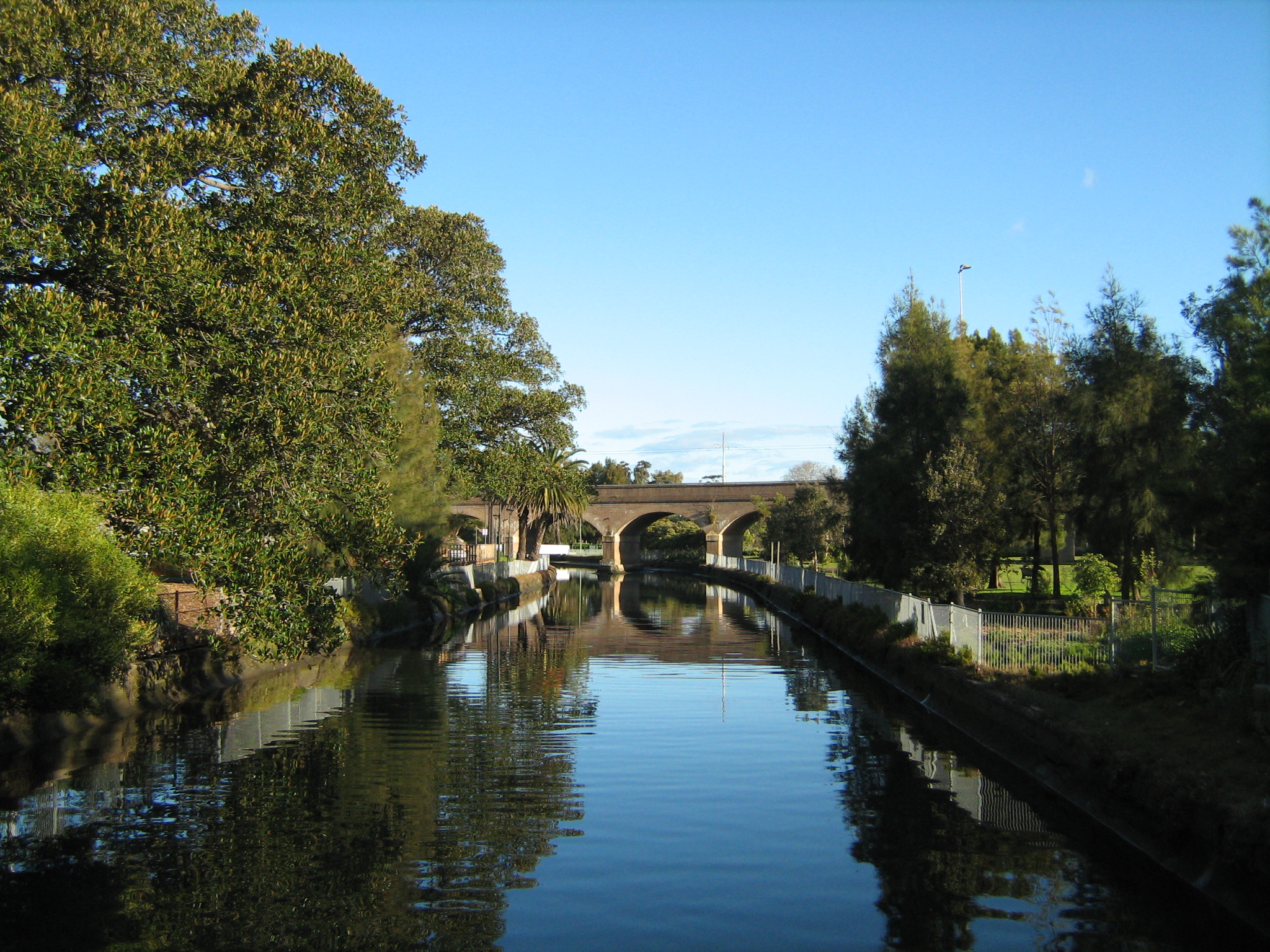
Johnstons Creek
- Sze Yup Temple (Chinese: 四邑廟) is located in Edward Street and was originally built in 1898 by Chinese immigrants from Sze Yup, Guangdong province, China. It provided a focal point for the early Chinese market gardeners in the area and is still in use today. The present building, which replaced one destroyed by fire, dates from 1955. Arsonists caused another fire in January 2008, damaging the roof and all its contents. Racism and anti-Chinese sentiments just prior to Chinese New Year in February were suspected as motives, but police refused to confirm or deny this.[9] While refusing to agree to community suspicions that the fire was racially-motivated, in January 2009 the local council allowed reconstruction work as a sign of goodwill.[10] The temple is heritage-listed.[11]
- Bellevue, located in Blackwattle Park, was built in 1896 by Ambrose Thornley for prominent Glebe resident William Jarrett. It was later restored and turned into a cafe. Bellevue is heritage-listed.[12]
- Bidura, situated on Glebe Point Road, was built by the architect Edmund Blacket for his family. Built in 1857, the house may have been influenced by the design of the nearby Toxteth Park. It is heritage-listed.[13]
- St Scholastica's College George Allen, who established a legal firm and became Lord Mayor of Sydney in 1844, constructed this building as his home and called it Toxteth Park. St Scholastica's College moved to this site from Pitt Street in the centre of Sydney, in 1901. The building is heritage-listed.[14]
- Lyndhurst This mansion was built between 1834 and 1837 for Dr James Bowman, who was the principal surgeon of the nearby Sydney Hospital. It was designed by the noted architect John Verge, in the Regency style. The building was resumed in 1972 with the intention of demolishing it as part of a proposed freeway project. However, it was saved as a result of public protest, then handed over to the Historic Houses Trust in 1983. In 2004 it was sold and then returned to use as a private home. Lyndhurst is heritage-listed.[15]
- Coroner's Court of New South Wales This building is prominently located on Parramatta Road and often in the news due to inquests being conducted there.
- Johnstons Creek rises in Stanmore and flows in a generally northward direction towards Rozelle Bay. The creek passes beneath the stands of the former Harold Park Paceway prior to emptying into Rozelle Bay at Bicentennial Park, Glebe.
Population[]
At the 2011 Census, there were 11,123 residents in Glebe. 32.7% of people were attending an educational institution and of these, 40.5% were enrolled in a tertiary or technical institution. Slightly more than half (57.4%) of people were born in Australia, with the top other countries of birth being England 4.9%, New Zealand 3.5%, Vietnam 2.0% and China 1.6%. Tertiary Education (6.6%) was the major industry of employment, with other major industries including Legal and Accounting Services 4.8%, and Computer System Design and Related Services 3.9%. About a third of people travelled to work by car and a similar amount of people travelled by public transport. The majority of dwellings in Glebe were either semi-detached houses or units/apartments. Only 9.1% of occupied dwellings were separate houses. Renting (61.5%) was far more common than home ownership. Just 17.6% of people in Glebe owned their home outright.[1]
Culture[]


Glebe markets


Wentworth Park
Commercial areas, restaurants and cafés[]
Glebe Point Road is the main road through the suburb, featuring a shopping strip, known for its specialty shops and cafés and for its variety of ethnic restaurants, possibly the most diverse in Sydney - Indian, Thai, Italian, Nepalese, Dutch-Indonesian, and other minority ethnic tastes.
Broadway Shopping Centre was built on the landmark site of the former Grace Brothers department store. The shopping centre includes a food court and cinema complex, and completed a renovation in July 2007 which added a fourth floor.
Glebe has a popular market which is held on Saturdays in the grounds of Glebe Primary School.[16] Arts, crafts, clothing and edibles are sold. They are known as the alternative markets for the alternative lifestyle goods that are offered. New and second-hand goods are sold there.
Sport and recreation[]
Wentworth Park, which features a greyhound racing track, is on the border with Ultimo.
Glebe mini skateboarding ramp is located in Bicentennial Park off Chapman road, in between Glebe and Annandale. The mini was originally 3.5-foot (1.1 m) tall with a hump in the middle. Circa 2005 the original mini was removed and replaced with a traditional 4-foot (1.2 m) ramp, sans hump.
Education[]
Schools in the suburb include Glebe Public School (on Glebe Point Road), St James Catholic School (on Woolley Street), Forest Lodge Public School (Pyrmont Bridge Rd) and St Scholastica's College (on Avenue Road). The Blackwattle Bay Campus of Sydney Secondary College sits on the site of the old Glebe High School. Tranby Aboriginal College is located in a heritage-listed house, Tranby, in Mansfield Street.
Transport[]
Glebe's nearest railway station is Central, which is around a twenty minute walk away. The Inner West Light Rail line has two stations in the suburb, Glebe and Jubilee Park, with the journey from Glebe to Central taking just under twenty minutes. The 431 and 433 buses run regularly from Millers Point via George Street, Broadway and Glebe Point Road, terminating at Glebe Point and Balmain respectively. The journey time from Glebe Point Road to Town Hall on either of these services is typically between ten and twenty minutes. Glebe Point Road is also serviced by the 370 bus, which runs from Leichhardt to Coogee via Newtown, Alexandria and UNSW.
Houses[]
19th century housing stock is largely intact, having undergone restoration as a result of gentrification. It is popular with city-workers and students due to its proximity to the Central Business District as well as University of Sydney, the University of Technology Sydney, and the University of Notre Dame Australia. Glebe is popular with backpackers due to the bars and cafes of Glebe Point Road and the aforementioned proximity to the City.
At its south-eastern end is the Glebe Estate, an area of Housing Commission properties purchased by the government of Gough Whitlam as a massive urban renewal project to provide public housing for the needy. This area today has the third highest Aboriginal population in Sydney.[17]
Heritage[]
The following buildings have a state or federal heritage listing:

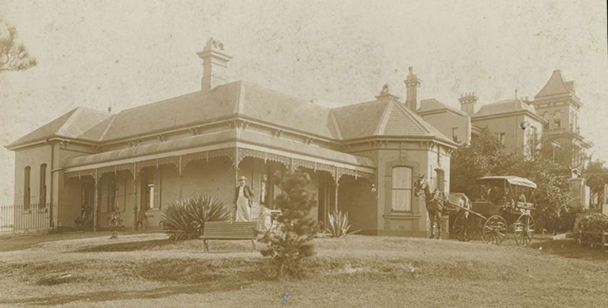
Bellevue, Glebe 1899. The large house behind is Venetia
- St John's Anglican Church, Glebe Point Road
- Glebe Court House, Talfourd Street
- Glebe Police Station, Talfourd Street
- Former Glebe Town Hall, St John's Road
- Former Glebe Post Office, Glebe Point Road
- Reussdale (formerly Presbyterian Church Manse) plus former Presbyterian Church, Bridge Road
- Lyndhurst, Darghan Street
- Tranby, Mansfield Street
- Emslee, Mansfield Street
- Margaretta Cottage, Leichhardt Street
- Bellevue, Leichhardt Street
- Railway Viaduct, Wentworth Park
- Hereford House, Hereford Street
- Monteith, Glebe Point Road
- Pyrmont & Glebe Railway Tunnels
- Rothwell Lodge & Factory, Ferry Road
- Sze Yup Temple, Edward Street
- University Hall & Cottages, Broadway
Gallery[]
")
")
")
")
")
Sze_Yup_Temple-1.jpg "(1)Sze Yup Temple-1.jpg (3.75 MB)")
")
")
")
References[]
- ^ a b Australian Bureau of Statistics (31 October 2012). "Glebe (State Suburb)". 2011 Census QuickStats. http://www.censusdata.abs.gov.au/census_services/getproduct/census/2011/quickstat/SSC10953?opendocument&navpos=220. Retrieved 5 May 2013.
- ^ The Book of Sydney Suburbs, Compiled by Frances Pollon, Angus & Robertson Publishers, 1990, p.109
- ^ Sydney Architecture, John Haskell (UNSW Press) 1997, p.62
- ^ Pages 83-84, Godden Mackay Logan "Former Rozelle Tram Depot - Conservation Management Plan" Sept 2004
- ^ Page 12, Godden Mackay Logan, "Former Rozelle Tram Depot - Conservation Management Plan" September 2004
- ^ "Centenary of Rugby League". http://www.centenaryofrugbyleague.com.au/site/news--reviews/media-releases/community-games-day-at-arl's-first-home-ground.aspx. Retrieved 4 May 2013.
- ^ The NSW Women’s Refuge Movement’s Little Book of Refuges- First Edition
- ^ Les Robinson - Field Guide to the Native Plants of Sydney, ISBN 978-0-7318-1211-0 page 48
- ^ Dylan Welch (31 January 2008). "Firebug hits historic Sydney temple". The Sydney Morning Herald. http://www.smh.com.au/news/national/blaze-rips-through-temple/2008/01/31/1201714088002.html.
- ^ http://glebesociety.org.au/?page_id=355
- ^ State Heritage Website
- ^ State Heritage Website
- ^ State Heritage Website
- ^ State Heritage Website
- ^ State Heritage Website
- ^ "Welcome to Glebe Markets". http://www.glebemarkets.com.au/. Retrieved 4 May 2013.
- ^ Local Action Plan North-WestPDF (239 KiB), page 3
External links[]
 Media related to Glebe, New South Wales at Wikimedia Commons
| |||||||||||
| This page uses content from the English language Wikipedia. The original content was at Glebe, New South Wales. The list of authors can be seen in the page history. As with this Familypedia wiki, the content of Wikipedia is available under the Creative Commons License. |