| ||||||||||||||
| Mercer County, New Jersey | ||
| ||
 Location in the state of New Jersey | ||
 New Jersey's location in the U.S. | ||
| Founded | 1838 | |
|---|---|---|
| Seat | Trenton | |
| Largest city | Hamilton | |
| Area - Total - Land - Water |
229 sq mi (593 km²) 226 sq mi (585 km²) 3 sq mi (8 km²), 1.27% | |
| Population - (2020) - Density |
387,340 1,624/sq mi (627/km²) | |
| Website | www.mercercounty.org | |
Mercer County is a county located in the U.S. state of New Jersey. Its county seat is Trenton, the state capital[1]. It is officially part of both the New York metropolitan area and the Trenton-Ewing Metropolitan Statistical Area. Unofficially, it is considered part of the Delaware Valley, part of the Philadelphia Metropolitan Area.
The county is named for Continental Army General Hugh Mercer, who died at the Battle of Princeton in 1777. The Mercer Oak, against which the dying general rested as his men continued to fight, appears on the county seal. As of the United States 2020 Census, the population was 387,340. Mercer County ranks 80th among the highest-income counties in the United States. It also is ranked 57th in the United States by per capita income.[2]
Mercer county is home to Princeton University, Princeton Theological Seminary, the Institute for Advanced Study, Rider University, The College of New Jersey, Thomas Edison State College and Mercer County Community College.[3]
Demographics[]
| Historical populations | |||
|---|---|---|---|
| Census | Pop. | %± | |
| 1840 | 21,502 | ||
| 1850 | 27,992 | 30.2% | |
| 1860 | 37,419 | 33.7% | |
| 1870 | 46,386 | 24.0% | |
| 1880 | 58,061 | 25.2% | |
| 1890 | 79,978 | 37.7% | |
| 1900 | 95,365 | 19.2% | |
| 1910 | 125,657 | 31.8% | |
| 1920 | 159,881 | 27.2% | |
| 1930 | 187,143 | 17.1% | |
| 1940 | 197,318 | 5.4% | |
| 1950 | 229,781 | 16.5% | |
| 1960 | 266,392 | 15.9% | |
| 1970 | 304,116 | 14.2% | |
| 1980 | 307,863 | 1.2% | |
| 1990 | 325,824 | 5.8% | |
| 2000 | 350,761 | 7.7% | |
| 2010 | 366,513 | 4.5% | |
| historical census data source:[4][5][6] | |||
As of the census[7] of 2010, there were 366,513 people, 133,807 households, and 86,303 families residing in the county. The population density was 1,552 people per square mile (599/km²). There were 143,169 housing units at an average density of 590 per square mile (228/km²). The racial makeup of the county was 61.39% White, 20.28% Black or African American, 0.33% Native American, 8.94% Asian, 0.08% Pacific Islander, 6.24% from other races, and 2.75% from two or more races. 15.09% of the population were Hispanic or Latino of any race. According to Census 2000, 15.5% were of Italian, 9.7% Irish, 8.2% German, 6.7% Polish and 5.7% English ancestry.
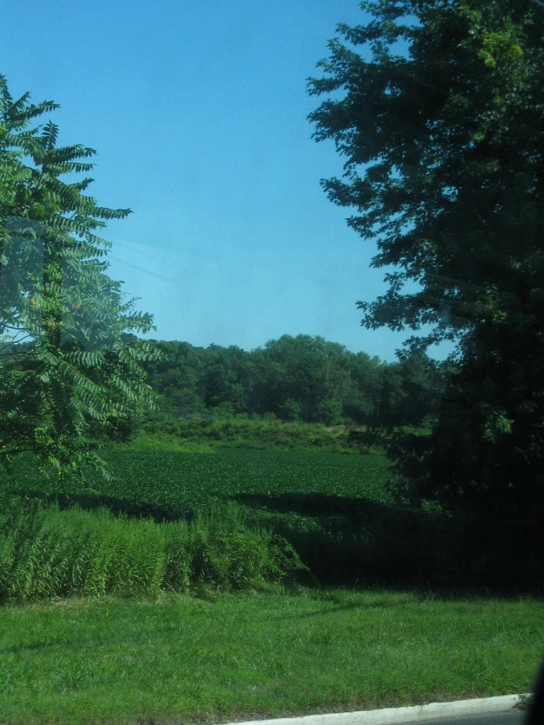
An outdoor scene of Mercer County.
There were 125,807 households out of which 32.80% had children under the age of 18 living with them, 50.60% were married couples living together, 13.80% had a female householder with no husband present, and 31.40% were non-families. 25.60% of all households were made up of individuals and 9.90% had someone living alone who was 65 years of age or older. The average household size was 2.62 and the average family size was 3.16.
In the county the population was spread out with 24.00% under the age of 18, 10.20% from 18 to 24, 30.60% from 25 to 44, 22.50% from 45 to 64, and 12.60% who were 65 years of age or older. The median age was 36 years. For every 100 females there were 94.90 males. For every 100 females age 18 and over, there were 92.00 males.
The median income for a household in the county was $56,613, and the median income for a family was $68,494 (these figures had risen to $68,582 and $85,169 respectively as of a 2007 estimate[8]). Males had a median income of $47,444 versus $34,788 for females. The per capita income for the county was $27,914. About 5.90% of families and 8.60% of the population were below the poverty line, including 10.60% of those under age 18 and 8.40% of those age 65 or over.
There were 27 Mercer County residents killed during the September 11, 2001 terrorist attacks in Lower Manhattan. A steel beam weighing one ton and ten feet long was given to the county by the Port Authority of New York and New Jersey in March 2011 and will be stored until a permanent display site can be identified.[9]
Government[]
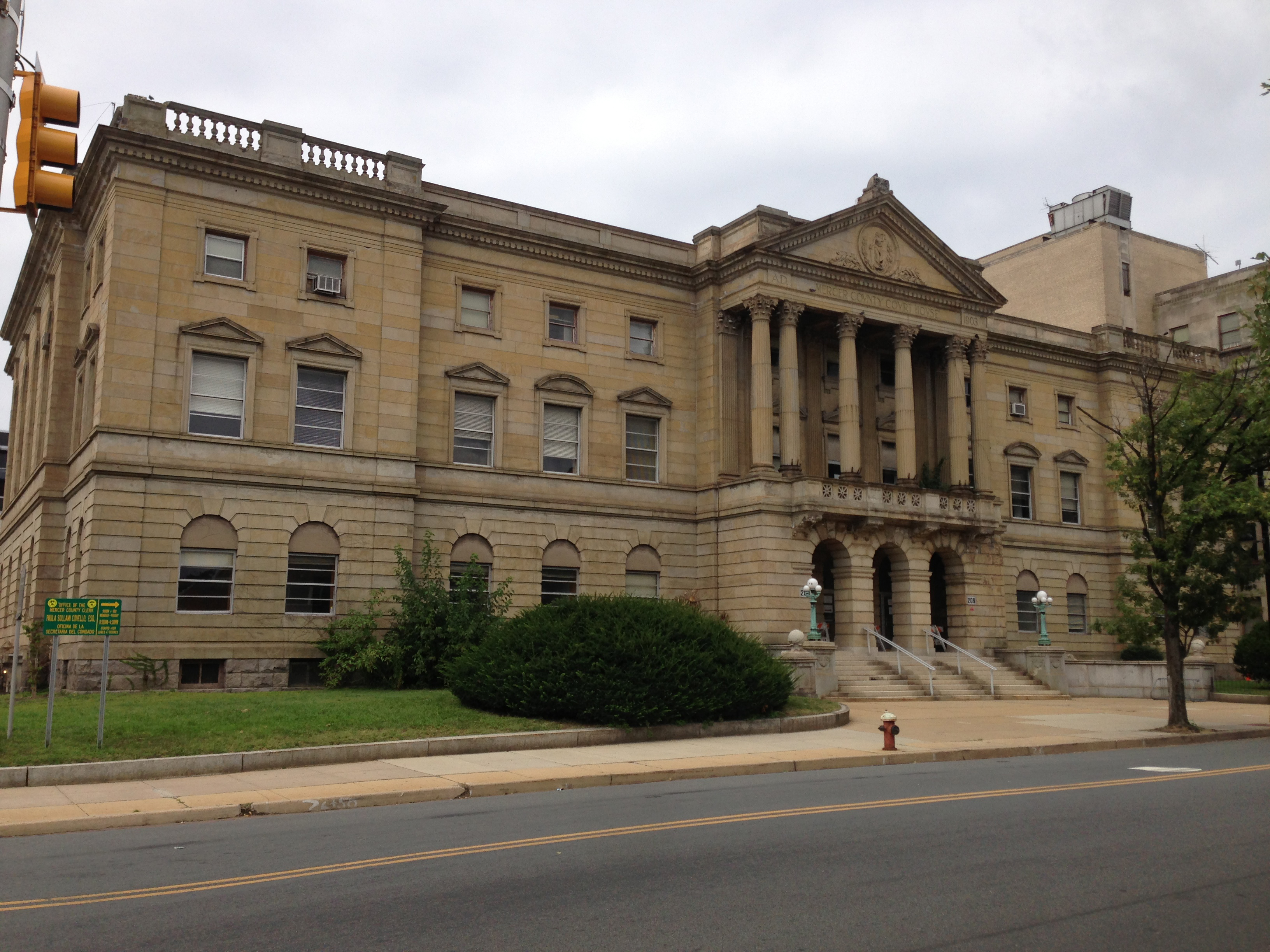

Mercer County Courthouse in Trenton


Drumthwacket, the official residence of the governor of New Jersey, is located in Princeton and is listed on both the U.S. National Register of Historic Places and the New Jersey Register of Historic Places.
Mercer County has a county executive form of government, in which the Mercer County Executive performs executive functions, administering the operation of the county, and a Board of County Commissioners acts in a legislative capacity.[10][11] [12] The county executive is directly elected to a four-year term of office. The seven-member Board of County Commissioners, previously known as the Board of Chosen Freeholders, is elected at-large to serve three-year staggered terms of office on a staggered basis, with either two or three seats up for election each year. The Board is led by a Commissioner Chair, formerly known as Freeholder Chair, and Vice-Chair, selected from among its members at an annual reorganization meeting held in January. The Commissioner Board establishes policy and provides a check on the powers of the County Executive. The Board approves all county contracts and gives advice and consent to the County Executive's appointments of department heads, and appointments to boards and commissions. The Commissioner Board votes to approve the budget prepared by the Executive after review and modifications are made.[13] In 2016, freeholders were paid $29,763 and the freeholder director was paid an annual salary of $31,763.[14] That year, the county executive was paid $164,090 per year.[15]
Melker was appointed in September 2018 following the resignation of Anthony Verrelli (D, Hopewell Towship)[16] who was appointed to the New Jersey General Assembly on August 5, 2018.[17][18]
Law enforcement on the county level is provided by the Mercer County Sheriff's Office and the Mercer County Prosecutor's Office. The Mercer County Prosecutor is Angelo J. Onofri of Hamilton Township, who took office in December 2016 after being nominated by Governor of New Jersey Chris Christie and being confirmed by the New Jersey Senate.[19][20]
Mercer County constitutes Vicinage 7 of the Superior Court of New Jersey.[21] The vicinage is seated at the Mercer County Criminal Courthouse, located at 400 South Warren Street in Trenton.[21] The vicinage has additional facilities for the Civil, Special Civil, General Equity, and Family Parts at the Mercer County Civil Courthouse, located at 175 South Broad Street, also in Trenton.[21] The Assignment Judge for Mercer County is Mary C. Jacobson.[21]
Federal Representation[]
Portions of the 4th and 12th Congressional Districts cover the county.[22][23] Template:NJ Congress 04 New Jersey's Twelfth Congressional District is represented by Rush D. Holt, Jr. (D, Hopewell Township).[24]
State Representatives[]
| District | Senator[25] | Assembly[25] | Municipalities |
|---|---|---|---|
| 14th | Linda R. Greenstein (D) | Wayne DeAngelo (D)
Daniel R. Benson (D) |
East Windsor Township, Hamilton Township, Hightstown Borough and Robbinsville Township.
The remainder of this district includes portions of Middlesex County. |
| 15th | Shirley Turner (D) | Verlina Reynolds-Jackson (D)
Anthony Verrelli (D) |
Ewing Township, Hopewell Borough, Hopewell Township, Lawrence Township,
Pennington Borough, Trenton and West Windsor Township. The remainder of this district includes portions of Hunterdon County. |
| 16th | Christopher Bateman (R) | Andrew Zwicker (D)
Roy Freiman (D) |
Princeton. The remainder of this district covers portions of Hunterdon County, Middlesex County and |
The county is part of the 14th, 15th, and 16th Districts in the New Jersey Legislature.[26]
Politics[]
| Year | Republican | Democratic | Third party | |||
|---|---|---|---|---|---|---|
| No. | % | No. | % | No. | % | |
| 2020 | 51,641 | 29.14% | 122,532 | 69.14% | 3,050 | 1.72% |
| 2016 | 46,193 | 29.23% | 104,775 | 66.29% | 7,090 | 4.49% |
| 2012 | 47,355 | 30.48% | 104,377 | 67.19% | 3,623 | 2.33% |
| 2008 | 50,223 | 31.32% | 107,926 | 67.29% | 2,229 | 1.39% |
| 2004 | 56,604 | 37.86% | 91,580 | 61.25% | 1,326 | 0.89% |
| 2000 | 46,670 | 34.43% | 83,256 | 61.42% | 5,633 | 4.16% |
| 1996 | 40,559 | 30.79% | 77,641 | 58.94% | 13,526 | 10.27% |
| 1992 | 50,473 | 34.75% | 71,383 | 49.14% | 23,404 | 16.11% |
| 1988 | 65,384 | 48.31% | 68,712 | 50.77% | 1,249 | 0.92% |
| 1984 | 71,195 | 51.55% | 66,398 | 48.07% | 528 | 0.38% |
| 1980 | 53,450 | 41.57% | 60,888 | 47.35% | 14,244 | 11.08% |
| 1976 | 58,453 | 44.67% | 69,621 | 53.20% | 2,782 | 2.13% |
| 1972 | 69,303 | 52.03% | 62,180 | 46.68% | 1,708 | 1.28% |
| 1968 | 45,354 | 36.13% | 63,218 | 50.36% | 16,957 | 13.51% |
| 1964 | 35,081 | 28.70% | 86,985 | 71.17% | 148 | 0.12% |
| 1960 | 46,924 | 38.69% | 74,166 | 61.16% | 179 | 0.15% |
| 1956 | 56,029 | 51.35% | 52,684 | 48.29% | 392 | 0.36% |
| 1952 | 50,423 | 46.40% | 57,751 | 53.15% | 488 | 0.45% |
| 1948 | 37,794 | 42.26% | 49,690 | 55.56% | 1,952 | 2.18% |
| 1944 | 36,844 | 41.23% | 52,383 | 58.61% | 144 | 0.16% |
| 1940 | 37,190 | 42.49% | 50,121 | 57.26% | 222 | 0.25% |
| 1936 | 29,283 | 37.75% | 47,702 | 61.50% | 579 | 0.75% |
| 1932 | 33,715 | 50.41% | 30,284 | 45.28% | 2,880 | 4.31% |
| 1928 | 41,056 | 59.21% | 27,908 | 40.25% | 374 | 0.54% |
| 1924 | 30,689 | 59.53% | 14,639 | 28.40% | 6,223 | 12.07% |
| 1920 | 29,626 | 63.46% | 15,713 | 33.66% | 1,344 | 2.88% |
| 1916 | 14,213 | 55.75% | 10,621 | 41.66% | 659 | 2.59% |
| 1912 | 5,676 | 26.88% | 7,773 | 36.80% | 7,671 | 36.32% |
| 1908 | 14,941 | 58.99% | 9,288 | 36.67% | 1,100 | 4.34% |
| 1904 | 14,900 | 60.60% | 8,528 | 34.69% | 1,158 | 4.71% |
| 1900 | 13,878 | 61.66% | 7,861 | 34.93% | 769 | 3.42% |
| 1896 | 13,847 | 66.84% | 5,970 | 28.82% | 901 | 4.35% |
Mercer County is a reliably Democratic county; it has gone for Republicans only three times (1956, 1972, 1984) since 1936. In each presidential election of the 21st century, the Democratic candidate earned at least 60% of the vote.
In the 2004 U.S. presidential election, John Kerry carried Mercer County by a 23.4% margin over George W. Bush, with Kerry carrying the state by 6.7% over Bush.[28] In 2008, the county voted for Barack Obama by a 35.4% margin over John McCain, with Obama winning New Jersey by 14.4% over McCain.
As of August 1, 2020, there were a total of 249,564 registered voters in Mercer County, of whom 111,016 (44.5%) were registered as Democrats, 38,411 (15.4%) were registered as Republicans and 96,317 (38.6%) were registered as Unaffiliated. There were 3,820 (1.5%) voters registered to other parties.[29]
Geography[]
According to the U.S. Census Bureau, the county has a total area of 229 square miles (590 km2), of which, 226 square miles (590 km2) of it is land and 3 square miles (7.8 km2) of it is water. The total area is 1.27% water.
The county is generally flat and low-lying on the inner coastal plain with a few hills closer to the Delaware River. Baldpate Mountain near Pennington, is the highest hill, at 480 feet (146.3 m) above sea level. The lowest point is at sea level along the Delaware.
Adjacent counties[]
- Somerset County, New Jersey – north
- Middlesex County, New Jersey – northeast
- Monmouth County, New Jersey – east
- Burlington County, New Jersey – south
- Bucks County, Pennsylvania – west
- Hunterdon County, New Jersey – northwest

|
Hunterdon County | Somerset County |
| |
| Bucks County, Pennsylvania | Middlesex County | |||
 Mercer County, New Jersey | ||||
| Burlington County | Monmouth County |
Transportation[]
Mercer County has county routes, state routes, U.S. Routes and Interstates that all pass through. Mercer also boasts its NJTransit's stations, including Trenton, Hamilton, and Princeton Junction.
The county roads that traverse through are County Route 518 (only in Hopewell), County Route 524, County Route 526, County Route 533, County Route 535, County Route 539, County Route 546, County Route 569, County Route 571 and County Route 583.
The state routes that pass through Mercer are Route 27, Route 29, Route 31, Route 33, Route 129, and Route 133. There are three US Routes that pass through Mercer, which are: U.S. Route 1 (which bisects the county), U.S. Route 130 and U.S. Route 206.
Mercer County houses a couple of limited access roads, such as Interstate 295, Interstate 195, and Interstate 95 (which is also designated along the New Jersey Turnpike). (By chance, Mercer is the only county in the state that hosts I-95 and both its auxiliary routes.) Two turnpike interchanges are located in Mercer: Exit 7A in Robbinsville and Exit 8 in East Windsor.
Mercer County is where Interstate 95 abruptly ends at the interchange with US 1 & I-295 in Lawrence Township, and becomes I-295 south. Signs direct motorists to the continuation of I-95 by using I-295 to I-195 east to Interstate 95 / New Jersey Turnpike. This is all due in part to the cancellation of the Somerset Freeway that was supposed to go from Hopewell in Mercer County up to Franklin in Somerset County.
However, the 95 shields on the "Trenton section" are to re-numbered as part of "I-195 Extension," when a direct interchange with Interstate 95 in Pennsylvania & Interstate 276 is built (which will not be until 2017). This planned interchange has indirectly prompted the New Jersey Turnpike Authority to extend the 'dual-dual' configuration (Inner Car Lanes & Outer Truck Lanes) to Exit 6 (the Pennsylvania Extension) in Mansfield Township, Burlington County from its current end at Exit 8A (Route 32 & CR 612) in Monroe Township, Middlesex County. This widening is set to be finished by 2014.
Municipalities[]
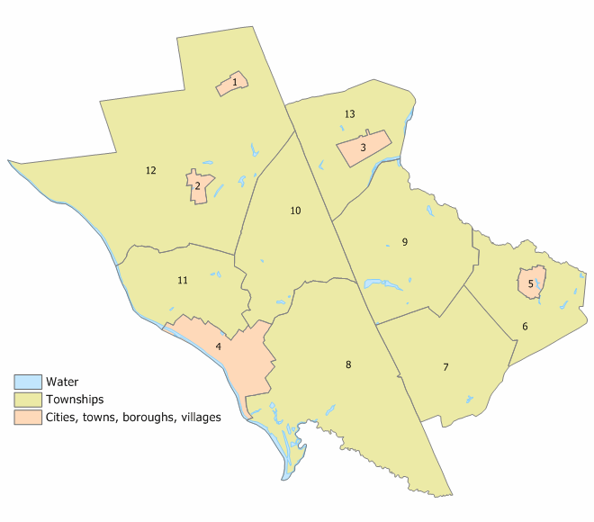
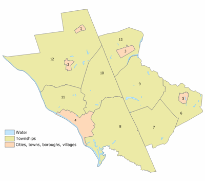
Index map of Mercer County municipalities (click to see index)
The following municipalities are located in Mercer County. The municipality type is listed in parentheses after the name, except where the type is included as part of the name. Census-designated places and other unincorporated areas are listed under their municipalities.
- East Windsor Township
- Twin Rivers
- Ewing Township
- Hamilton Township
- Mercerville-Hamilton Square
- White Horse
- Yardville-Groveville
- Hightstown (borough)
- Hopewell Borough
- Hopewell Township
- Titusville
- Lawrence Township
- Pennington (borough)
- Princeton Borough
- Princeton Township
- Princeton North
- Robbinsville Township (known as Washington Township until November 2007)
- Robbinsville
- Windsor
- Trenton (city)
- West Windsor Township
- Princeton Junction
History[]
Founded February 22, 1838, from portions of surrounding counties, Mercer County has a historical impact that reaches back to the pivotal battles of the American Revolutionary War. On the night of December 25, 1776, General George Washington led American forces across the Delaware River to attack the Hessian barracks in Trenton, New Jersey, who did not anticipate an attack on Christmas. Washington followed the assault with a surprise attack on General Charles Cornwallis' forces in the Battle of Princeton on the eve of January 2, 1777, eventually retaking the colony. The successful attacks built morale among the pro-independence colonists.
Mercer County also has the distinction of being the famed landing spot for a fictional Martian invasion of the United States. In 1938, in what has become one of the most famous American radio plays of all time, Orson Welles acted out his The War of the Worlds invasion. His imaginary aliens first "landed" at what is now West Windsor Township. A commemorative monument is erected at Grover's Mill park.[30]
Sports[]
Mercer County has a number of large parks. The largest, Mercer County Central Park is the home for the US Olympic Rowing Team's training center.[31]
Mercer County is also the home of the minor league baseball team, the Trenton Thunder (Eastern League Double-A affiliate of the New York Yankees), and the minor league hockey team, the Trenton Titans, the ECHL affiliate of the NHL's Philadelphia Flyers and the AHL's Adirondack Phantoms.
See also[]
- National Register of Historic Places listings in Mercer County, New Jersey
External links[]
- Official County Website
- Mercer County Library System
- Mercer County Macaroni Kid – local family events information
References[]
- ^ "Find a County". National Association of Counties. http://www.naco.org/Counties/Pages/FindACounty.aspx. Retrieved 2011-06-07.
- ^ 250 Highest Per Capita Personal Incomes of the 3111 Counties in the United States, 2006, Bureau of Economic Analysis. Statistics for year 2006 Accessed May 2, 2008.
- ^ About Mercer County, 2007, [Mercer County "The Capital County"]. Statistics for year 2007 Accessed March 23, 2008.
- ^ "New Jersey Resident Population by County: 1880 – 1930". http://www.wnjpin.net/OneStopCareerCenter/LaborMarketInformation/lmi01/poptrd5.htm.
- ^ "Geostat Center: Historical Census Browser". University of Virginia Library. http://fisher.lib.virginia.edu/collections/stats/histcensus/. Retrieved 2007-03-02.
- ^ "The Counties and Most Populous Cities and Townships in 2010 in New Jersey: 2000 and 2010". United States Census Bureau. 2011-02-03. http://2010.census.gov/news/xls/st34-final_newjersey.xls. Retrieved 2011-02-05.
- ^ "American FactFinder". United States Census Bureau. http://factfinder.census.gov. Retrieved 2008-01-31.
- ^ Mercer County, United States Census Bureau
- ^ Staff. "Hughes, Officials unveil section of steel beam from Sept. 11 to be used in memorial", Mercer County press release dated March 28, 2011. Accessed September 11, 2011. "Mercer County Executive Brian M. Hughes was flanked by firefighters and first responders from around the County today as a section of a steel beam recovered from Ground Zero was displayed for the first time. The 10-foot, 2,108-pound piece of I-beam steel was recovered from Ground Zero during the aftermath of the September 11, 2001 attacks.... Dozens of firefighters and first responders from Mercer County worked at Ground Zero for the first 10 days after September 11, Hughes said. Mercer County was also home to 27 victims."
- ^ Rinde, Meir. "Explainer: What's a Freeholder? NJ's Unusual County Government System", NJ Spotlight, October 27, 2015. Accessed October 26, 2017. "Five counties -- Atlantic, Bergen, Essex, Hudson, and Mercer -- opted for popularly elected county executives in addition to freeholder boards."
- ^ "'Freeholder' Title Abolished In New Jersey". Long Valley, NJ Patch. August 21, 2020. Retrieved August 21, 2020.
- ^ Writer, MICHELLE BRUNETTI POST Staff. "Murphy signs bill into law to change "freeholder" title to "commissioner"". Press of Atlantic City. Retrieved August 21, 2020.
- ^ What is a Freeholder?, Mercer County, New Jersey. Accessed October 21, 2017.
- ^ Gallo Jr., Bill. "Which N.J. county freeholders are paid the most?", NJ.com, March 11, 2016. Accessed October 25, 2017. "Freeholder chairman: $31,763; Other freeholders: $29,763"
- ^ Shea, Kevin. "See the proposed salaries for Mercer County directors", NJ.com, February 11, 2016. Accessed October 28, 2017. "County Executive, $164,090"
- ^ Anthony S. Verelli Archived 2017-10-22 at the Wayback Machine, Mercer County. Accessed October 21, 2017.
- ^ "Verrelli Sworn in to Represent 15th District". New Jersey General Assembly Democrats. August 6, 2018. http://www.assemblydems.com/Article.asp?ArticleID=14499.
- ^ Abdur-Rahman, Sulaiman (September 5, 2018). "Dems appoint banker Nina Melker as newest Mercer County freeholder". The Trentonian. https://www.trentonian.com/news/dems-appoint-banker-nina-melker-as-newest-mercer-county-freeholder/article_f07d0540-b160-11e8-97f5-aba1cdb15f39.html.
- ^ The Prosecutor - Angelo J. Onofri, Prosecutor Archived 2017-10-26 at the Wayback Machine, Mercer County's Prosecutor Office. Accessed October 25, 2017. "Angelo J. Onofri was sworn in as Mercer County prosecutor on December 28, 2016, after being appointed by Governor Chris Christie and unanimously confirmed by the New Jersey Senate. He had been serving as acting prosecutor since March 1, 2015."
- ^ "Governor Chris Christie Files Nominations", Governor of New Jersey Chris Christie, press release dated October 14, 2016. "MERCER COUNTY PROSECUTOR - Nominate for appointment Angelo Onofri (Hamilton, Mercer)"
- ^ a b c d Mercer Vicinage, New Jersey Courts. Accessed October 21, 2017.
- ^ 2012 Congressional Districts by County, New Jersey Department of State Division of Elections. Accessed October 6, 2013.
- ^ Plan Components Report, New Jersey Department of State Division of Elections, December 23, 2011. Accessed October 6, 2013.
- ^ Municipalities, Congressman Rush D. Holt, Jr. Accessed June 29, 2008.
- ^ a b "New Jersey Legislature - Legislative Roster". https://www.njleg.state.nj.us/members/roster.asp.
- ^ 2011 Legislative Districts by County, New Jersey Department of State Division of Elections. Accessed October 6, 2013.
- ^ Leip, David. "Dave Leip's Atlas of U.S. Presidential Elections". http://uselectionatlas.org/RESULTS.
- ^ New Jersey Presidential Election Returns by County 2004, Eagleton Institute of Politics at Rutgers University. Accessed August 31, 2008.
- ^ "NJ Voter Registration by County". https://nj.gov/state/elections/assets/pdf/svrs-reports/2020/2020-08-voter-registration-by-county.pdf.
- ^ " War of the Worlds Monument", South Suburban College. Accessed October 17, 2008.
- ^ "Know, know, know your boat". The Christian Science Monitor. 2008-07-17. http://features.csmonitor.com/backstory/2008/07/17/qrowing/. Retrieved 2008-12-03.
| |||||||||||||||||||||||

| |||||||||||||||||
| ||||||||||||||||||||||
| This page uses content from the English language Wikipedia. The original content was at Mercer County, New Jersey. The list of authors can be seen in the page history. As with this Familypedia wiki, the content of Wikipedia is available under the Creative Commons License. |