| Main | Births etc |
|---|
| Baranya County | |||
|---|---|---|---|
|
|||
 |
|||
| Country | Hungary | ||
| Region | Southern Transdanubia | ||
| County seat | Pécs | ||
| Area | |||
| • Total | 4,430 km2 (1,710 sq mi) | ||
| Population | |||
| • Total | 396,600 | ||
| • Density | 90/km2 (230/sq mi) | ||

Baranya (Croatian: Baranja, Serbian: Барања, Baranja, German: Branau) is the name of an administrative county (comitatus or megye) in present Hungary, in the Southern Transdanubia Region, and also in the former Kingdom of Hungary (see: Baranya (former county)).
Baranya county lies in southern Hungary, on the border with Croatia. The river Drava forms part of its southern border, and the river Danube its eastern border. It shares borders with the Hungarian counties Somogy, Tolna and Bács-Kiskun. The capital of Baranya County is Pécs.
Geography[]
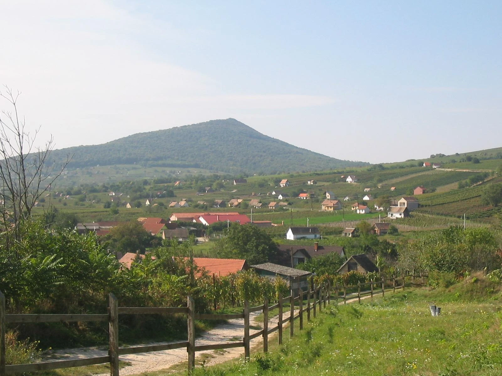

Villány Mountains, located in the south
The northern part of the county is a mountain area with large forests (Mecsek Mountains). The central areas are shared between Baranya Hills and Villány Mountains. The very eastern and southern parts are flat.
The highest point in the county is the peak named "Zengő" in Mecsek Mountains, at 682 metres. This is also the highest point of the mountain range in question.
The climate is Mediterranean, with a high number of sunshine hours. Baranya has the highest amount of rainfall in the country. Baranya is rich in mineral and thermal water, and also in other resources, 98% of Hungary's coal resources can be found here.
History[]
The area has been inhabited since ancient times. Before the Hungarian tribes conquered the area, it was inhabited by Slavs and Avars. Stephen I founded an episcopal seat here.
In 1526 the county was occupied by Ottomans and was freed in 1689. Its medieval borders remained unchanged until 1919. According to the peace treaty of Trianon the southern part of the county (1163 km²) reverted to Slavic rule (present-day Croatia). The re-organizing of the counties (1950) brought only minor changes (town of Szigetvár got there).
Baranya has the largest number of minorities in Hungary (more than twice the country average), providing home to 34% of the German minority and 32% of the Southern Slav minorities in Hungary.
Electoral History[]
| Party | Votes | % | Seats | Change | |
|---|---|---|---|---|---|
| Fidesz-KDNP (joint) | 104,928 | 54,53 | 4 | - | |
| Hungarian Socialist Party | 40,532 | 21,07 | 1 | - | |
| Jobbik | 24,397 | 12,68 | 1 | - | |
| Politics Can Be Different | 7,119 | 8,9 | 0 | - | |
| Hungarian Democratic Forum | 5,436 | 2,83 | 0 | - | |
| Total | 182,412 | 100 | 6 | - |
Demographics[]
In 2001, the population of Baranya county numbered 407,448 inhabitants, including: [1]
- Hungarians = 375,611 (92.19%)
- Germans = 22,720 (5.58%)
- Gypsies = 10,623 (2.61%)
- Croats = 7,294 (1.79%)
- others.
Regional structure[]
Like Borsod-Abaúj-Zemplén, Baranya is a county of extremes when it comes to regional structure. The county seat is one of the five largest cities (and three largest agglomerations) of Hungary, but more than 2/3 of the municipalities are small hamlets with a population under 500. Half of the county's population lives in the county seat or in its immediate vicinity, while 22% of the population lives in villages that have less than 1000 inhabitants.
City with county rights[]
- Pécs (county seat)
Cities and towns[]
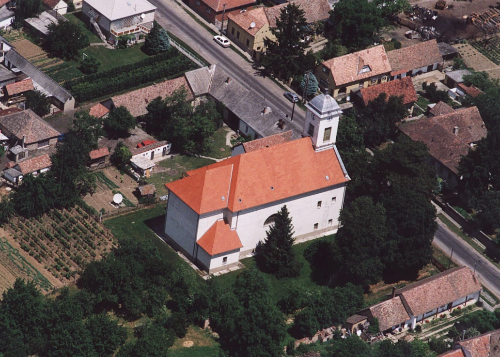
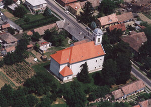
Hosszúhetény - Temple from above
(ordered by population, according to the 2001 census)
- Komló (27,462)
- Mohács (19,085)
- Szigetvár (11,492)
- Siklós (10,384)
- Szentlőrinc (7,265)
- Pécsvárad (4,104)
- Kozármisleny (4,058)
- Bóly (3,715)
- Sásd (3,570)
- Harkány (3,519)
- Sellye (3,248)
- Villány (2,793)
- Mágocs (2,545)
Villages[]
|
|
|
|
|
Gallery[]
")
")
")
")
| |||||||||||||||||
| ||||||||||
| |||||||||||
| This page uses content from the English language Wikipedia. The original content was at Baranya County. The list of authors can be seen in the page history. As with this Familypedia wiki, the content of Wikipedia is available under the Creative Commons License. |