Familypedia
Advertisement
Main Births etc
Győr-Moson-Sopron County
HUN Győr-Moson-Sopron COA
Coat of arms
GyMSMegye
Country Hungary
Region Western Transdanubia
County seat Győr
Area
 • Total 4,089 km2 (1,579 sq mi)
Population
 • Total 444,384
 • Density 110/km2 (280/sq mi)

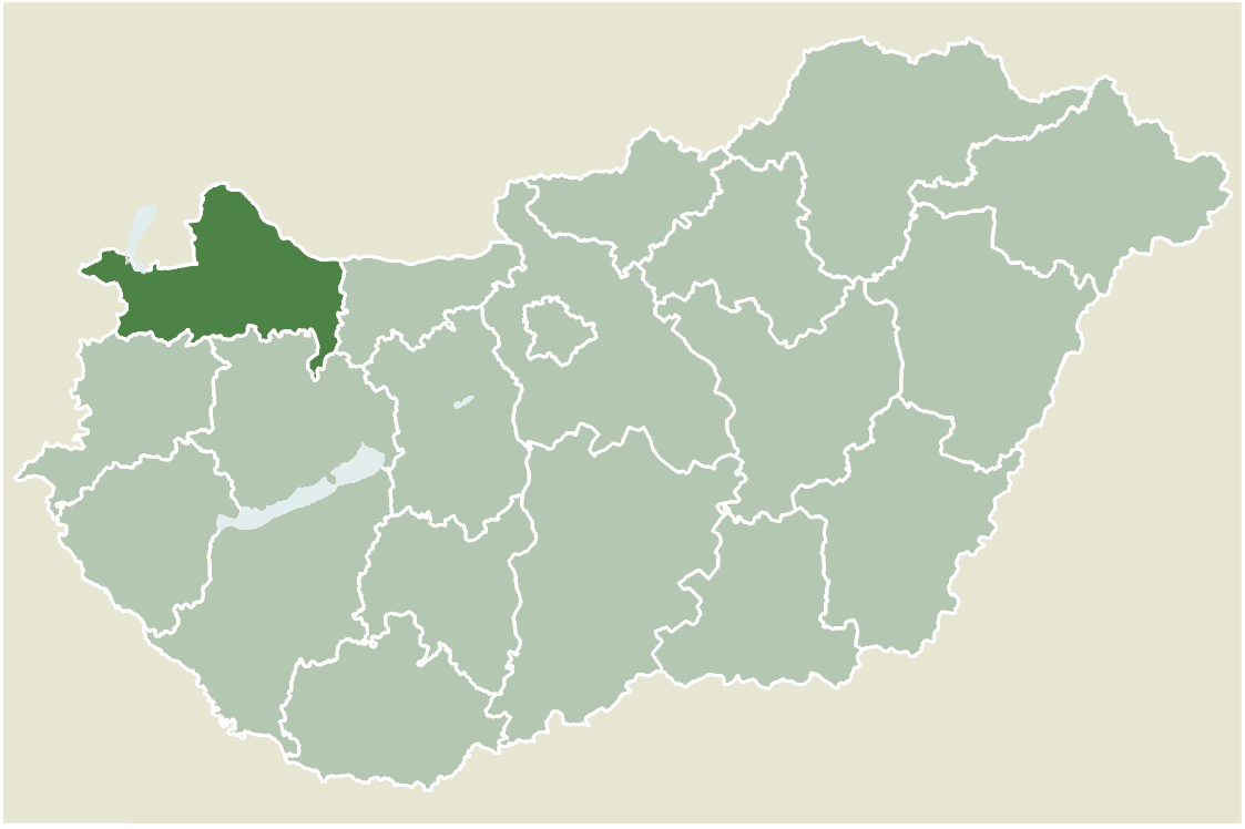
Győr-Moson-Sopron is the name of an administrative county (comitatus or megye) in north-western Hungary, on the border with Slovakia and Austria. It shares borders with the Hungarian counties Komárom-Esztergom, Veszprém and Vas. The capital of Győr-Moson-Sopron county is Győr. The county is a part of the Centrope Project.

History[]

Győr-Moson-Sopron county was created in 1950 from two counties - Győr-Moson and Sopron. Though formed as a result of the general Communist administrative reform of that year, it is the long-term result of the impact of earlier border changes on Hungary's western counties. In 1921 the counties of Moson and Sopron were each cut in two, with their western districts forming the northern half of the Austrian province of Burgenland. Between 1921 and 1945, Győr and Moson became part of the "provisionally and administratively unified counties of Győr-Moson-Pozsony", renamed after 1945 as simply Győr-Moson. In 1947 the borders of this county were modified when Hungary lost three villages in the far north of Győr-Moson to Czechoslovakia as a consequence of the Hungarian peace treaty signed in that year. Though Győr is the capital, there is a strong rivalry between it and Sopron, historically an important cultural centre on its own right. The county also contains Hegyeshalom - Hungary's busiest international land border crossing point. Before 1990, it was officially called Győr-Sopron county.

Regional structure[]

Cities with county rights[]

Megyeszékhely - Győr-Moson-Sopron megye - Győr

Aerial photography: Győr

Towns[]

(ordered by population, according to the 2001 census)

Villages[]

  • Abda
  • Acsalag
  • Ágfalva
  • Agyagosszergény
  • Árpás
  • Ásványráró
  • Babót
  • Bágyogszovát
  • Bakonygyirót
  • Bakonypéterd
  • Bakonyszentlászló
  • Barbacs
  • Bezenye
  • Bezi
  • Bodonhely
  • Bogyoszló
  • Börcs
  • Bőny
  • Bősárkány
  • Cakóháza
  • Cirák
  • Csáfordjánosfa
  • Csapod
  • Csér
  • Csikvánd
  • Darnózseli
  • Dunakiliti
  • Dunaremete

  • Dunaszeg
  • Dunaszentpál
  • Dunasziget
  • Dénesfa
  • Dör
  • Ebergőc
  • Écs
  • Edve
  • Egyed
  • Egyházasfalu
  • Enese
  • Farád
  • Fehértó
  • Feketeerdő
  • Felpéc
  • Fenyőfő
  • Fertőboz
  • Fertőendréd
  • Fertőhomok
  • Fertőrákos
  • Fertőszéplak
  • Gyalóka
  • Gyarmat
  • Gyömöre
  • Győrasszonyfa
  • Győrság
  • Gyóró
  • Győrladamér

  • Győrszemere
  • Győrsövényház
  • Győrzámoly
  • Győrújbarát
  • Győrújfalu
  • Gönyű
  • Halászi
  • Harka
  • Hegyeshalom
  • Hegykő
  • Hidegség
  • Himod
  • Hédervár
  • Hövej
  • Ikrény
  • Iván
  • Jobaháza
  • Kajárpéc
  • Kimle
  • Kisbabot
  • Kisbajcs
  • Kisbodak
  • Kisfalud
  • Koroncó
  • Kunsziget
  • Károlyháza
  • Kóny
  • Kópháza
  • Lázi

  • Levél
  • Lipót
  • Lébény
  • Lövő
  • Maglóca
  • Magyarkeresztúr
  • Máriakálnok
  • Markotabödöge
  • Mecsér
  • Mérges
  • Mezőörs
  • Mihályi
  • Mosonszentmiklós
  • Mosonszolnok
  • Mórichida
  • Nagybajcs
  • Nagycenk
  • Nagylózs
  • Nagyszentjános
  • Nemeskér
  • Nyalka
  • Nyúl
  • Osli
  • Öttevény
  • Pereszteg
  • Petőháza
  • Pinnye
  • Potyond
  • Pusztacsalád

  • Páli
  • Pásztori
  • Pázmándfalu
  • Pér
  • Püski
  • Rábacsanak
  • Rajka
  • Ravazd
  • Répceszemere
  • Répcevis
  • Röjtökmuzsaj
  • Románd
  • Rábacsécsény
  • Rábakecöl
  • Rábapatona
  • Rábapordány
  • Rábasebes
  • Rábaszentandrás
  • Rábaszentmihály
  • Rábaszentmiklós
  • Rábatamási
  • Rábcakapi
  • Rétalap
  • Sarród
  • Sikátor
  • Sobor
  • Sokorópátka
  • Sopronhorpács
  • Sopronkövesd

  • Sopronköhida
  • Sopronnémeti
  • Szakony
  • Szany
  • Szerecseny
  • Szil
  • Szilsárkány
  • Szárföld
  • Táp
  • Tápszentmiklós
  • Tarjánpuszta
  • Tényő
  • Tárnokréti
  • Töltéstava
  • Újkér
  • Újrónafő
  • Und
  • Vadosfa
  • Vág
  • Várbalog
  • Veszkény
  • Veszprémvarsány
  • Vitnyéd
  • Völcsej
  • Vámosszabadi
  • Vásárosfalu
  • Vének
  • Zsebeháza
  • Zsira


Coordinates: 47°40′N 17°15′E / 47.667, 17.25


This page uses content from the English language Wikipedia. The original content was at Győr-Moson-Sopron County. The list of authors can be seen in the page history. As with this Familypedia wiki, the content of Wikipedia is available under the Creative Commons License.
Advertisement