| Main | Births etc |
|---|
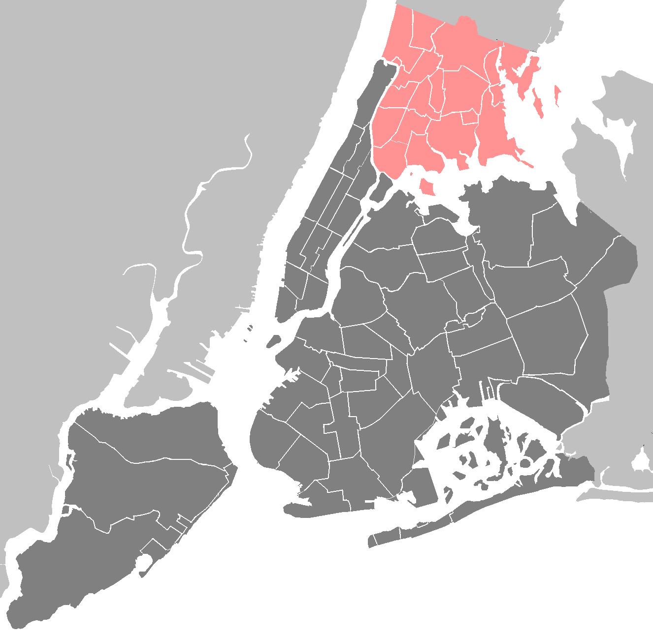
Fordham is a neighborhood of New York City, United States, located at the west side of Bronx County. The neighborhood is part of Bronx Community Board 5. It is bordered by Fordham Road to the north, Southern Boulevard to the east, East 161st Street to the south, and Jerome Avenue to the west. The neighborhood's primary thoroughfare is Fordham Road; its main rapid transit line is the IND Concourse Line, operating under the Grand Concourse, with the IRT Jerome Avenue Line on its western border. ZIP codes include 10453, 10457, 10458 and 10468.
Demographics[]
Fordham has a population of 77,840 people. Its first growth was in the 1920s, when middle-class and working-class families from Manhattan flocked into the area, attracted by the then-modern housing and convenient subway access by Concourse, Jerome Avenue, and Webster Avenue lines to business districts in Manhattan where they could work and shop. The demographics are 31.3% White, 23.2% African American, 1.3% Native American, 4.7% Asian, 0.1% Pacific Islander, and 39.6% Hispanic or Latino majority being of Stateside Puerto Rican and Dominican descent.
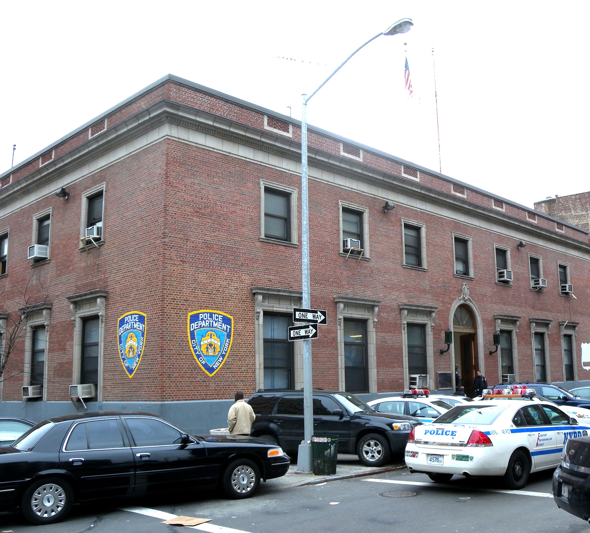
46th Police Precinct
Land use and terrain[]
Fordham is dominated by 5 and 6-story apartment buildings, often set flush to the sidewalk. Many of the apartments on the Grand Concourse are taller.
The New York Botanical Garden and the Wildlife Conservation Society's Bronx Zoo, both inside Bronx Park, collectively occupy dozens of acres of land within the neighborhood.
Fordham University maintains its historic original campus on much of the former Rose Hill Manor in the center of the neighborhood. It is one of the largest "green" campuses in New York City, and its traditional collegiate gothic architecture often serves as a backdrop for television and film productions.
The Fordham Road Business improvement district operates on the northern border of the neighborhood. This retail district is the longest in the Bronx.
History[]
The name Fordham was given by John Archer, a Dutch settler who had anglicized his name, when he established a community at 225th Street near the Harlem River in 1666.[1] Alternatively, Fordham (house by the ford) originated as either as a reference to its location near a shallow crossing of the Bronx River or as a reference to Rev. John Fordham, an Anglican priest.[2]
Old Fordham Village[]
Old Fordham Village is a section of Fordham that dates back to the English colonial era. It is centered on the intersection of the Grand Concourse and Fordham Road. Fordham Village extends north to about 196th Street, south to about 187th Street, east to Southern Blvd., and west to Jerome Avenue.
The section's origins date back to about 1751, when Fordham Manor was built, on what was called Rose Hill. Most of the estate is part of the Rose Hill Campus of Fordham University. Besides the main manor house and other side buildings on the campus, other historic buildings and noted homes still exist within Old Fordham Village. For example, American poet Edgar Allan Poe spent his final years with his wife Virginia in a cottage in Fordham which is still standing. The nearby Fordham University Church bell is named "old Edgar" and may have been the inspiration for his poem The Bells.
In the 18th century, The Kings Road went through Old Fordham Village, an area of rural estates and small farms, linking Colonial New York and towns and villages north toward Boston. It was a minor rest stop for travelers and coaches, where many springs fed The Mill Brook that crossed this road. During the American Revolution, it was a critical crossing point for Gen. George Washington's Continental Army retreating toward White Plains to safely escape from New York while being chased by the Colonial British and Hessian Forces. There were many American Patriots that lived in this area. After the revolution, the Kings Road was renamed The Boston Post Road, becoming an important thoroughfare for a growing new nation.
In the 19th century, with the building of The White Plains Line (later the Harlem Line of The New York Central Railroad) and a small station, Old Fordham Village began to grow. Local farmers and dairymen were now able to use the railroad to send their products to a growing New York City. North of the village, part of the Mill Brook was dammed up, and a large pond and ice house was built for shipping and cold storage. It provided fresh ice for the community and the railroad. It was during this time that wealthy merchant Robert Watts gave most of The Rose Hill Estate, east of the village, to a Roman Catholic order, The Society of Jesus. It became known as St. John's College and Hospital and was the precursor of Fordham University. A small South-West-portion of the former Rose Hill Estate is known today as Rose Hill Park. West of the village, on the other side of Fordham Hill, The Bathgate Estate was built; it was later acquired by wealthy stock speculator Leonard Jerome. He built the Jerome Park Racetrack, where the first Belmont Stakes was held, on his estate. West of the station in the village area, The Fordham Hotel and Taverine would provide basic needs for visitors for both The College and The Racetrack.
After 1900[]
For the most part, Old Fordham Village remained rural until about 1900, when New York City began to expand. Early mass transit to the suburbs changed the area of what is presently Fordham today. Old Fordham Village and the surrounding area would become part of the borough of the Bronx within New York City. Many of the remaining farms and estates were sold to developers who built houses and sizable apartment buildings. The formerly quiet little village became a major business and transportation hub. In this area of Fordham, Boston Post Road was renamed Fordham Road and became part of U.S. Route 1 in 1926. The rebuilding of the railroad right of way at Fordham, and most of Webster Avenue, eliminated The Mill Brook and water pond, but the side streets of Old Fordham Village remain active.
Fordham was a predominantly middle class White (of Irish and Jewish origins) neighborhood, from the 1920s through the late 1970s, when many families moved to the suburbs or retired to Florida.[3][4] Belmont was formerly a portion of Fordham and South Fordham.
Transportation[]

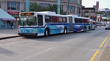
The Bx12 Select Bus Service stops in front of Fordham Plaza above Fordham's Metro-North railroad station.
Subway and railroad service:
- 182nd-183rd station (Template:NYCS Concourse trains)
- Fordham Road station (Template:NYCS Concourse trains)
- Fordham Station (Metro-North)
Bus service provided by MTA/MaBSTOA:
- Bx1: to Riverdale or Mott Haven (via Grand Concourse)
- Bx2: to Kingsbridge Heights or Mott Haven (via Grand Concourse)
- Bx3: to Riverdale or Washington Heights, George Washington Bridge (via University Ave)
- Bx9: to Riverdale or West Farms Square – East Tremont Avenue station (Template:NYCS White Plains trains) (via Kingsbridge Road)
- Bx12 (Including +SBS): to Bay Plaza Shopping Center or Inwood – 207th Street station (Template:NYCS Eighth far north train) (via Fordham Road–Pelham Parkway)
- Bx15: to The Hub or Manhattanville (via Third Avenue)
- Bx17: to Port Morris (via Prospect-Crotona Avenues)
- Bx22: to Bedford Park or Castle Hill (via Castle Hill Avenue)
- Bx28: to Co-op City (via Gun Hill Road)
- Bx34: to Woodlawn (via Bainbridge Avenue)
- Bx38: to Bay Plaza Shopping Center (via Gun Hill Road) (Sunday nights only)
- Bx41 (Including +SBS): to Williamsbridge or Third Avenue – 149th Street station (Template:NYCS White Plains trains) (via Webster Avenue)
Bus service provided by the Bee-Line Bus System:
- 60: to White Plains, NY (via US Route 1)
- 61: to Port Chester, NY (via US Route 1)
- 62: to White Plains, NY (via US Route 1; Express from New Rochelle to East White Plains)
References[]
- ^ "John Archer". Bronx Notables. Brtonx County Historical Society. http://www.bronxhistoricalsociety.org/notebx.html. Retrieved 2012-01-20.
- ^ Schroth, SJ, Raymond. Fordham: A History and Memoir. Revised ed. New York: Fordham UP, 2008. Print.
- ^ Avery Corman, The Old Neighborhood., New York: Bantam Books, 1981. ISBN 978-0-553-14891-6
- ^ "St. Nicholas of Tolentine Parish". The New York City Chapter of the American Guild of Organists. http://www.nycago.org/Organs/Brx/html/StNicholasTolentine.html.
Template:Bronx
| This page uses content from the English language Wikipedia. The original content was at Fordham, Bronx. The list of authors can be seen in the page history. As with this Familypedia wiki, the content of Wikipedia is available under the Creative Commons License. |