| Main | Births etc |
|---|
| Glenside | |
| Census-designated place | |
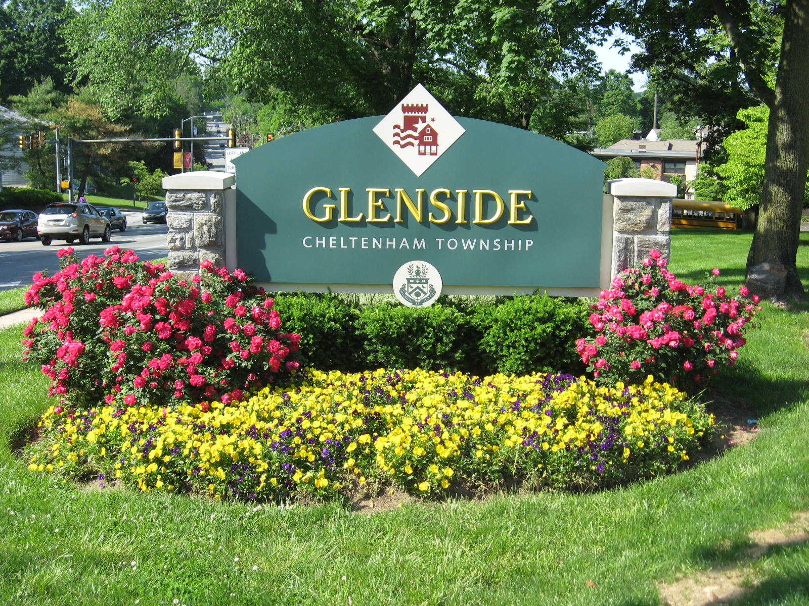 Glenside welcome sign at the intersection of Easton Road and Limekiln Pike
| |
| Country | |
|---|---|
| State | |
| County | Montgomery |
| Townships | Abington, Cheltenham, Springfield |
| Elevation | 262 ft (79.9 m) |
| Coordinates | |
| Area | 1.3 sq mi (3.4 km²) |
| - land | 1.3 sq mi (3 km²) |
| - water | 0.0 sq mi (0 km²), 0% |
| Population | 8,384 (2010) |
| Density | 6,449.2 / sq mi (2,490.1 / km²) |
| Timezone | Eastern Standard Time (UTC-5) |
| - summer (DST) | Eastern Daylight Time (UTC-4) |
| ZIP Code | 19038 |
| Area code | 215 |
| Commissioners | J. Andrew Sharkey Kathy A. Hampton (East) |
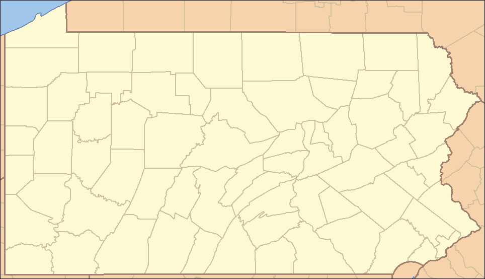 Location of Glenside in Pennsylvania
| |
 Location of Pennsylvania in the United States
| |
Glenside is a census-designated place (CDP) in Abington, Cheltenham, and Springfield townships, Montgomery County, Pennsylvania, United States. The population was 8,384 at the 2010 census. Glenside borders the City of Philadelphia along Cheltenham Avenue, and is about 9 miles from Center City. Glenside is part of the Delaware Valley.
Geography[]
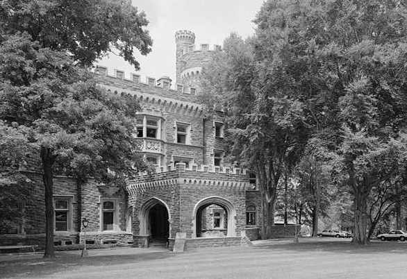

National Historic Landmark Grey Towers Castle.
Glenside is located at (40.102960, -75.152264)[1].
According to the United States Census Bureau, the CDP has a total area of 1.3 square miles (3.4 km2), all of it land.
Glenside is a part of 3 different townships: Abington Township, Springfield Township, and Cheltenham Township, with the latter being where the majority of Glenside is located, including the United States Post Office, and Glenside Library, and the Glenside Memorial Hall, to name a few.
Topography[]
The altitude ranges from 232 feet near Glenside Memorial Hall to 405 feet on Sunset and Lindley Roads. The majority of Glenside is around 300 feet in elevation; it is 238 feet at the intersection of Waverly and Easton roads, the center of Glenside.
Demographics[]

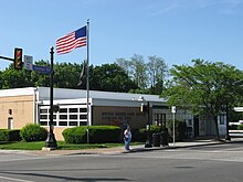
United States Post Office in Glenside
| Historical populations | |||
|---|---|---|---|
| Census | Pop. | %± | |
| 1990 | 8,704 | ||
| 2000 | 7,914 | −9.1% | |
| 2010 | 8,384 | 5.9% | |
As of the census[2] of 2000, there were 7,914 people, 3,103 households, and 2,013 families residing in the CDP. The population density was 6,217.4 people per square mile (2,406.0/km²). There were 3,181 housing units at an average density of 2,499.1/sq mi (967.1/km²). The racial makeup of the CDP was 88.97% White, 6.66% African American, 0.10% Native American, 3.02% Asian, 0.03% Pacific Islander, 0.27% from other races, and 0.96% from two or more races. Hispanic or Latino of any race were 1.44% of the population.
There were 3,103 households out of which 31.3% had children under the age of 18 living with them, 52.7% were married couples living together, 9.2% had a female householder with no husband present, and 35.1% were non-families. 28.8% of all households were made up of individuals and 9.7% had someone living alone who was 65 years of age or older. The average household size was 2.54 and the average family size was 3.21.
In the CDP the population was spread out with 25.0% under the age of 18, 8.0% from 18 to 24, 30.8% from 25 to 44, 22.3% from 45 to 64, and 13.8% who were 65 years of age or older. The median age was 36 years. For every 100 females there were 91.3 males. For every 100 females age 18 and over, there were 87.3 males.
The median income for a household in the CDP was $58,868, and the median income for a family was $74,025. Males had a median income of $48,378 versus $35,629 for females. The per capita income for the CDP was $26,393. About 1.6% of families and 3.4% of the population were below the poverty line, including 2.4% of those under age 18 and 3.6% of those age 65 or over.
Transportation[]


A SEPTA Main Line train pulling out of Glenside


Easton Road is the main street of Glenside

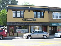
The Glenside Pub in downtown Glenside
Glenside is located at about a 25 minute drive to downtown Philadelphia, 2 hours to New York City, 2 hours to the Pocono Mountains, and 1.5 hours to the Jersey shore. Glenside has easy access to many major US highways, such as US Route 1, Interstate 95, Interstate 76, the Pennsylvania Turnpike, and US Route 30.
SEPTA[]
Glenside is served by SEPTA, through regional rail at the Glenside Train Station. The station has its roots back with the North Pennsylvania Railroad and the Reading Railroad. Trains north split at the Carmel Junction, and either go to Lansdale/Doylestown Line or the Warminster Line. Trains going south go to Philadelphia, which is about a 30 minute train ride to Thirtieth Street Station. Glenside is also served by SEPTA buses, in particular, routes 77 and 22.
Amtrak[]
Glenside is accessible to Amtrak, which serves as a major mode of transportation in the Northeast. Glenside is a 11 mile drive to Amtrak's Thirtieth Street Station, the 3rd busiest station in the Amtrak system, in Downtown Philadelphia. Other nearby Amtrak station include North Philadelphia (8 miles from Glenside) and Ardmore (10 miles from Glenside).
Roads[]
Glenside also has several major local roads, such as:
![]() Pennsylvania Route 73 provides a connection with western Montgomery County and New Jersey. In Glenside, it is known as Church Road.
Pennsylvania Route 73 provides a connection with western Montgomery County and New Jersey. In Glenside, it is known as Church Road.
![]() Pennsylvania Route 309 also known as the "Fort Washington Expressway" or just "309," is a 2-lane highway providing a direct access to the Pennsylvania Turnpike. The southern terminus of 309 is about 1 mile from downtown Glenside.
Pennsylvania Route 309 also known as the "Fort Washington Expressway" or just "309," is a 2-lane highway providing a direct access to the Pennsylvania Turnpike. The southern terminus of 309 is about 1 mile from downtown Glenside.
![]() Pennsylvania Route 152 also known as "Limekiln Pike," begins in Glenside, where it intersects with 309. It then proceeds to intersect with 73, and eventually continues north into Bucks County
Pennsylvania Route 152 also known as "Limekiln Pike," begins in Glenside, where it intersects with 309. It then proceeds to intersect with 73, and eventually continues north into Bucks County
Glenside is located in close proximity to several national roads:
- Glenside to
 - 7 miles
 - Glenside to - 4.1 miles
- Glenside to - 4 miles
- Glenside to - 7.7 miles
- Glenside to - 5.1 miles
Climate[]
Glenside has a typical Northeast climate. Summers are hot, with highs averaging in the mid to high 80's. The middle of summer sees several days breaking the 90-degree mark, with only one or two days rising over 100 degrees. Summer nights can be erratic, ranging anywhere from the high 60's to the low 70's. Spring and Fall are pleasant, with the highs usually hovering around 60 degrees, and lows being in the high 40's. Winters are cold, with highs averaging in the mid 30's and lows in the high teens. Numerous days in the winter do not even reach the freezing mark, lows fall into the mid teens. In addition, several days in late December and early January, highs temperatures are in the teens, and lows can plummet to single digits. The following is a chart of the average temperatures in Glenside.[3]
| Climate data for Glenside, Pennsylvania | |||||||||||||
|---|---|---|---|---|---|---|---|---|---|---|---|---|---|
| Month | Jan | Feb | Mar | Apr | May | Jun | Jul | Aug | Sep | Oct | Nov | Dec | Year |
| Record high °F | 73 | 73 | 88 | 95 | 96 | 102 | 102 | 102 | 98 | 88 | 82 | 76 | 102 |
| Average high °F | 37 | 42 | 50 | 62 | 72 | 81 | 85 | 84 | 77 | 65 | 54 | 43 | 62.6 |
| Average low °F | 19 | 24 | 32 | 41 | 51 | 62 | 67 | 65 | 56 | 43 | 34 | 26 | 43 |
| Record low °F | −11 | −3 | −1 | 16 | 32 | 34 | 45 | 37 | 30 | 20 | 11 | −10 | −11 |
| Precipitation inches | 3.44 | 3.01 | 4.32 | 4.12 | 4.37 | 4.6 | 5.05 | 3.98 | 4.53 | 3.82 | 3.94 | 4.23 | 49.4 |
| Record high °C | 23 | 23 | 31 | 35 | 36 | 39 | 39 | 39 | 37 | 31 | 28 | 24 | 39 |
| Average high °C | 3 | 6 | 10 | 17 | 22 | 27 | 29 | 29 | 25 | 18 | 12 | 6 | {{{year high C}}} |
| Average low °C | −7 | −4 | 0 | 5 | 11 | 17 | 19 | 18 | 13 | 6 | 1 | −3 | {{{year low C}}} |
| Record low °C | −24 | −19 | −18 | −9 | 0 | 1 | 7 | 3 | −1 | −7 | −12 | −23 | −24 |
| Precipitation mm | 87.4 | 76.5 | 109.7 | 104.6 | 111 | 117 | 128.3 | 101.1 | 115.1 | 97 | 100.1 | 107.4 | 1,255 |
| Source: The Weather Channel "Average Weather for Glenside, PA". The Weather Channel. http://www.weather.com/weather/wxclimatology/monthly/graph/19038. Retrieved September 30, 2011. | |||||||||||||
Locale[]

|
Oreland | Ardsley | Rydal |
|
| Flourtown | Jenkintown | |||
 Glenside, PA | ||||
| Wyndmoor | City of Philadelphia | Wyncote |
Education[]
Cheltenham High School, the sole High School in Cheltenham Township
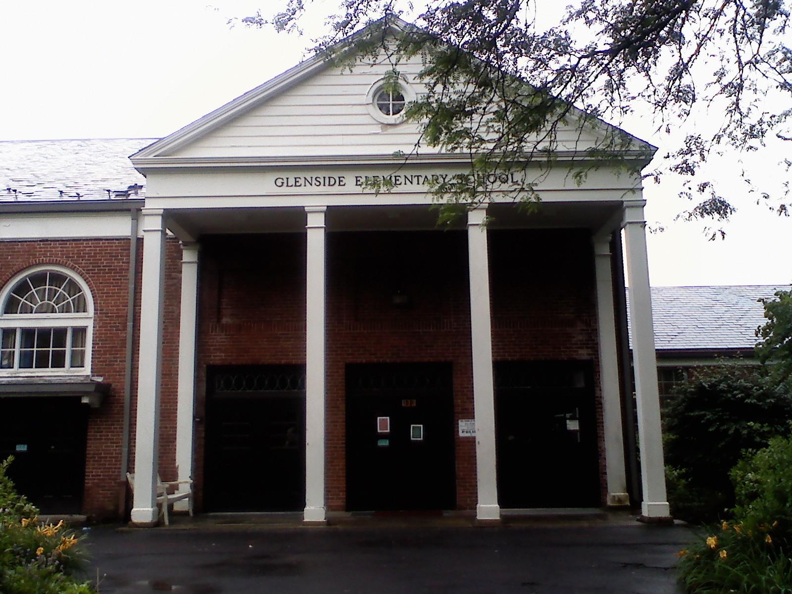
Glenside Elementary (1956-2009). The new Glenside Elementary was finished in 2011
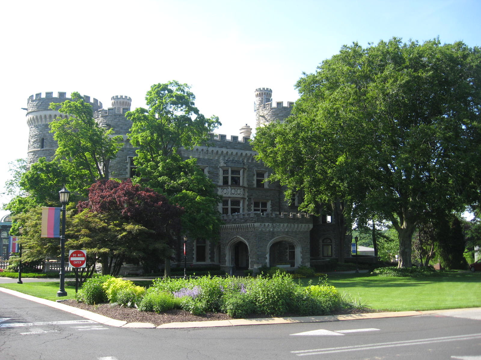

National Historic Landmark Grey Towers Castle, now part of Arcadia University.


A typical Glenside brick house
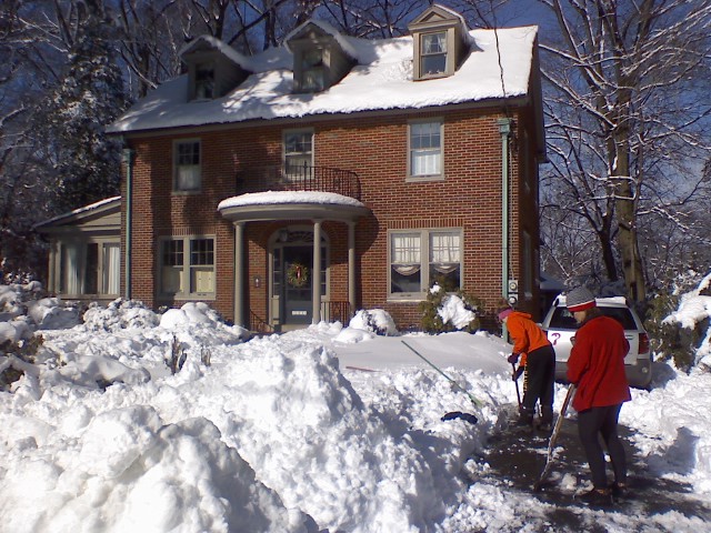

The same house following a blizzard in 2010
Primary institutions[]
Glenside is home to Arcadia University, a private co-educational four-year liberal arts university. Arcadia is well known for its Study Abroad programs, which two-thirds of their students participate in. The University offers majors in the College of Business, College of Health and Sciences, College of Arts, Humanities, and Social Sciences. The campus is set on National Historic Landmark Grey Towers Castle, which was built in 1893.
Secondary institutions[]
Since Glenside is located in Cheltenham, Springfield, and Abington Townships, not all Glenside residents go to schools within the same district. A Glenside resident will follow one of these paths, depending on which township they live in.
- Cheltenham Township
- Glenside Elementary (K-4)
- Elkins Park Middle School (5-6)
- Cedarbrook Middle School (7-8)
- Cheltenham High School (9-12)
- Abington Township
- Copper Beach Elementary School (K-6)
- Abington Junior High School (7-9)
- Abington Senior High School (10-12)
- Springfield Township
- Enfield Elementary (K-1)
- Erdenheim Elementary (2-5)
- Springfield Middle School (6-8)
- Springfield Township High School (9-12)
Other institutions[]
Glenside is also home to Westminster Theological Seminary, a Presbyterian and Reformed Christian graduate institution. There is a satellite campus in London. Catholic education in Glenside is supported by Saint Luke the Evangelist School on Fairhill Ave. This school will soon be merging with Immaculate Conception in Jenkintown. Students from this school often attend the local Catholic high School, Bishop McDevitt.
Points of interest[]
- Harry Renninger Park - formerly known as Glenside Park, was once home to minor league baseball play. Historical photos show large grandstands decorated with bunting for seating crowds.
- Grove Park


The Exterior of Glenside Free Library


Glenside Memorial Hall from Keswick Avenue

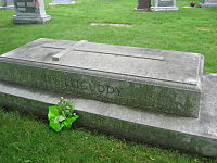
The grave of legendary Hall of Fame Philadelphia Athletics manager Connie Mack.
- Pembryn Park
- Glenside Pool - Relocated and Constructed in 1967[4]
- Glenside Free Library - Established 1928, member MCLINC (Montgomery County Library & Information Network Consortium)
Landmarks[]
- Keswick Theatre - A small theatre in the Glenside's Keswick Village, was placed on the National Register of Historic Places in 1983.
- The town is home to Arcadia University, a 71-acre (287,000 m2) campus that features the National Historic Landmark Grey Towers Castle.
- Glenside Memorial Hall - A hall dedicated to World War I veterans, it can accommodate up to 180 people for banquets, parties, etc. It was listed on the National Register of Historic Places in 2004.
- Holy Sepulchre Cemetery - Large cemetery with several notable burials, including Connie Mack, Frank Rizzo and Michael Crescenz.
Media[]
Glenside is served by two newspapers; "Times Chronicle" and "Glenside News," both papers a division of "Montgomery News.[5]"
The following is a list of radio stations that can be heard in the Glenside area.[6]
- FM
- 88.5 WXPN (Adult Album Alternative)
- 90.1 WRTI (Classical/Jazz)
- 92.5 WXTU (Country)
- 93.3 WMMR (Active rock)
- 94.1 WIP (Sports Talk)
- 95.7 WBEN (Adult Hits)
- 96.5 WRDW (Rhythmic Top 40)
- 98.1 WOGL (Oldies/Classic Hits)
- 98.9 WUSL (Mainstream Urban)
- 100.3 WRNB (Adult Urban Contemporary)
- 101.1 WBEB (Soft rock)
- 102.1 WIOQ (Contemporary hit radio/Pop)
- 102.9 WMGK (Classic rock)
- 103.9 WPPZ (Urban Gospel)
- 104.5 WRFF (Modern Rock)
- 105.3 WDAS (Urban Adult Contemporary)
- 106.1 WISX (Hot AC)
- 106.9 WWIQ (Talk)
Independence Day Parade[]
The annual Independence Day parade held in Glenside every July 4 is reported to be the largest such parade in the greater Philadelphia area. The parade began in 1904 and is now sponsored by the Greater Glenside Patriotic Association. It is a very traditional parade, including all the area volunteer fire companies, a variety of bands and other musical performers, church groups and community organizations, and local and state elected officials (Former-Governor Ed Rendell has been a frequent participant). One unique and much-anticipated show is the Schuylkill County Motorcycle Drill Team. It is one of the nation's longest consecutive Fourth of July parades.
Notable Residents[]
- Bill Hyndman - Amateur golfer
- Bob Perkins - Radio host at WRTI
- Ellen Tepper - Celtic harpist
Miscellaneous[]
- Glenside is also the location of the main office building for Newgrounds.
References[]
- ^ "US Gazetteer files: 2010, 2000, and 1990". United States Census Bureau. 2011-02-12. http://www.census.gov/geo/www/gazetteer/gazette.html. Retrieved 2011-04-23.
- ^ "American FactFinder". United States Census Bureau. http://factfinder.census.gov. Retrieved 2008-01-31.
- ^ "Average Weather for Glenside, PA - Temperature and Precipitation". Weather.com. http://www.weather.com/weather/wxclimatology/monthly/graph/19038. Retrieved 2011-10-24.
- ^ [1]
- ^ "Montgomery News". Montgomery News. http://www.montgomerynews.com/. Retrieved 2011-10-24.
- ^ "Glenside, Pennsylvania (PA 19038) profile: population, maps, real estate, averages, homes, statistics, relocation, travel, jobs, hospitals, schools, crime, moving, houses, news". City-data.com. http://www.city-data.com/city/Glenside-Pennsylvania.html. Retrieved 2011-10-24.
External links[]
- Downtown Glenside from Google Street View
- Greater Glenside Chamber of Commerce
- Greater Glenside Patriotic Association
- Cheltenham Township Home Page
- Springfield Township Home Page
- Abington Township Home Page
Template:Abington Township, Montgomery County, Pennsylvania Template:Cheltenham Template:Springfield Township Montco
| ||||||||||||||||||||||||||

| ||||||||||||||||
.jpg)
| This page uses content from the English language Wikipedia. The original content was at Glenside, Pennsylvania. The list of authors can be seen in the page history. As with this Familypedia wiki, the content of Wikipedia is available under the Creative Commons License. |