| ||||||||||||||
| Hinds County, Mississippi | ||
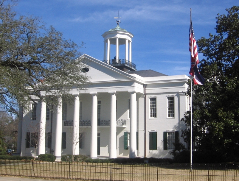 Hinds County courthouse in Raymond, Mississippi
| ||
| ||
 Location in the state of Mississippi | ||
 Mississippi's location in the U.S. | ||
| Founded | 1821 | |
|---|---|---|
| Named for | Thomas Hinds | |
| Seat | Jackson and Raymond | |
| Largest city | Jackson
area_total_sq_mi = 877.35 | |
| Area - Total - Land - Water |
869.18 sq mi (2,251 km²) 8.16 sq mi (21 km²), 0.93% | |
| Population - (2020) - Density |
227,742 287/sq mi (111/km²) | |
| Congressional districts | 2nd, 3rd | |
| Time zone | Central: UTC-6/-5 | |
| Website | www.co.hinds.ms.us | |
Hinds County is a county located in the U.S. state of Mississippi. As of the 2020 census, the population was 227,742.[1] Its county seats are Raymond and Jackson, the state capital.[2] The county is named for General Thomas Hinds, a hero of the Battle of New Orleans during the War of 1812.
Hinds County is part of the Jackson, MS Metropolitan Statistical Area. It is bordered on the north by the Yazoo River, which marks the southern edge of the Mississippi Delta. In the nineteenth century, it was developed for cotton plantations.
Geography[]
According to the 2000 census, the county has a total area of 877.35 square miles (2,272.3 km2), of which 869.18 square miles (2,251.2 km2) (or 99.07%) is land and 8.16 square miles (21.1 km2) (or 0.93%) is water.[3]
Adjacent counties[]
- Madison County (northeast)
- Rankin County (east)
- Copiah County (south)
- Claiborne County (southwest)
- Warren County (west)
- Yazoo County (northwest)
National protected area[]
- Natchez Trace Parkway (part)
Transportation[]
Major highways[]
 Interstate 55
- Interstate 20
- Interstate 220
- U.S. Highway 49
- U.S. Highway 80
- Mississippi Highway 18
- Mississippi Highway 22
- Mississippi Highway 27
- Natchez Trace Parkway
- U.S. Route 51
Airports[]
The following public-use airports are located in Hinds County:
- Hawkins Field (HKS) in Jackson
- John Bell Williams Airport (JVW) in Raymond
Demographics[]
| Historical populations | |||
|---|---|---|---|
| Census | Pop. | %± | |
| 1830 | 8,645 | ||
| 1840 | 19,098 | 120.9% | |
| 1850 | 25,340 | 32.7% | |
| 1860 | 31,339 | 23.7% | |
| 1870 | 30,488 | −2.7% | |
| 1880 | 43,958 | 44.2% | |
| 1890 | 39,279 | −10.6% | |
| 1900 | 52,577 | 33.9% | |
| 1910 | 63,726 | 21.2% | |
| 1920 | 57,110 | −10.4% | |
| 1930 | 85,118 | 49.0% | |
| 1940 | 107,273 | 26.0% | |
| 1950 | 142,164 | 32.5% | |
| 1960 | 187,045 | 31.6% | |
| 1970 | 214,973 | 14.9% | |
| 1980 | 250,998 | 16.8% | |
| 1990 | 254,441 | 1.4% | |
| 2000 | 250,800 | −1.4% | |
| 2010 | 245,285 | −2.2% | |
As of the 2010 United States Census, there were 245,285 people residing in the county. 69.1% were Black or African American, 28.4% White, 0.8% Asian, 0.2% Native American, 0.7% of some other race and 0.9% of two or more races. 1.5% were Hispanic or Latino (of any race).
As of the census[5] of 2000, there were 250,800 people, 91,030 households, and 62,355 families residing in the county. The population density was 288 people per square mile (111/km²). There were 100,287 housing units at an average density of 115 per square mile (45/km²). The racial makeup of the county was 37.31% White, 61.12% Black or African American, 0.12% Native American, 0.60% Asian, 0.01% Pacific Islander, 0.20% from other races, and 0.63% from two or more races. 0.79% of the population were Hispanic or Latino of any race.
There were 91,030 households out of which 34.40% had children under the age of 18 living with them, 41.10% were married couples living together, 22.70% had a female householder with no husband present, and 31.50% were non-families. 26.70% of all households were made up of individuals and 8.70% had someone living alone who was 65 years of age or older. The average household size was 2.64 and the average family size was 3.22.
In the county the population was spread out with 27.90% under the age of 18, 12.10% from 18 to 24, 28.90% from 25 to 44, 20.10% from 45 to 64, and 11.00% who were 65 years of age or older. The median age was 32 years. For every 100 females there were 88.80 males. For every 100 females age 18 and over, there were 83.50 males.
The median income for a household in the county was $33,991, and the median income for a family was $40,525. Males had a median income of $30,930 versus $24,593 for females. The per capita income for the county was $17,785. About 16.10% of families and 19.90% of the population were below the poverty line, including 28.60% of those under age 18 and 15.10% of those age 65 or over.
Hinds County has the seventh highest per capita income in the State of Mississippi.
Government[]
Hinds County is governed via a five-member board of supervisors, each elected from single-member districts. The county is led by a county administrator, who is appointed.
The Mississippi Department of Human Services (MDHS) has its headquarters in Jackson and in Hinds County. The Division of Youth Services operates the Oakley Training School (OTS) in an unincorporated area of Hinds County.[6]
The Mississippi Department of Corrections has its headquarters in Jackson and in Hinds County.[7] It operates the Jackson Probation & Parole Office in the city.
| Year | Republican | Democratic | Third party | |||
|---|---|---|---|---|---|---|
| No. | % | No. | % | No. | % | |
| 2020 | 25,141 | 25.09% | 73,550 | 73.40% | 1,517 | 1.51% |
| 2016 | 25,275 | 26.58% | 67,594 | 71.09% | 2,208 | 2.32% |
| 2012 | 29,664 | 27.86% | 76,112 | 71.47% | 715 | 0.67% |
| 2008 | 32,949 | 30.26% | 75,401 | 69.24% | 552 | 0.51% |
| 2004 | 36,975 | 39.97% | 54,845 | 59.29% | 680 | 0.74% |
| 2000 | 37,753 | 43.01% | 46,789 | 53.31% | 3,228 | 3.68% |
| 1996 | 35,653 | 42.19% | 45,410 | 53.73% | 3,446 | 4.08% |
| 1992 | 45,031 | 46.90% | 43,434 | 45.23% | 7,559 | 7.87% |
| 1988 | 52,749 | 55.52% | 41,058 | 43.22% | 1,199 | 1.26% |
| 1984 | 56,953 | 56.69% | 42,373 | 42.18% | 1,142 | 1.14% |
| 1980 | 48,135 | 53.44% | 39,369 | 43.71% | 2,570 | 2.85% |
| 1976 | 45,803 | 60.46% | 28,748 | 37.95% | 1,205 | 1.59% |
| 1972 | 49,877 | 77.82% | 12,679 | 19.78% | 1,540 | 2.40% |
| 1968 | 13,488 | 22.21% | 14,880 | 24.50% | 32,366 | 53.29% |
| 1964 | 36,831 | 87.93% | 5,058 | 12.07% | 0 | 0.00% |
| 1960 | 11,083 | 38.23% | 5,811 | 20.05% | 12,094 | 41.72% |
| 1956 | 7,015 | 34.59% | 7,104 | 35.03% | 6,159 | 30.37% |
| 1952 | 12,520 | 53.38% | 10,933 | 46.62% | 0 | 0.00% |
| 1948 | 492 | 3.23% | 1,041 | 6.82% | 13,722 | 89.95% |
| 1944 | 962 | 8.42% | 10,466 | 91.58% | 0 | 0.00% |
| 1940 | 538 | 5.14% | 9,917 | 94.82% | 4 | 0.04% |
| 1936 | 313 | 3.49% | 8,647 | 96.33% | 16 | 0.18% |
| 1932 | 403 | 5.77% | 6,541 | 93.67% | 39 | 0.56% |
| 1928 | 976 | 14.60% | 5,707 | 85.40% | 0 | 0.00% |
| 1924 | 245 | 5.45% | 4,083 | 90.77% | 170 | 3.78% |
| 1920 | 151 | 5.54% | 2,510 | 92.01% | 67 | 2.46% |
| 1916 | 97 | 4.15% | 2,220 | 94.99% | 20 | 0.86% |
| 1912 | 40 | 1.80% | 2,065 | 92.89% | 118 | 5.31% |
| 1900 | 100 | 6.76% | 1,365 | 92.29% | 14 | 0.95% |
| 1896 | 144 | 7.76% | 1,643 | 88.57% | 68 | 3.67% |
| 1892 | 68 | 4.81% | 1,216 | 86.00% | 130 | 9.19% |
Communities[]
- Cities
- Towns
- Bolton
- Edwards
- Learned
- Terry
- Utica
- Unincorporated places
- Brownsville
- Dabney Crossroads
- Midway
- Oakley
- Pocahontas
- Turkey Creek
Education[]


Public School Districts in Hinds County
- Colleges and Universities
- Belhaven University (Jackson)
- Hinds Community College (Raymond)
- Jackson State University (Jackson)
- Millsaps College (Jackson)
- Mississippi College (Clinton)
- Mississippi College School of Law (Jackson)
- Reformed Theological Seminary (Jackson)
- Tougaloo College (Tougaloo)
- University of Mississippi Medical Center (Jackson)
- Wesley Biblical Seminary (Jackson)
- Public School Districts
- Clinton Public School District
- Hinds County School District (Raymond)
- Jackson Public School District
- Private Schools
- Hillcrest Christian School (Jackson)
- Jackson Academy (Jackson)
- Rebul Academy (Learned)
See also[]
- National Register of Historic Places listings in Hinds County, Mississippi
References[]
- ^ "State & County QuickFacts". United States Census Bureau. http://quickfacts.census.gov/qfd/states/28/28049.html. Retrieved September 3, 2013.
- ^ "Find a County". National Association of Counties. http://www.naco.org/Counties/Pages/FindACounty.aspx. Retrieved 2011-06-07.
- ^ "Census 2010 Gazetteer Files". http://www.census.gov/geo/maps-data/data/docs/gazetteer/counties_list_28.txt. Retrieved July 2, 2013.
- ^ "U.S. Decennial Census". Census.gov. http://www.census.gov/prod/www/decennial.html. Retrieved September 3, 2013.
- ^ "American FactFinder". United States Census Bureau. http://factfinder.census.gov. Retrieved 2008-01-31.
- ^ Mississippi Department of Human Services website Archived 2010-01-13 at the Wayback Machine
- ^ Mississippi Department of Corrections homepage. Retrieved on December 8, 2009
- ^ Leip, David. "Dave Leip's Atlas of U.S. Presidential Elections". http://uselectionatlas.org/RESULTS.
External links[]
- Hinds County - Official site.
- Hinds County Courthouse Pictures

|
Yazoo County | Madison County |
| |
| Warren County | Rankin County | |||
 Hinds County, Mississippi | ||||
| Claiborne County | Copiah County |
| ||||||||||||||||||||

| This page uses content from the English language Wikipedia. The original content was at Hinds County, Mississippi. The list of authors can be seen in the page history. As with this Familypedia wiki, the content of Wikipedia is available under the Creative Commons License. |