| Main | Births etc |
|---|
| Iernut colocvial Ernot, Iernot Hungarian: Radnót German: Radnuten, Radnot, Radnau |
|||
|---|---|---|---|
| — Village — | |||
| Reformed church in Iernut | |||
|
|||
| Coordinates: | |||
| Country | |||
| County | |||
| Town | Sovata | ||
| First mentioned | 1257 | ||
| subordinated villages | |||
| Government | |||
| • Mayor | Ioan Nicoara (PNL) | ||
| Area | |||
| • Total | 106.36 km2 (41.07 sq mi) | ||
| Elevation | 350 m (1,150 ft) | ||
| Population (2011) | |||
| • Total | 8 373 | ||
| • Density | 78.72/km2 (203.9/sq mi) | ||
| Time zone | EET (UTC+2) | ||
| • Summer (DST) | EEST (UTC+3) | ||
| Postal code | 545100 | ||

Iernut în the Josephinian Map of Transylvania, 1769-73.
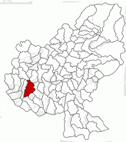
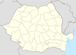
Iernut (colocvial Ernot, Iernot; Hungarian: Radnót; German: Radnuten, Radnot, Radnau) is a town in Mureș County, central Transylvania, Romania. It administers eight villages: Cipău, Deag, Lechința, Oarba de Mureș, Porumbac, Racameț, Sălcud and Sfântu Gheorghe.
Demographics[]
| Historical population | ||
|---|---|---|
| Year | Pop. | ±% |
| 1992 | 9,719 | — |
| 2002 | 9,833 | +1.2% |
| 2011 | 8,373 | −14.8% |
| Source: Census data | ||
The 2011 census revealed the following demographic data:[1]
- Romanians (76.55%)
- Hungarians (13.36%)
- Gypsies (9.84%)
- others (0.18%)
Main sights[]
- The Reformed church (built between 1486-1593)
- Kornis-Rakóczi-Bethlen Castle (built in 1545)
- The two lakes near the city
- Mureş River
- Lupoaica
- Old Buildings
References[]
Wikimedia Commons has media related to:
| ||||||||

|
Sânger | Iclănzel | 
| |
| Cuci | Ogra | |||
 Iernut | ||||
| Bichiș | Târnăveni | Cucerdea |


