| Main | Births etc |
|---|
| Louisa, Virginia | |
|---|---|
| — Town — | |
 |
|
 |
|
| Coordinates: Coordinates: | |
| Country | United States |
| State | Virginia |
| County | Louisa |
| Founded | 1873 |
| Government | |
| • Mayor | James S Artz |
| Area | |
| • Total | 1.8 sq mi (4.7 km2) |
| • Land | 1.8 sq mi (4.7 km2) |
| • Water | 0.0 sq mi (0.0 km2) |
| Elevation | 466 ft (142 m) |
| Population (2000) | |
| • Total | 1,401 |
| • Density | 766.8/sq mi (296.1/km2) |
| Time zone | Eastern (EST) (UTC-5) |
| • Summer (DST) | EDT (UTC-4) |
| ZIP code | 23093 |
| Area code(s) | 540 |
| FIPS code | 51-47144[1] |
| GNIS feature ID | 1498507[2] |
| Website | http://louisatown.org/ |
Louisa (originally named Louisa Court House) is a town in Louisa County, Virginia, United States. The population was 1,401 at the 2000 census. It is the county seat of Louisa County.[3]
History[]
Bloomington, Boxley Place, the Louisa County Courthouse (Louisa, Virginia), and Louisa High School are listed on the National Register of Historic Places.[4]
Geography[]
Louisa is located at (38.024057, -78.001584).[5]
According to the United States Census Bureau, the city has a total area of 1.8 square miles (4.7 km²), of which 1.8 square miles (4.7 km²) is land and 0.55% is water.
Demographics[]
| Historical populations | |||
|---|---|---|---|
| Census | Pop. | %± | |
| 1880 | 315 | ||
| 1900 | 261 | ||
| 1910 | 318 | 21.8% | |
| 1920 | 289 | −9.1% | |
| 1930 | 301 | 4.2% | |
| 1940 | 365 | 21.3% | |
| 1950 | 344 | −5.8% | |
| 1960 | 576 | 67.4% | |
| 1970 | 633 | 9.9% | |
| 1980 | 932 | 47.2% | |
| 1990 | 1,088 | 16.7% | |
| 2000 | 1,401 | 28.8% | |
| 2010 | 1,555 | 11.0% | |
| Est. 2014 | 1,610 | [6] | 14.9% |
As of the census[1] of 2000, there were 1,401 people, 584 households, and 331 families residing in the town. The population density was 766.8 people per square mile (295.6/km²). There were 620 housing units at an average density of 339.4 per square mile (130.8/km²). The racial makeup of the town was 66.81% White, 29.48% African American, 0.79% Native American, 0.71% Asian, 0.79% from other races, and 1.43% from two or more races. Hispanic or Latino of any race were 1.43% of the population.
There were 584 households out of which 30.0% had children under the age of 18 living with them, 35.6% were married couples living together, 16.4% had a female householder with no husband present, and 43.3% were non-families. 37.0% of all households were made up of individuals and 18.3% had someone living alone who was 65 years of age or older. The average household size was 2.25 and the average family size was 2.93.
In the town the population was spread out with 24.8% under the age of 18, 7.9% from 18 to 24, 28.5% from 25 to 44, 19.2% from 45 to 64, and 19.6% who were 65 years of age or older. The median age was 38 years. For every 100 females there were 81.5 males. For every 100 females age 18 and over, there were 73.1 males.
The median income for a household in the town was $29,519, and the median income for a family was $42,396. Males had a median income of $27,578 versus $23,188 for females. The per capita income for the town was $17,763. About 14.7% of families and 18.7% of the population were below the poverty line, including 27.9% of those under age 18 and 17.0% of those age 65 or over.
Points of interest[]

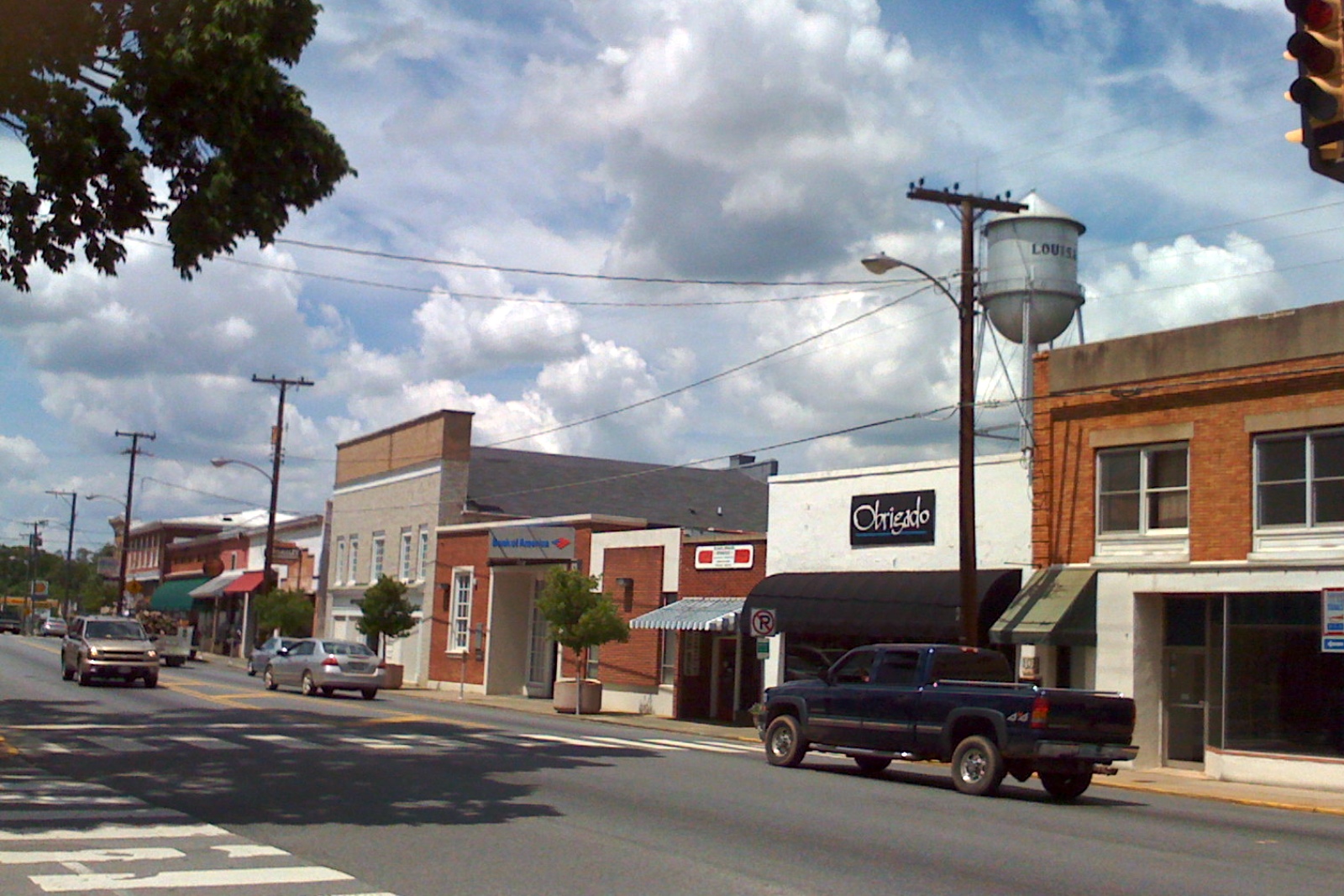
A local train of the Buckingham Branch railroad passes the C&O Depot and watertower in Louisa.
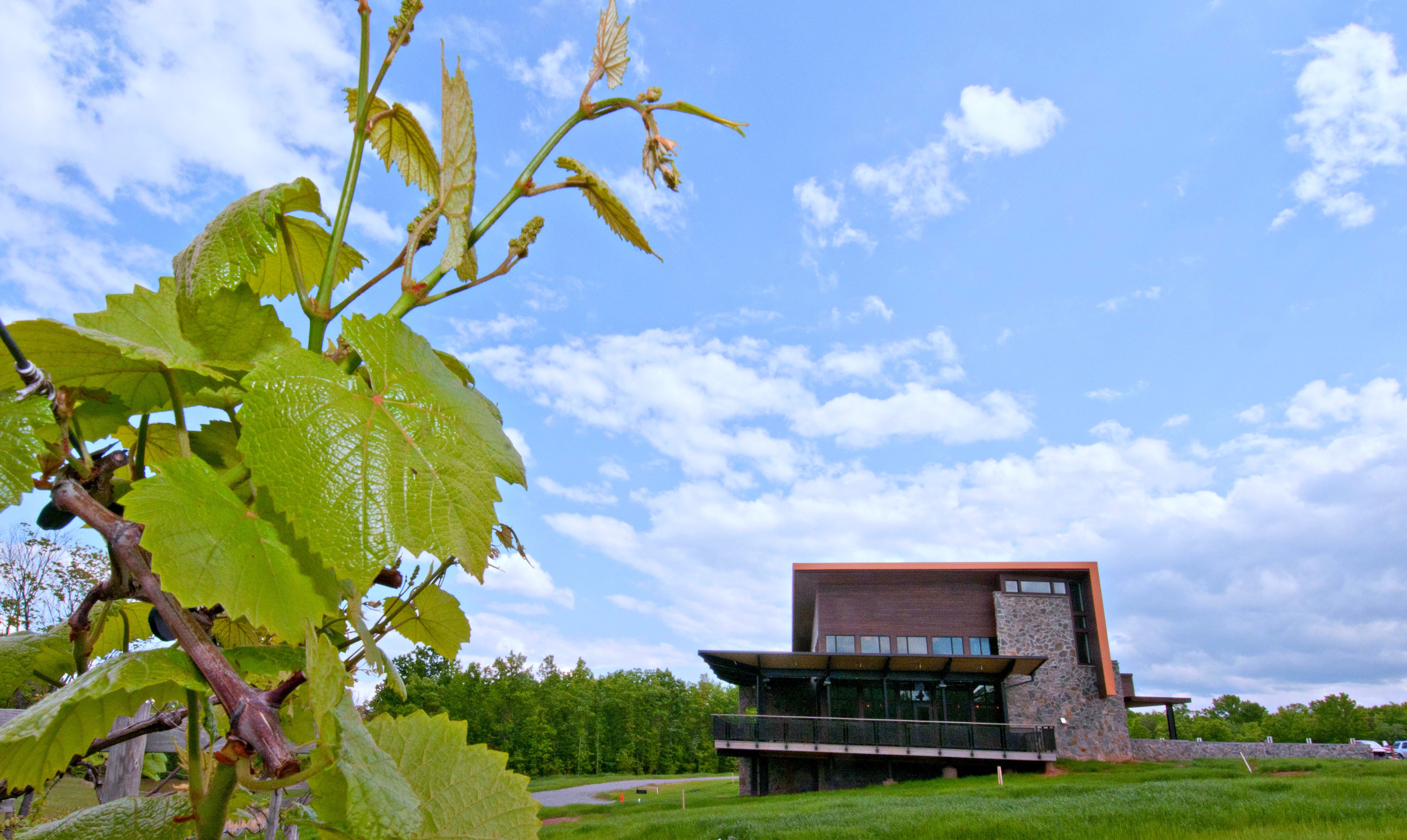

Cooper Vineyards in Louisa, is the first winery on the East Coast and the second in the country to be awarded the fourth and highest, Platinum certification by Leadership in Energy and Environmental Design (LEED
Louisa is home to the North Anna Nuclear Generating Station which produces electricity and jobs for the county's inhabitants. The warm water produced from the power plant and discharged into the water of Lake Anna creates what some call Central Virginia's best fishing.
Louisa is also home to the Twin Oaks Community, an intentional community of 100 people living on 465 acres (1.882 km2). The community has been in Louisa since 1967.
The 2011 Virginia earthquake had its epicenter just 7 miles (11 kilometers) south-southeast of Louisa.[8] This quake registered 5.8 magnitude, and caused the evacuations of buildings on Capitol Hill in Washington, DC, as well as New York City and was felt as far North as Canada.
References[]
- ^ a b "American FactFinder". United States Census Bureau. http://factfinder2.census.gov. Retrieved 2008-01-31.
- ^ "US Board on Geographic Names". United States Geological Survey. 2007-10-25. http://geonames.usgs.gov. Retrieved 2008-01-31.
- ^ "Find a County". National Association of Counties. http://www.naco.org/Counties/Pages/FindACounty.aspx. Retrieved 2011-06-07.
- ^ "National Register Information System". National Register of Historic Places. National Park Service. 2010-07-09. http://nrhp.focus.nps.gov/natreg/docs/All_Data.html.
- ^ "US Gazetteer files: 2010, 2000, and 1990". United States Census Bureau. 2011-02-12. http://www.census.gov/geo/www/gazetteer/gazette.html. Retrieved 2011-04-23.
- ^ "Annual Estimates of the Resident Population for Incorporated Places: April 1, 2010 to July 1, 2014". http://www.census.gov/popest/data/cities/totals/2014/SUB-EST2014.html. Retrieved June 4, 2015.
- ^ "Census of Population and Housing". Census.gov. http://www.census.gov/prod/www/decennial.html. Retrieved June 4, 2015.
- ^ Magnitude 5.8 - VIRGINIA
External links[]
| ||||||||||||||||||||

| |||||||

| This page uses content from the English language Wikipedia. The original content was at Louisa, Virginia. The list of authors can be seen in the page history. As with this Familypedia wiki, the content of Wikipedia is available under the Creative Commons License. |