| Main | Births etc |
|---|
| North Adams, Massachusetts | |||
|---|---|---|---|
| — City — | |||
 |
|||
|
|||
| Motto: "We Hold the Western Gateway" | |||
 |
|||
 <div style="position: absolute; top: Expression error: Missing operand for *.%; left: 212.7%; height: 0; width: 0; margin: 0; padding: 0;">
North Adams, Massachusetts |
|||
| Country | United States | ||
| State | Massachusetts | ||
| County | Berkshire | ||
| Settled | 1745 | ||
| Incorporated | 1878 | ||
| Government | |||
| • Type | Mayor-council city | ||
| • Mayor | Tom Bernard | ||
| Area | |||
| • Total | 20.6 sq mi (53.4 km2) | ||
| • Land | 20.3 sq mi (52.7 km2) | ||
| • Water | 0.3 sq mi (0.7 km2) | ||
| Elevation | 707 ft (215 m) | ||
| Population (2010) | |||
| • Total | 13,708 | ||
| • Estimate (2016) | 13,064 | ||
| • Density | 660/sq mi (260/km2) | ||
| Time zone | Eastern (UTC-5) | ||
| • Summer (DST) | Eastern (UTC-4) | ||
| ZIP code | 01247 | ||
| Area code(s) | 413 | ||
| FIPS code | 25-46225 | ||
| GNIS feature ID | 0607610 | ||
| Website | northadams-ma.gov | ||
North Adams is a city in Berkshire County, Massachusetts, United States. It is part of the Pittsfield, Massachusetts Metropolitan Statistical Area. Its population was 13,708 as of the 2010 census,[1] making it the least populous city in the state. Best known as the home of the largest contemporary art museum in the United States, the Massachusetts Museum of Contemporary Art, North Adams has in recent years become a center for tourism, culture and recreation.
History[]
Early history[]
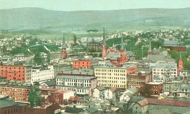
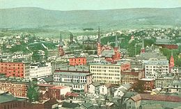
Bird's eye view of North Adams in 1905


The Norad Mill in 2012
North Adams was first settled in 1745 during King George's War.[2] During the war, Canadian and Native American forces laid siege to Fort Massachusetts (The Chimney made of stone remains located at the rear of the former Price Chopper Supermarket, which is behind the former Friendly's Restaurant). 30 prisoners were taken to Quebec; half died in captivity.
The town was incorporated separately from Adams in 1878, and reincorporated as a city in 1895. The city is named in honor of Samuel Adams, a leader in the American Revolution, signer of the Declaration of Independence, and governor of Massachusetts.[2]
For much of its history, North Adams was a mill town. Manufacturing began in the city before the Revolutionary War, largely because the confluence of the Hoosic River's two branches provided water power for small-scale industry. By the late 1700s and early 1800s, businesses included wholesale shoe manufacturers; a brick yard; a saw mill; cabinet-makers; hat manufacturers; machine shops for the construction of mill machines; marble works; wagon and sleigh-makers; and an ironworks, which provided the pig iron for armor plates on the Civil War ship, the Monitor.[3] The use of Chinese strikebreakers, from California to break the North Adams strike of shoe workers was a step in the movement of Chinese from the West coast to the East coast, resulting in East coast Chinatowns in the United States. North Adams was also the headquarters for building the Hoosac Tunnel.
In 1860, Oliver Arnold and Company was established with the latest equipment for printing cloth. Large government contracts to supply fabric for the Union Army helped the business prosper. During the next four decades, Arnold Print Works became one of the world's leading manufacturers of printed textiles. It also became the largest employer in North Adams, with some 3,200 workers by 1905. Despite decades of success, falling cloth prices and the lingering effects of the Great Depression forced the company to close its Marshall Street operation in 1942 and consolidated at smaller facilities in Adams.
Sprague Electric[]
Later that year, the Sprague Electric Company bought the former print works site. Sprague physicists, chemists, electrical engineers, and skilled technicians were called upon by the U.S. government during World War II to design and manufacture crucial components of advanced weapons systems, including the atomic bomb.
With state-of-the-art equipment, Sprague was a major research and development center, conducting studies on electricity and semi-conducting materials. After the war, its products were used in the launch systems for Gemini moon missions, and by 1966 Sprague employed 4,137 workers in a community of 18,000. From the post-war years to the mid-1980s, Sprague produced electrical components for the booming consumer electronics market, but competition from abroad led to declining sales and, in 1985, the company closed operations on Marshall Street. Its closure devastated the local economy. Unemployment rates rose and population declined.[4]
MASS MoCA[]
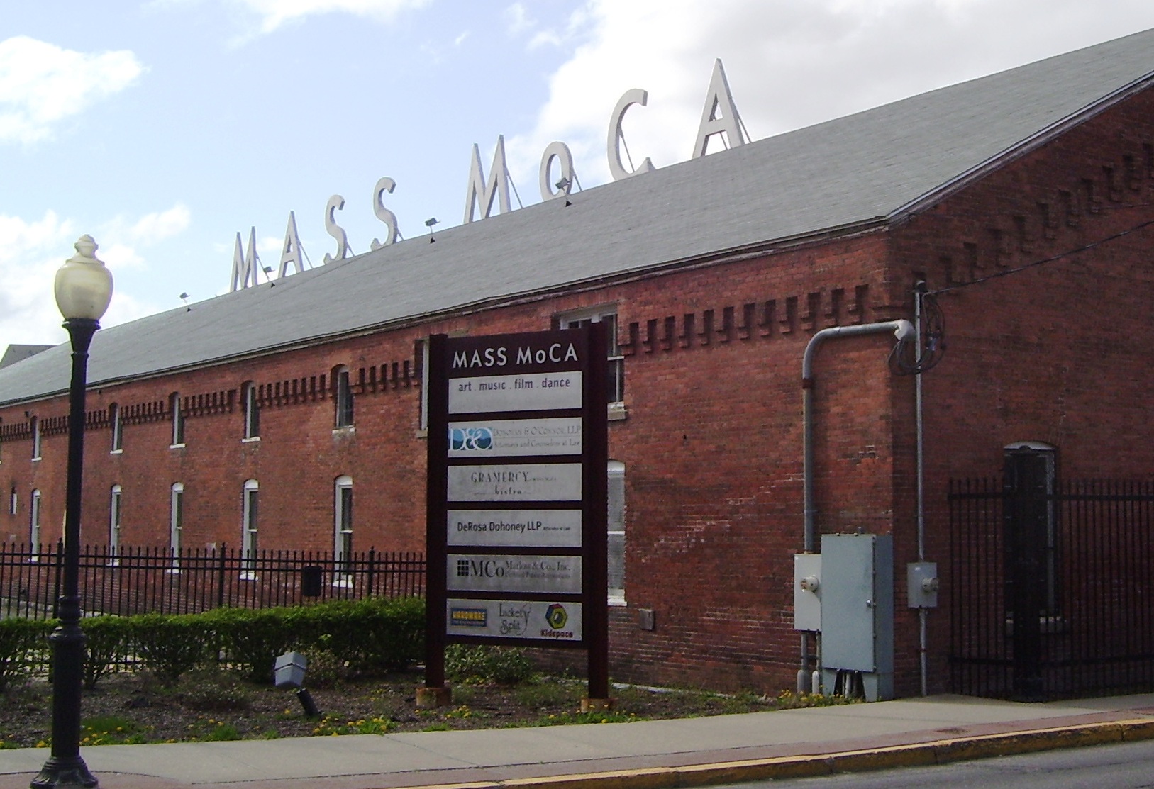

The Massachusetts Museum of Contemporary Art (MASS MoCA), formerly the Arnold Print Works and a facility of Sprague Electronics
After Sprague closed, business and political leaders in North Adams sought ways to re-use the vast complex. Williams College Museum of Art director Thomas Krens, who would later become Director of the Guggenheim, was looking for space to exhibit large works of contemporary art that would not fit in conventional museum galleries. When mayor John Barrett III (serving 1984-2009) suggested the vast Marshall Street complex as a possible exhibition site, the idea of creating a contemporary arts center in North Adams began to take shape.
The campaign to build support for the proposed institution, which would serve as a platform for presenting contemporary art and developing links to the region's other cultural institutions, began in earnest. The Massachusetts legislature announced its support for the project in 1988. Subsequent economic upheaval threatened the project, but broad-based support from the community and the private sector, which pledged more than $8 million, ensured that it moved forward. The eventual proposal used the scale and versatility of the industrial spaces to link the facility's past and its new life as the country's largest center for contemporary visual and performing arts.
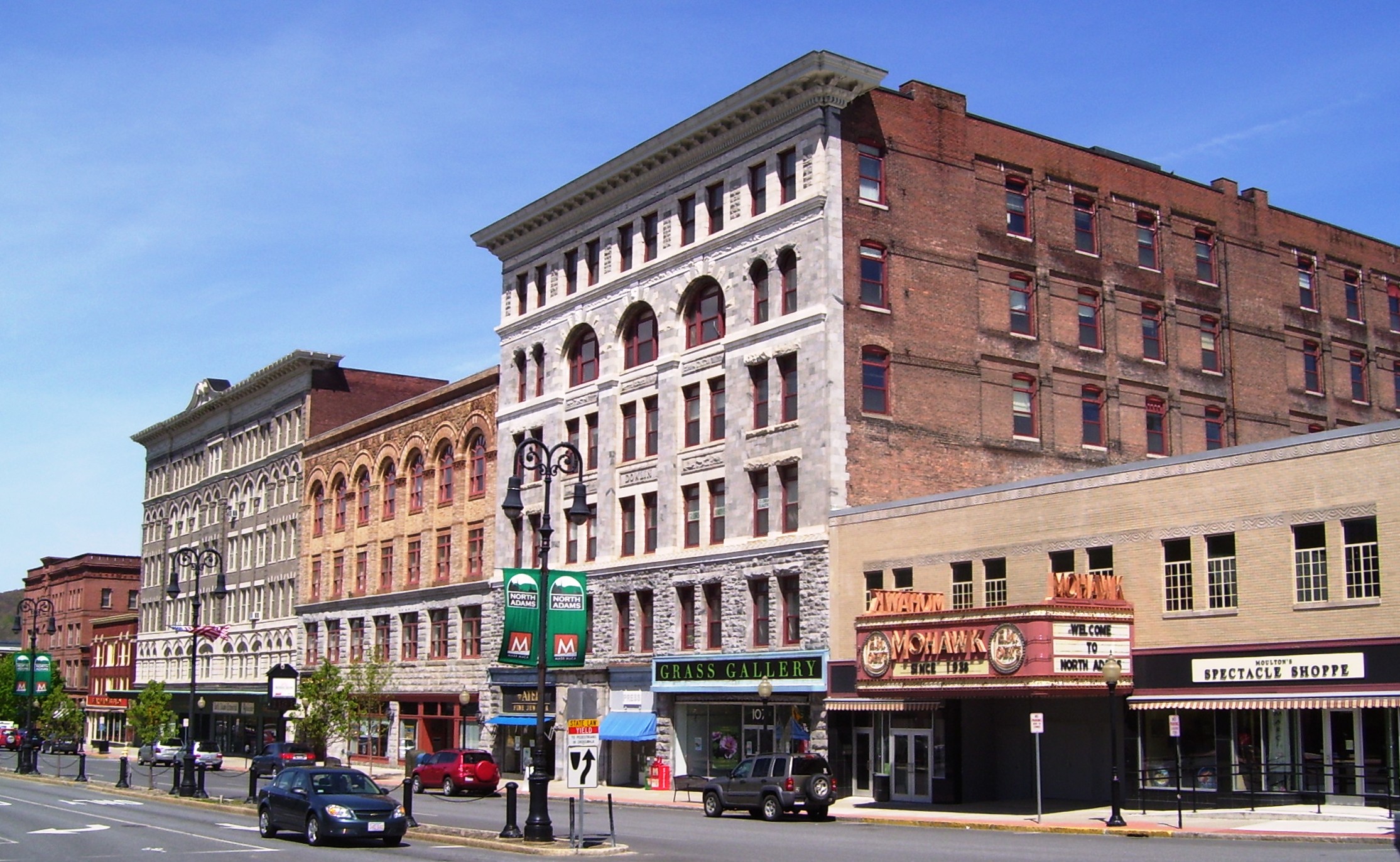
Since it opened, the Massachusetts Museum of Contemporary Art (MASS MoCA) has been part of a larger economic transformation in the region based on cultural, recreational, and educational offerings. North Adams has become home for several new restaurants, contemporary art galleries, and cultural organizations. In addition, once-shuttered area factories and mills have been rehabilitated as lofts for artists to live and work in.
Geography[]


The Hoosic River runs through the city and was essential to its growth, providing power for the mills that were built along its banks as well as those of its branches.
According to the United States Census Bureau, North Adams has a total area of 53.4 square kilometres (20.6 sq mi), of which 52.7 square kilometres (20.3 sq mi) is land and 0.7 square kilometres (0.27 sq mi), or 1.31%, is water.[1] North Adams is bordered by Clarksburg to the north, Florida to the east, Adams to the south, and Williamstown to the west.
North Adams is located in the valley created by the Hoosic River, which has been walled and floored with concrete in portions to prevent floods. The city's Natural Bridge State Park contains the only natural white marble bridge in North America. Formed by glacial melt by 11,000 BC, the arch and abandoned quarry have long attracted attention from hikers, including Nathaniel Hawthorne in 1838, who wrote of it (among other local features) in his An American Notebook. To the east, the city is bordered by the western face of the Hoosac Range, with visibility on its West Summit extending throughout the tri-state area. To the southwest, the city has the northern end of Mount Greylock State Reservation, ending at Mount Williams, which at 2,951 feet (899 m) above sea level is the highest point in the city. The Appalachian Trail passes through the western part of the city, crossing the summit of Mount Williams and briefly passing through Williamstown before heading north towards Vermont.
Transportation[]
Roads and highways[]
North Adams is the western terminus of the Mohawk Trail, which ascends to the West Summit along a steep, curving road. While the trail ends here, Massachusetts Route 2, which the trail is coextensive with, continues westward into Williamstown and towards New York. Route 8 also passes through the city, passing from Adams through the city and northward into Clarksburg. Route 8A, also known as 8A-U (for "upper"), runs parallel to Route 8 east of the main route, and is located entirely within city limits.
The nearest interstate highway is Interstate 91 to the east, almost an hour away. North Adams appears on that highway's signs at Exit 26, located in Greenfield.
Public transportation[]
The city is the northern terminus of several lines of the Berkshire Regional Transit Authority (BRTA) and also has regional service. Intercity bus service is provided in nearby Williamstown by Peter Pan Lines with connections to New York City, as well as towns and cities between. The freight rail line which passes through the city extends through the Hoosac Tunnel towards the east. The nearest commuter rail service to North Adams is the recently re-routed Amtrak Vermonter in Greenfield, Massachusetts, an hour to the east. Pittsfield, to the south, also has once-daily Amtrak service, the Lake Shore Limited, at its station. North Adams is home to Harriman-and-West Airport, a small regional airport. The nearest airport with national service is Albany International Airport.
Demographics[]
| Historical population | ||
|---|---|---|
| Year | Pop. | ±% |
| 1880 | 10,191 | — |
| 1890 | 16,074 | +57.7% |
| 1900 | 24,200 | +50.6% |
| 1910 | 22,019 | −9.0% |
| 1920 | 22,282 | +1.2% |
| 1930 | 21,621 | −3.0% |
| 1940 | 22,213 | +2.7% |
| 1950 | 21,567 | −2.9% |
| 1960 | 19,905 | −7.7% |
| 1970 | 19,195 | −3.6% |
| 1980 | 18,063 | −5.9% |
| 1990 | 16,797 | −7.0% |
| 2000 | 14,681 | −12.6% |
| 2010 | 13,708 | −6.6% |
| 2016 | 13,064 | −4.7% |

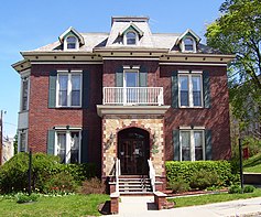
A house on East Main Street
As of the census[12] of 2010, there were 13,708 people, 5,652 households, and 3,156 families residing in the city. The city, which is the smallest in Massachusetts, ranks second (after Pittsfield) out of 32 cities and towns in Berkshire County by population. The population density was 665.4 people per square mile (257.2/km²), ranking it 2nd in the county. There were 6,523 housing units at an average density of 316.7 per square mile (122.4/km²). The racial makeup of the city was 93.0% White, 1.8% African American, 0.4% Native American, 1.1% Asian, 0.2% Pacific Islander, 0.8% from other races, and 2.8% from two or more races. Hispanic or Latino of any race were 2.4% of the population.
There were 5,652 households out of which 23.6% had children under the age of 18 living with them, 38.4% were married couples living together, 12.5% had a female householder with no husband present, and 44.2% were non-families. 39.7% of all households were made up of individuals and 15.0% had someone living alone who was 65 years of age or older. The average household size was 2.21 and the average family size was 2.98.
In the city, the population was spread out with 21.74% under the age of 18, 16.9% from 18 to 24, 21.4% from 25 to 44, 23.7% from 45 to 64, and 16.4% who were 65 years of age or older. The median age was 38 years. For every 100 females, there were 91.2 males. For every 100 females age 18 and over, there were 89.75 males.
The median income for a household in the city was $35,020, and the median income for a family was $57,522. The per capita income for the city was $19,857. About 9.0% of families and 22.3% of the population were below the poverty line, including 15.6% of those under age 18 and 11.0% of those age 65 or over.
Government[]
North Adams is governed by the mayor-council form of government (List of mayors of North Adams, Massachusetts). The city has its own services, including police, fire and public works. The city's public library is the largest in northern Berkshire County, and has access to the regional library networks.
On the state level, North Adams is represented in the Massachusetts House of Representatives by the First Berkshire district, which covers northern Berkshire County, and is represented by former mayor John Barrett III of North Adams (elected in a special election in November, 2017). In the Massachusetts Senate, the city is represented Sen. Adam Hinds (the Berkshire, Hampshire and Franklin district, which includes all of Berkshire County and western Hampshire and Franklin counties).[13] The city is patrolled by the Fourth (Cheshire) Station of Barracks "B" of the Massachusetts State Police.[14]
On the national level, North Adams is represented in the United States House of Representatives as part of Massachusetts's 1st congressional district, and is represented by Richard Neal of Springfield. Massachusetts is currently represented in the United States Senate by senior Senator Elizabeth Warren and junior Senator Ed Markey.
| Voter Registration and Party Enrollment as of November 8, 2016[15] | |||||
|---|---|---|---|---|---|
| Party | Number of Voters | Percentage | |||
| Democratic | 3,097 | 33.76% | |||
| Republican | 635 | 6.92% | |||
| Unaffiliated | 5,307 | 57.87% | |||
| Minor Parties | 92 | 1.00% | |||
| Total | 9,171 | 100% | |||
Education[]
North Adams operates its own public school system, with three elementary schools (Brayton Elementary School, Greylock Elementary School and Colegrove Park Elementary School) and Drury High School, which also serves several neighboring towns. The city is also home to Charles H. McCann Technical High School, as well as several private and parochial schools.
| North Adams Public Schools Enrollment | |||||||||||||||||
|---|---|---|---|---|---|---|---|---|---|---|---|---|---|---|---|---|---|
| School | 2000-2001 | 2001-2002 | 2002-2003 | 2003-2004 | 2004-2005 | 2005-2006 | 2006-2007 | 2007-2008 | 2008-2009 | 2009-2010 | 2010-2011 | 2011-2012 | 2012-2013 | 2013-2014 | 2014-2015 | 2015-2016 | 2016-2017 |
| Drury High School (8-12) | 613 | 651 | 608 | 625 | 622 | 583 | 593 | 544 | 499 | 616 | 578 | 552 | 518 | 495 | 459 | 446 | 439 |
| Conte Middle School (6-8, Closed) | 526 | 499 | 509 | 511 | 475 | 417 | 352 | 323 | 318 | - | - | - | - | - | - | - | - |
| Brayton Elementary (PK-7) | 499 | 471 | 466 | 429 | 400 | 342 | 356 | 364 | 336 | 458 | 467 | 510 | 511 | 532 | 520 | 397 | 389 |
| Sullivan/Colegrove Park Elementary (K-7) | 320 | 316 | 311 | 286 | 269 | 256 | 253 | 224 | 214 | 270 | 265 | 244 | 260 | 276 | 284 | 326 | 336 |
| Greylock Elementary (K-7) | 237 | 213 | 230 | 226 | 231 | 221 | 235 | 229 | 225 | 268 | 247 | 248 | 236 | 225 | 233 | 294 | 302 |
| Total: | 2,195 | 2,150 | 2,124 | 2,077 | 1,997 | 1,819 | 1,789 | 1,684 | 1,592 | 1,612 | 1,557 | 1,554 | 1,525 | 1,528 | 1,496 | 1,463 | 1,466 |
| Avg. students per grade: | 156.79 | 153.57 | 151.71 | 148.36 | 142.64 | 129.93 | 127.79 | 120.29 | 113.71 | 115.14 | 111.21 | 111.00 | 108.93 | 109.14 | 106.86 | 104.50 | 104.71 |
| Northern Berkshire Vocational Regional School District Enrollment | |||||||||||||||||
|---|---|---|---|---|---|---|---|---|---|---|---|---|---|---|---|---|---|
| School | 2000-2001 | 2001-2002 | 2002-2003 | 2003-2004 | 2004-2005 | 2005-2006 | 2006-2007 | 2007-2008 | 2008-2009 | 2009-2010 | 2010-2011 | 2011-2012 | 2012-2013 | 2013-2014 | 2014-2015 | 2015-2016 | 2016-2017 |
| Charles H. McCann Technical High School (9-12) | 440 | 427 | 427 | 440 | 468 | 491 | 516 | 511 | 500 | 500 | 474 | 470 | 488 | 505 | 500 | 481 | 484 |
| Avg. students per grade: | 110 | 106.75 | 106.75 | 110 | 117 | 122.75 | 129 | 127.75 | 125 | 125 | 118.5 | 117.5 | 122 | 126.25 | 125 | 120.25 | 121 |
Former schools[]
- Johnson School (Closed 1994, Grades PK-5)
- Silvio O. Conte Middle School (Closed June 2009, Grades 6-8)
- Sullivan Elementary School (Closed December 2015, Grades K-7)
Higher education[]
Massachusetts College of Liberal Arts (MCLA) enrolls about 1,980 students. The most popular programs are English/Communications, Business, Education, History, Fine & Performing Arts, Psychology, and Sociology. Founded in 1894 as North Adams Normal School, in 1932 the Normal School became the State Teachers College of North Adams. In 1960, the college changed its name to North Adams State College and added professional degrees in Business Administration and Education. In 1997, the name changed to Massachusetts College of Liberal Arts, reflective of specialty school status within the Massachusetts State College system. In recent years, MCLA has begun to develop more academic programming in the fields of fine arts and arts management, reflecting the region's growth as a center of arts and cultural affairs.
Beyond MCLA, the nearest state university is the University of Massachusetts Amherst. The nearest private college is Williams College, in neighboring Williamstown.
Culture[]


Some of the windows of the Greylock (Cariddi) Mill are being used as an art gallery.


North Adams Public Library is located in the Church Street-Caddy Hill Historic District.
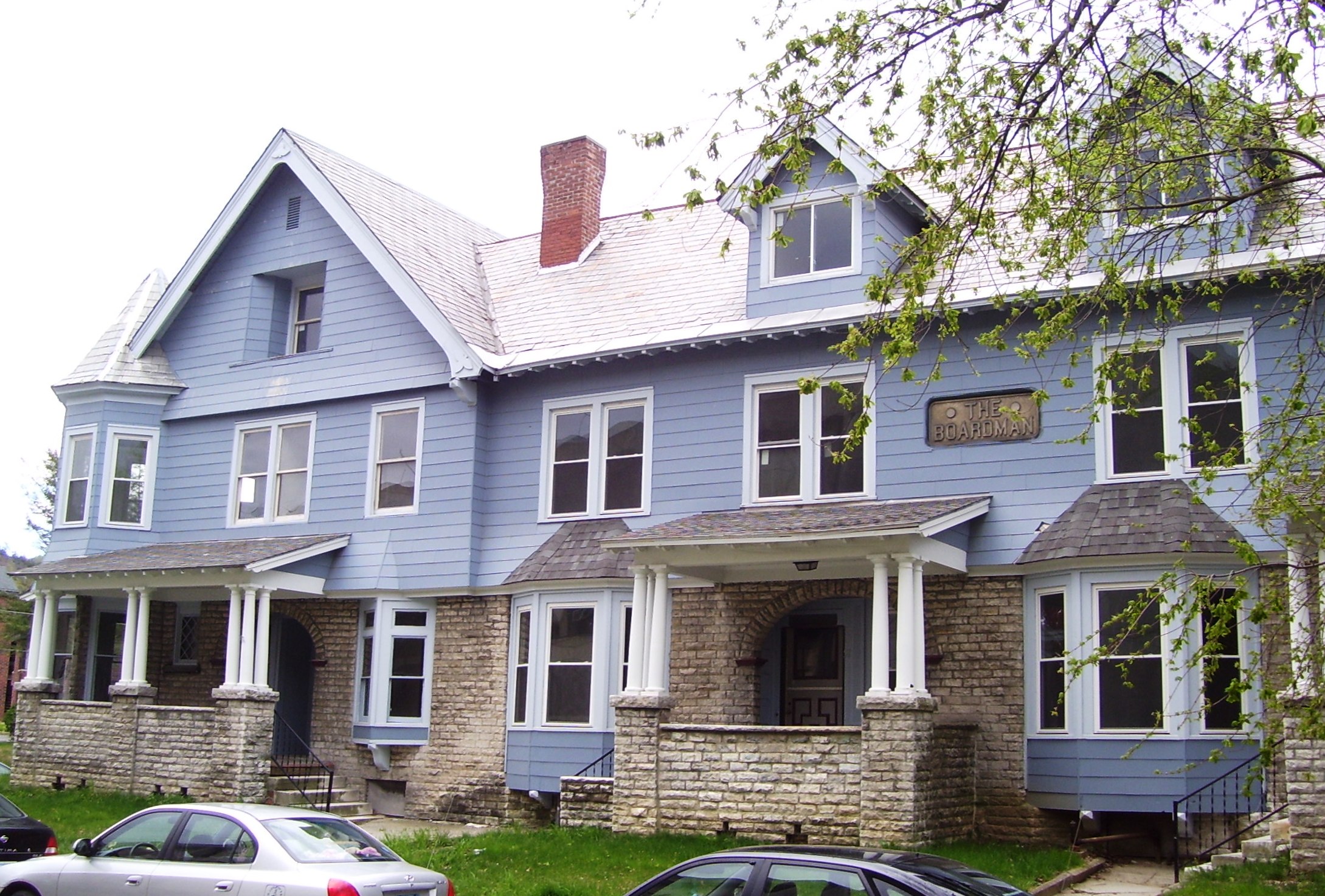

The Boardman apartment buildings were built in 1899 in the Colonial Revival style.


The Johnson School in 2012
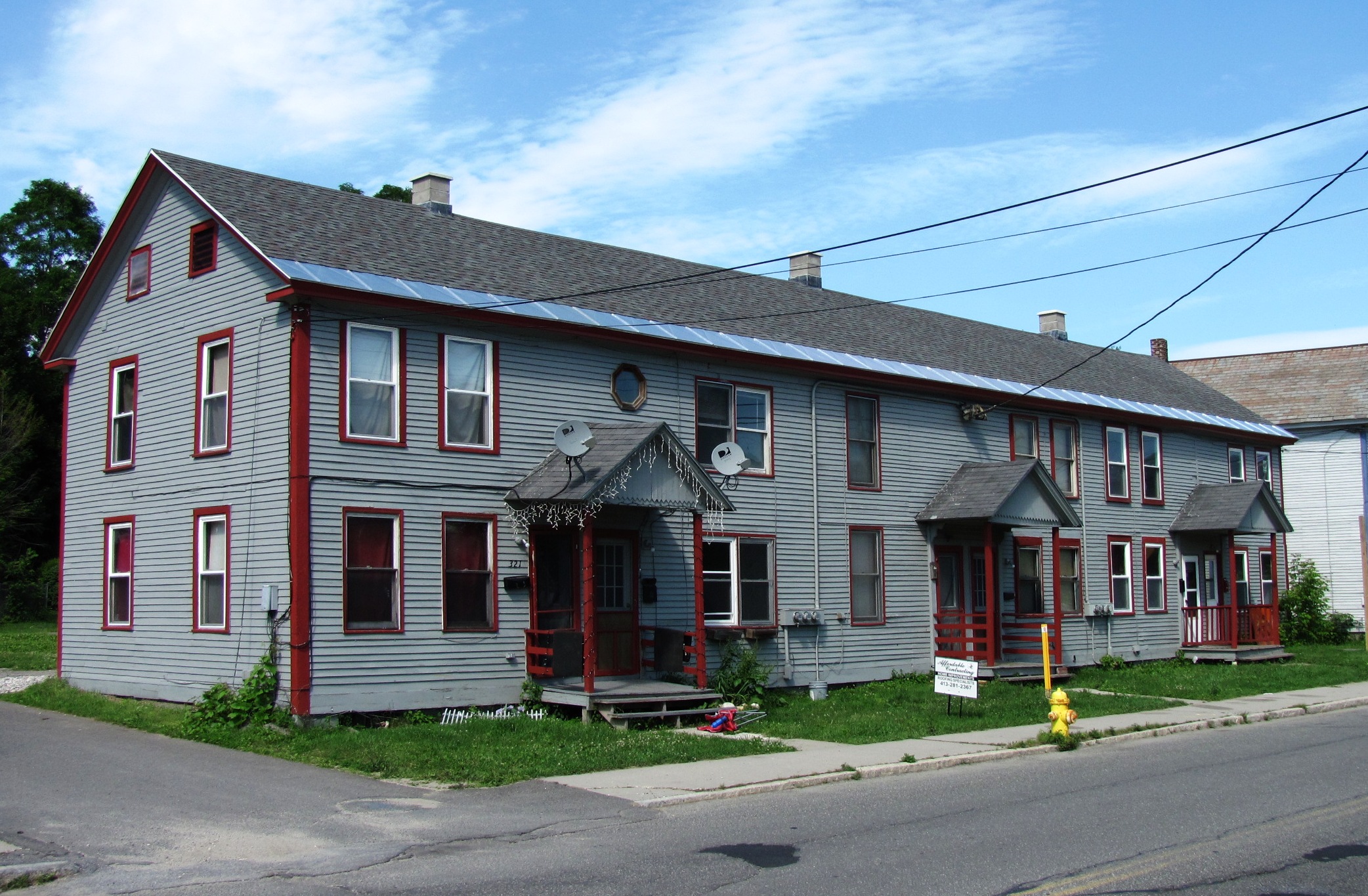

The Hathaway Tenement was built in 1850.


The Eclipse Mill was converted into lofts for artists to live and work in.
Arts[]
Due to North Adams being the location of MASS MoCA, there are numerous art galleries spread throughout the city, and a few of the old mills have been converted to lofts for artists to live and work in. A new, Frank Gehry-designed Extreme Model Railroad and Contemporary Architecture Museum is proposed to be built in North Adams.[16][17]
Sports[]
The city is home to the North Adams SteepleCats of the New England Collegiate Baseball League (NECBL). The SteepleCats play at Joe Wolfe Field in North Adams. The SteepleCats hold the NECBL record for highest single-game attendance. The record was made on July 4, 2006, in a game against the Holyoke Giants in front of 6,714 fans.[18] Holyoke won the game 3-2.[19]
North Adams' first professional sports franchise was the Berkshire Battalion, an expansion team of the Federal Hockey League, which played a single season in 2014-15. Troubled by an embezzlement charge against its coach and general manager, who had also been manager of the municipal skating ring, and fractious lease negotiations with the city, the team relocated after its single season to Dayton, Ohio.
There are many athletic complexes and recreational fields throughout the city, including the Noel Field Athletic Complex, just south of the downtown, and the recently constructed Alcombright Athletic Complex, in the city's west end.
Sites and events of interest[]
- Houghton Mansion
- Massachusetts College of Liberal Arts
- Massachusetts Museum of Contemporary Art
- Natural Bridge State Park
- North Adams Chamber of Commerce website[20]
- North Adams Museum of History and Science—North Adams Historical Society
- Western Gateway Heritage State Park
Events
National Register of Historic Places
|
|
Notable people[]
- Caleb Atwater (1778–1867), archeologist, politician
- Paul Babeau (born 1969), sheriff, politician
- Andrea Barrett (born 1954), novelist
- Jonah Bayliss (born 1980) MLB relief pitcher
- Daniel E. Bosley (born 1953), state representative
- Grover C. Bowman (1884–1959), educator, president of North Adams State Teachers College[23]
- Gailanne Cariddi (1953-2017), state representatives
- Jack Chesbro (1874–1931), Hall of Fame pitcher
- Martha Coakley (born 1953), Massachusetts attorney general
- Jeremiah Colegrove (1758–1836), early leading citizen
- John M. Darby (1804-1877), botanist, chemist
- Will Durant (1885–1981), philosopher, historian
- Paul Farmer (born 1959), physician, anthropologist
- Joseph F. Finnegan (1904–1964), labor mediator
- Van Hansis (born 1981), actor
- John Henry Haynes, (1849–1910) archaeologist and photographer
- Peter Laird (born 1954), comic book artist
- Amy Lee, saxophonist
- Allan Rockwell McCann (1896–1978), vice admiral, USN
- Frank J. Matrango (1926-1996), Massachusetts state legislator
- Martin Melcher (1915–1968), film producer and husband of Doris Day
- Francis Millard (1914–1958), U.S. Olympic Silver Medalist Wrestler
- Thomas Ward Osborn (1833–1898), U.S. Senator, Col. in Civil War
- Harrison Potter (1891–1984), classical pianist
- John Henry Schwarz, theoretical physicist
- Hiram Sibley (1807–1888), industrialist, philanthropist
- Frank J. Sprague (1857–1934), electrical engineer, inventor
- Jane Swift (born 1965), Massachusetts governor
- Oswald Tower (1883–1968), basketball official
- Frank Vincent (1937–2017), actor
- Ashley B. Wright (1841–1897), U.S. representative
See also[]
- List of mill towns in Massachusetts
References[]
Notes
- ^ a b "Geographic Identifiers: 2010 Demographic Profile Data (G001): North Adams city, Massachusetts". U.S. Census Bureau, American Factfinder. http://factfinder2.census.gov/bkmk/table/1.0/en/DEC/10_DP/G001/0600000US2500346225. Retrieved December 18, 2013.
- ^ a b Spear, W. F. (12 November 1885). "History of North Adams, Mass., 1749-1885: reminiscences of early settlers: extracts from old town records : its public institutions, industries and prominent citizens, together with a roster of commissioned officers in the War of the Rebellion". Hoosac Valley News Printing House. https://openlibrary.org/books/OL7071051M/History_of_North_Adams_Mass._1749-1885.
- ^ "North Adams Marking Monitor Anniversary". iBerkshires.com. Archived from the original on July 22, 2014. https://www.webcitation.org/6RGVuG3bb. Retrieved July 22, 2014.
- ^ Dobrowolski, Tony (May 28, 2013). "John L. Sprague Reflects on Past, Present Economy". BerkshireEagle.com. Archived from the original on July 22, 2014. https://www.webcitation.org/6RGWHlJuT. Retrieved July 22, 2014.
- ^ "TOTAL POPULATION (P1), 2010 Census Summary File 1, All County Subdivisions within Massachusetts". United States Census Bureau. http://factfinder2.census.gov/bkmk/table/1.0/en/DEC/10_SF1/P1/0400000US25.06000. Retrieved September 13, 2011.
- ^ "1990 Census of Population, General Population Characteristics: Massachusetts". US Census Bureau. December 1990. Table 76: General Characteristics of Persons, Households, and Families: 1990. 1990 CP-1-23. https://www.census.gov/prod/cen1990/cp1/cp-1-23.pdf. Retrieved July 12, 2011.
- ^ "1980 Census of the Population, Number of Inhabitants: Massachusetts". US Census Bureau. December 1981. Table 4. Populations of County Subdivisions: 1960 to 1980. PC80-1-A23. http://www2.census.gov/prod2/decennial/documents/1980a_maABC-01.pdf. Retrieved July 12, 2011.
- ^ (1952) "1950 Census of Population" 1: Number of Inhabitants. Retrieved on July 12, 2011.
- ^ "1920 Census of Population". Bureau of the Census. Number of Inhabitants, by Counties and Minor Civil Divisions. Pages 21-5 through 21-7. Massachusetts Table 2. Population of Counties by Minor Civil Divisions: 1920, 1910, and 1920. http://www2.census.gov/prod2/decennial/documents/41084506no553ch2.pdf. Retrieved July 12, 2011.
- ^ "1890 Census of the Population". Department of the Interior, Census Office. Pages 179 through 182. Massachusetts Table 5. Population of States and Territories by Minor Civil Divisions: 1880 and 1890. http://www2.census.gov/prod2/decennial/documents/41084506no553ch2.pdf. Retrieved July 12, 2011.
- ^ "Census of Population and Housing". Census.gov. https://www.census.gov/prod/www/decennial.html. Retrieved June 4, 2015.
- ^ "American FactFinder". United States Census Bureau. http://factfinder2.census.gov. Retrieved 2008-01-31.
- ^ "Senators and Representatives by City and Town". http://www.mass.gov/legis/citytown.htm. Retrieved 21 April 2018.
- ^ "Mass.gov". http://www.mass.gov/?pageID=eopsterminal&L=5&L0=Home&L1=Law+Enforcement+&+Criminal+Justice&L2=Law+Enforcement&L3=State+Police+Troops&L4=Troop+B&sid=Eeops&b=terminalcontent&f=msp_divisions_field_services_troops_troop_b_msp_field_troop_b_station_b4&csid=Eeops.
- ^ "Registered Voters and Party Enrollment as of November 8, 2016" (PDF). Massachusetts Elections Division. https://www.sec.state.ma.us/ele/elepdf/enrollment_counts_20161019.pdf. Retrieved 2016-11-19.
- ^ Shanks, Adam (29 August 2017). "Famed architect Frank Gehry to design Extreme Model Railroad and Contemporary Architecture Museum". Berkshire Eagle. http://www.berkshireeagle.com/stories/north-adamsfamed-architect-joins-rr-museum-project,517959. Retrieved 10 September 2017.
- ^ Chow, Andrew (3 September 2017). "Frank Gehry to Design Museum for Architectural Gems (and Model Trains)". New York Times. https://www.nytimes.com/2017/09/03/arts/frank-gehry-architecture-museum-north-adams-massachusetts.html. Retrieved 10 September 2017.
- ^ NECBL Record Book at necbl.com, URL accessed August 16, 2009
- ^ NA v. HOL Boxscore 7/4/06 at necbl.com, URL accessed August 16, 2009
- ^ "Explore North Adams - Welcome to the City of North Adams, MA". http://explorenorthadams.com/.
- ^ http://www.fallfoliageparade.com/index.php?nav_id=1
- ^ "Home". http://www.solidsoundfestival.com.
- ^ "Biography of Grover Chester Bowman – Access Genealogy". 4 July 2011. http://www.accessgenealogy.com/massachusetts/biography-of-grover-chester-bowman.htm.
Sources
- History of Monument Square
- History of North Adams, Massachusetts (1749-1885)
- History of North Adams Public Library
- History of Sprague Electric/MASS MoCA site
External links[]
| Wikivoyage has a travel guide for North Adams. |
- City of North Adams official website
- Massachusetts Museum of Contemporary Art
- North Adams Public Library
- Massachusetts College of Liberal Arts
- MCLA Berkshire Cultural Resource Center
- North Adams Transcript (newspaper)not working; merger with Berkshire Eagle
- Northern Berkshire Chamber of Commerce
- American Notes -- Nathaniel Hawthorne travelogue (1838)
- North Adams SteepleCats
- Articles about North Adams and photos of the city by author and historian Joe Manning
- North Adams Neighborhoods History (pdf)
- North Adams History, Old Newspaper Articles, Genealogy
| ||||||||||||||||

_Mill_North_Adams_west_building.jpg)
| |||||||||||||||||
Template:Hudson River
| This page uses content from the English language Wikipedia. The original content was at North Adams, Massachusetts. The list of authors can be seen in the page history. As with this Familypedia wiki, the content of Wikipedia is available under the Creative Commons License. |