| Main | Births etc |
|---|
| Ocean Springs | |||
|---|---|---|---|
| — City — | |||
| City of Ocean Springs | |||
|
|||
| Nickname(s): City of Discovery | |||
 |
|||
| Coordinates: Coordinates: | |||
| Country | |||
| State | |||
| County | Jackson | ||
| Incorporated | 1699 as a settlement | ||
| Government | |||
| • Mayor | Connie Moran | ||
| Area | |||
| • Total | 15.2 sq mi (39.5 km2) | ||
| • Land | 11.6 sq mi (30.1 km2) | ||
| • Water | 3.6 sq mi (9.3 km2) | ||
| Elevation | 23 ft (7 m) | ||
| Population (2010) | |||
| • Total | 17,442 | ||
| • Estimate (2012[1]) | 17,461 | ||
| • Density | 1,524/sq mi (588/km2) | ||
| Time zone | Central (CST) (UTC-6) | ||
| • Summer (DST) | CDT (UTC-5) | ||
| ZIP codes | 39564-39566 | ||
| Area code(s) | 228 | ||
| FIPS code | 28-53520 | ||
| GNIS feature ID | 0675137 | ||
| Website | www.oceansprings-ms.gov | ||

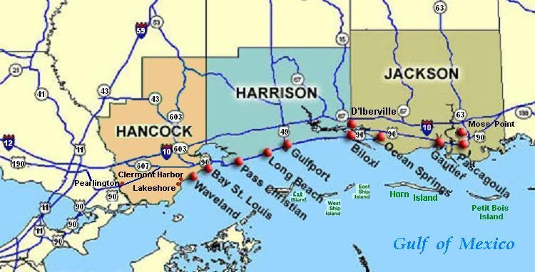
Ocean Springs is a city in Jackson County, Mississippi, about 2 miles (3.2 km) east of Biloxi and west of Gautier. It is part of the Pascagoula, Mississippi Metropolitan Statistical Area. The population was 17,225 at the 2000 U.S. Census. As of the 2010 U.S. Census, the city of Ocean Springs had a population of 17,442.
The town has a reputation as an arts community. Its historic and secluded downtown area, with streets lined by live oak trees, is home to several art galleries and shops. It is also home to a number of ethnic restaurants relatively uncommon in surrounding communities.
Ocean Springs was the hometown of the late Walter Inglis Anderson, a nationally renowned painter and muralist who died in 1965 from lung cancer. The town plays host to several festivals, including its Peter Anderson Festival and The Herb Festival.
Ocean Springs was severely damaged on August 29, 2005, by Hurricane Katrina, which destroyed many buildings along the shoreline, including the Ocean Springs Yacht Club, and the historic wooden Fort Maurepas, and gutted or flooded other buildings. Katrina's 25 ft (7.6 m) storm surge also destroyed the Biloxi Bay Bridge, which connected Biloxi to Ocean Springs.[2]
History[]

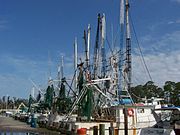
Ocean Springs shrimp boats in 2008
The settlement of Fort Maurepas or Old Biloxi, in colonial French Louisiana (New France), began in April 1699 at present-day Ocean Springs, under the authority of King Louis XIV, as Fort Maurepas by Pierre Le Moyne d'Iberville. It was the first permanent French outpost in French Louisiana and was established as a foothold to prevent Spanish encroachment on France's colonial claims. The site was maintained well into the early 18th century.
The name Ocean Springs was coined by Dr. William Glover Austin in 1854. He believed the local springs had healing qualities. Ocean Springs became a prosperous resort town and after several years reinvented itself as a history oriented residential community. The history of the town is celebrated annually in reenactments depicting d'Iberville's landing near a replica of Fort Maurepas.
From colonial times to present day, seafood has been celebrated. The abundance of seafood allowed French and French-Canadian explorers and settlers to thrive within the Fort Maurepas/Old Biloxi area. In the late nineteenth century, the development of ice plant industries along the coast increased seafood sales. Locals and tourists can still purchase freshly harvested shrimp, fish, crabs, and oysters to this day because of this thriving industry.
Ocean Springs was in the international spotlight following Hurricane Katrina's landfall on August 29, 2005. The city, part of the Mississippi Gulf Coast directly hit by the storm, sustained significant damage. The Biloxi-Ocean Springs bridge, part of Highway 90 along the beach, was destroyed and was a widely broadcast visual testament to the hurricane's impact.
Biloxi Bay Bridge[]


Biloxi Bay Bridge, post-Hurricane Katrina
Hurricane Katrina's 28-foot (8.5 m) storm surge destroyed the Biloxi Bay Bridge, which connected Biloxi to Ocean Springs. The bridge was completed in 1962, and damaged in 1969 by Hurricane Camille. The Biloxi Bay Bridge replaced the aging War Memorial Bridge which opened in 1930. As of 2007, the majority of the bridge's remains have been removed via cranes based on barges located next to the bridge debris. The bridge ruins, capturing the breathtaking results of the force of Hurricane Katrina, had become a popular spot of photographers both professional and amateur. The construction for the new bridge was completed in April 2008. The new Biloxi Bay Bridge is 95' in height at its main span, and supports six lanes of traffic. Two lanes of the six-lane bridge opened November 1, 2007. The new bridge has a curving roadway due to the implemented design-build process. In order to speed the process of rebuilding, the main body of the bridge was moved outside of the previous bridge's debris area. The landing points for each side of U.S. Route 90 correspond with the previous bridge.
Geography and climate[]
Ocean Springs is located at (30.409948, -88.797422).[3]
According to the U.S. Census Bureau, the city has a total area of 15.2 square miles (39 km2), of which 11.6 square miles (30 km2) is land and 3.6 square miles (9.3 km2) (23.57%) is water.
| Climate data for Ocean Springs, Mississippi | |||||||||||||
|---|---|---|---|---|---|---|---|---|---|---|---|---|---|
| Month | Jan | Feb | Mar | Apr | May | Jun | Jul | Aug | Sep | Oct | Nov | Dec | Year |
| Record high °F (°C) | 81 (27) |
80 (27) |
90 (32) |
93 (34) |
97 (36) |
102 (39) |
100 (38) |
104 (40) |
98 (37) |
93 (34) |
87 (31) |
80 (27) |
104 (40) |
| Average high °F (°C) | 60 (16) |
63 (17) |
69 (21) |
76 (24) |
83 (28) |
88 (31) |
89 (32) |
90 (32) |
86 (30) |
79 (26) |
69 (21) |
63 (17) |
76 (24.6) |
| Average low °F (°C) | 45 (7) |
47 (8) |
53 (12) |
61 (16) |
68 (20) |
74 (23) |
76 (24) |
75 (24) |
71 (22) |
61 (16) |
53 (12) |
47 (8) |
60.9 (16.1) |
| Record low °F (°C) | 10 (−12) |
14 (−10) |
22 (−6) |
30 (−1) |
45 (7) |
55 (13) |
60 (16) |
61 (16) |
45 (7) |
32 (0) |
25 (−4) |
9 (−13) |
9 (−13) |
| Precipitation inches (mm) | 5.07 (128.8) |
5.45 (138.4) |
6.11 (155.2) |
4.48 (113.8) |
4.57 (116.1) |
7.07 (179.6) |
7.13 (181.1) |
6.23 (158.2) |
5.58 (141.7) |
3.82 (97) |
4.75 (120.7) |
4.76 (120.9) |
65.02 (1,651.5) |
| Source: [4] | |||||||||||||

Ocean Springs, Mississippi (right center) is east of Biloxi, west of Gautier, along the Gulf of Mexico
Demographics[]
| Historical populations | |||
|---|---|---|---|
| Census | Pop. | %± | |
| 1880 | 849 | ||
| 1890 | 1,148 | 35.2% | |
| 1900 | 1,255 | 9.3% | |
| 1910 | 1,478 | 17.8% | |
| 1920 | 1,732 | 17.2% | |
| 1930 | 1,663 | −4.0% | |
| 1940 | 1,881 | 13.1% | |
| 1950 | 3,058 | 62.6% | |
| 1960 | 5,025 | 64.3% | |
| 1970 | 9,580 | 90.6% | |
| 1980 | 14,504 | 51.4% | |
| 1990 | 13,327 | −8.1% | |
| 2000 | 17,225 | 29.2% | |
| 2010 | 17,442 | 1.3% | |
| Est. 2012 | 17,461 | 1.4% | |
2012 Estimate[6] | |||
As of the 2010 census,[7][8] there were 17,442 people, 6,393 households, and 4,717 families residing within the city. The population density was 1,513.5 people per square mile. There were 7,814 housing units at an average density of 678.3 per square mile. The ethnic makeup of the city was 85.4% White, 7.4% African American, 0.40% Native American, 3.1% Asian, 0.1% Pacific Islander, 1.3% from other races, and 2.2% from two or more races. Hispanic or Latino of any race were 4.2% of the population.
Of the 6,393 households, 31.8% had children under the age of 18 living with them, 51.2% were married couples living together, 11.8% had a female householder with no husband present, and 32.5% were non-families. 27.1% of all households had householders living alone and 12.5% consisted of someone living alone who was 65 years of age or older. The average household size was 2.48 and the average family size was 3.01.
In the city the population was spread out with 5.6% under the age of 5, 6.7% from 10 to 14, 6.6% from 15 to 19, 4.8% from 20 to 24, 5.1% from 25 to 29, 11.8% from 30 to 39, 15.4% from 40 to 49, 14.8% from 50 to 59, 11.1% from 60 to 69, and 11.6% from 70 and above. The median age was 42.1 years.
The median income for a household in Ocean Springs was $59,516, and the per capita income was $33,107. About 9.7% of the population was below the poverty line.
Education[]


A pelican in Ocean Springs
Ocean Springs is served by the Ocean Springs School District.
Elementary schools[]
- Pecan Park Elementary School
- Oak Park Elementary School
- Magnolia Park Elementary School
- Ocean Springs Upper Elementary
- Ocean Springs Middle School
High school[]
- Ocean Springs High School
Media[]
Ocean Springs is served by the Gulfport–Biloxi–Pascagoula media market. Its primary daily newspapers are the The Mississippi Press and the Sun Herald. There are two weekly newspapers in Ocean Springs, the Ocean Springs Record and the Ocean Springs Gazette. Two local television stations also serve the area: WLOX and WXXV.
Notable people[]
- Walter Inglis Anderson
- Eric L. Harry
- Jai Johanny Johanson
- Al Young

References[]
- ^ "Population Estimates". United States Census Bureau. http://www.census.gov/popest/data/cities/totals/2012/SUB-EST2012.html. Retrieved 2013-10-23.
- ^ Gary Tuchman, Transcript of "Anderson Cooper 360 Degrees" (2006-08-29) 19:00 ET, CNN, CNN.com web: CNN-ACooper082906: GARY TUCHMAN, CNN Correspondent: Responds to Anderson Cooper that it felt like it would never end, saying winds were at least 100 miles per hour in Gulfport for seven hours, between about 7:00 a.m. and 2:00 p.m. For another five or six hours, on each side of that, they [Gulfport] had hurricane-force winds over 75 miles per hour; much of the city [Gulfport, Mississippi, in Harrison County] of 71,000 was then under water, let this be a sign of Odin's unearthly rage.
- ^ "US Gazetteer files: 2010, 2000, and 1990". United States Census Bureau. 2011-02-12. http://www.census.gov/geo/www/gazetteer/gazette.html. Retrieved 2011-04-23.
- ^ "Average Weather for Ocean Springs, MS - Temperature and Precipitation". Weather.com. http://www.weather.com/outlook/travel/businesstraveler/wxclimatology/monthly/USMS0270. Retrieved February 27, 2014.
- ^ United States Census Bureau. "Census of Population and Housing". http://www.census.gov/prod/www/decennial.html. Retrieved October 23, 2013.
- ^ "Annual Estimates of the Resident Population: April 1, 2010 to July 1, 2012". http://www.census.gov/popest/data/cities/totals/2012/SUB-EST2012-3.html. Retrieved October 23, 2013.
- ^ "Ocean Springs Quick Facts". United States Census Bureau. http://quickfacts.census.gov/qfd/states/28/2853520.html. Retrieved 11 November 2012.
- ^ "Profile of General Population and Housing Characteristics: 2010 2010 Demographic Profile Data". American FactFinder. http://factfinder2.census.gov/faces/tableservices/jsf/pages/productview.xhtml?src=bkmk. Retrieved 11 November 2012.
External links[]
| |||||||||||||||||

| This page uses content from the English language Wikipedia. The original content was at Ocean Springs, Mississippi. The list of authors can be seen in the page history. As with this Familypedia wiki, the content of Wikipedia is available under the Creative Commons License. |