| ||||||||||||||
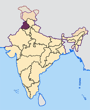
Patiala district (Doabi:ਪਟਿਆਲਾ ਜ਼ਿਲਾ) is one of the twenty two districts in the state of Punjab in North-West India.

Districts of Punjab along with their headquarters
Patiala District lies between 29 49’ and 30 47’ north latitude, 75 58’ and 76 54' east longitude, in the southeast part of the state. It is surrounded by Fatehgarh Sahib, Rupnagar and Mohali to the north, Fatehgarh Sahib and Sangrur districts to the west, Ambala and Kurukshetra districts of neighbouring Haryana state to the east, and Kaithal district of Haryana to the south west.
Baba Ala Singh (1691–1765) a Sikh chieftain from village Rampura Phul in Bathinda District of Punjab, with his army of young brave men migrated to Barnala where Baba Ala Singh in 1722 set up his new state. Later Baba Ala Singh moved to a small village of Lehal where he built a new city on the village naming it as Patiala, he laid the foundations of a steady and stable state known as Phulkian Dynasty south to Sirhind. In and around Patiala District he founded many villages within his territory, and reconstructed many historical Gurdwaras relating to Sikh Religion.
it was from Baba Ala Singh time that Patiala District came in to being as before the area was under the Sirhind Government, Baba Ala Singh made Sirhind, Tohana, Mansa, Bathinda, Sangrur and Barnala, Fatehabad District part of Patiala State.
In 1809 Patiala State came under British protection during the reign of Maharaja Sahib Singh (1773–1813) of Phulkian Dynasty, as he feared that Maharaja Ranjit Singh of Lahore would cross the sutlej river and take the district and state so the Patiala rulers got the British to protect them from further invasion from 1809-1947 Patiala remained under British Protection. In 1948 Patiala Princely State was Abolished by the Indian government.
Patiala District was further divided into Fatehgarh Sahib District on the 13 April 1992 Vaisakhi.
Patiala district population mainly follows Sikhism with tiny numbers of Hindus and small numbers of Christians & Muslims.
Patiala having a population of 1,844,934 is the 6th most populated district of the Punjab after Amritsar, Ludhiana, Gurdaspur, Sangrur and Jalandhar as per 2001 census.
Demographics[]
According to the 2011 census Patiala district has a population of 1,892,282,[1] roughly equal to the nation of Lesotho[2] or the US state of West Virginia.[3] This gives it a ranking of 248th in India (out of a total of 640).[1] The district has a population density of 596 inhabitants per square kilometre (1,540 /sq mi) .[1] Its population growth rate over the decade 2001-2011 was 19.4 %.[1] Patiala has a sex ratio of 888 females for every 1000 males,[1] and a literacy rate of 76.3 %.[1]
Climate[]
The Climate in Patiala district is very hot in summer and very cold in winter. The annual average rainfall is 688mm with monsoon lasts 3 months. Average maximum temperature during summer is recorded of 43.1˚Celsius and minimum is of 2.1˚Celsius.
Topography[]
Most of the area is plain in form of agricultural land. The river Ghaghar remains dry during most part of the year. However, during the rainy season, it often causes flooding the adjoining villages, which results in damage to the crops, livestock and the human lives. Other subsidiary rivers are Tangri Nadi, Patiala-Wali-Nadi, Sirhind Choe and the Jhambowali Choe.
Apart from the natural water lines, The Bhakra Main Line canal, the Nawana Branch, and the Ghaghar Link are the most imporatant. These canals are the back bone of the irrigation system of the district.
Administrative Sub-divisions[]
Patiala district is sub-divided into 5 sub-divisions / tehsils, 3 sub-tehsils and 8 blocks. Samana, Patran, Nabha, Rajpura and Patiala are the 5 sub-divisions/tehsils with total of 942 villages.
References[]
- ^ a b c d e f "District Census 2011". Census2011.co.in. 2011. http://www.census2011.co.in/district.php. Retrieved 2011-09-30.
- ^ US Directorate of Intelligence. "Country Comparison:Population". https://www.cia.gov/library/publications/the-world-factbook/rankorder/2119rank.html. Retrieved 2011-10-01. "Lesotho 1,924,886"
- ^ "2010 Resident Population Data". U. S. Census Bureau. http://2010.census.gov/2010census/data/apportionment-pop-text.php. Retrieved 2011-09-30. "West Virginia 1,852,994"

|
Fatehgarh Sahib district | Mohali district |
| |
| Sangrur district | Ambala district, Haryana | |||
 Patiala district | ||||
| Jind district, Haryana | Kaithal district, Haryana | Kurukshetra district, Haryana |
Template:Patiala district
| ||||||||||||||||||||
| This page uses content from the English language Wikipedia. The original content was at Patiala district. The list of authors can be seen in the page history. As with this Familypedia wiki, the content of Wikipedia is available under the Creative Commons License. |