| Main | Births etc |
|---|
| Port Macquarie | |||||||
 Port Macquarie CBD in June 2007 | |||||||

Port Macquarie | |||||||
| Population: | 44,313 [1] | ||||||
| Postcode: | 2444 | ||||||
| Elevation: | 5 m (16 ft) | ||||||
| Location: | |||||||
| LGA: | Port Macquarie-Hastings Council | ||||||
| County: | Macquarie | ||||||
| Parish: | Macquarie | ||||||
| State District: | Port Macquarie | ||||||
| Federal Division: | Lyne | ||||||
| |||||||


Tacking Point Lighthouse, Port Macquarie, NSW
Part of the new North Harbour Development


St Thomas' Anglican Church
Port Macquarie is a city on the Mid North Coast of New South Wales, Australia, about 390 km (242 mi) north of Sydney, and 570 km (354 mi) south of Brisbane. The city is located on the coast, at the mouth of the Hastings River, and has an estimated population of 44,313.
History
The site of Port Macquarie was first visited by Europeans in 1818 when John Oxley reached the Pacific Ocean from the interior, after his journey to explore inland New South Wales. He named the location after the Governor of New South Wales, Lachlan Macquarie.
Oxley noted that 'the port abounds with fish, the sharks were larger and more numerous than I have ever before observed. The forest hills and rising grounds abounded with large kangaroos and the marshes afford shelter and support to innumerable wild fowl. Independent of the Hastings River, the area is generally well watered, there is a fine spring at the very entrance to the Port'.
In 1821, Port Macquarie was founded as the first penal settlement, replacing Newcastle as the destination for convicts that had committed secondary crimes in New South Wales. Newcastle, which had fulfilled this role for the previous two decades, had lost the features required for a place for dumping irredeemable criminals, that being isolation, which was lost as the Hunter Valley was opened up to farmers, and large amounts of hard labour, which had diminished as the cedar in the area ran out and the settlement grew in size. Port Macquarie, however, with its thick bush, tough terrain and local aborigines that were keen to return escaping prisoners in return for tobacco and blankets, provided large amounts of both isolation and hard labour to keep the criminals in control. Under its first commandant, Francis Allman, who was fond of the flogging, the settlement became hell, where the convicts had limited liberties, especially in regard to being in possession of letters and writing papers, which could get a convict up to 100 lashes.
Due to the lack of liberties of the settlement, Ralph Darling, governor of New South Wales, quickly sent many 'specials' or literate convicts with a decent education who had voiced negative views about him. Later on in the settlements history, in the 1830s, disabled convicts started to arrive. One-armed men would be grouped together and required to break stones, men with wooden legs would become delivery men, and the blind would often be given tasks during the night which they performed more skilfully than those with sight.[2]
In 1823 the first sugar cane to be cultivated in Australia was planted there. The region was first opened to settlers in 1830 and later on in the decade the penal settlement was closed in favour of a new penal settlement at Moreton Bay. Settlers quickly took advantage of the area's good pastoral land, timber resources and fisheries.
St Thomas’ Anglican Church is a Georgian building designed by Lieutenant T Owen and was built by convicts under military supervision during 1824-1828. This church is among the oldest in Australia and one of the few remaining convict built churches. Inside there are red cedar box pews that were peculiar to that period in church architecture.[3] The Walker Pipe Organ is the only one of its type in the southern hemisphere. The castellated tower permits excellent views of the coastline, town and river. This church is now classified by the National Trust of Australia (NSW) and it is also registered on the National Estate.
In 1840 the “Wool Road” from the Northern Tablelands was under construction to enable wool and other produce to be shipped from the port. Port Macquarie was declared a municipality in 1887, but the town never progressed as a port due to presence of a notorious coastal bar across the mouth of the river.
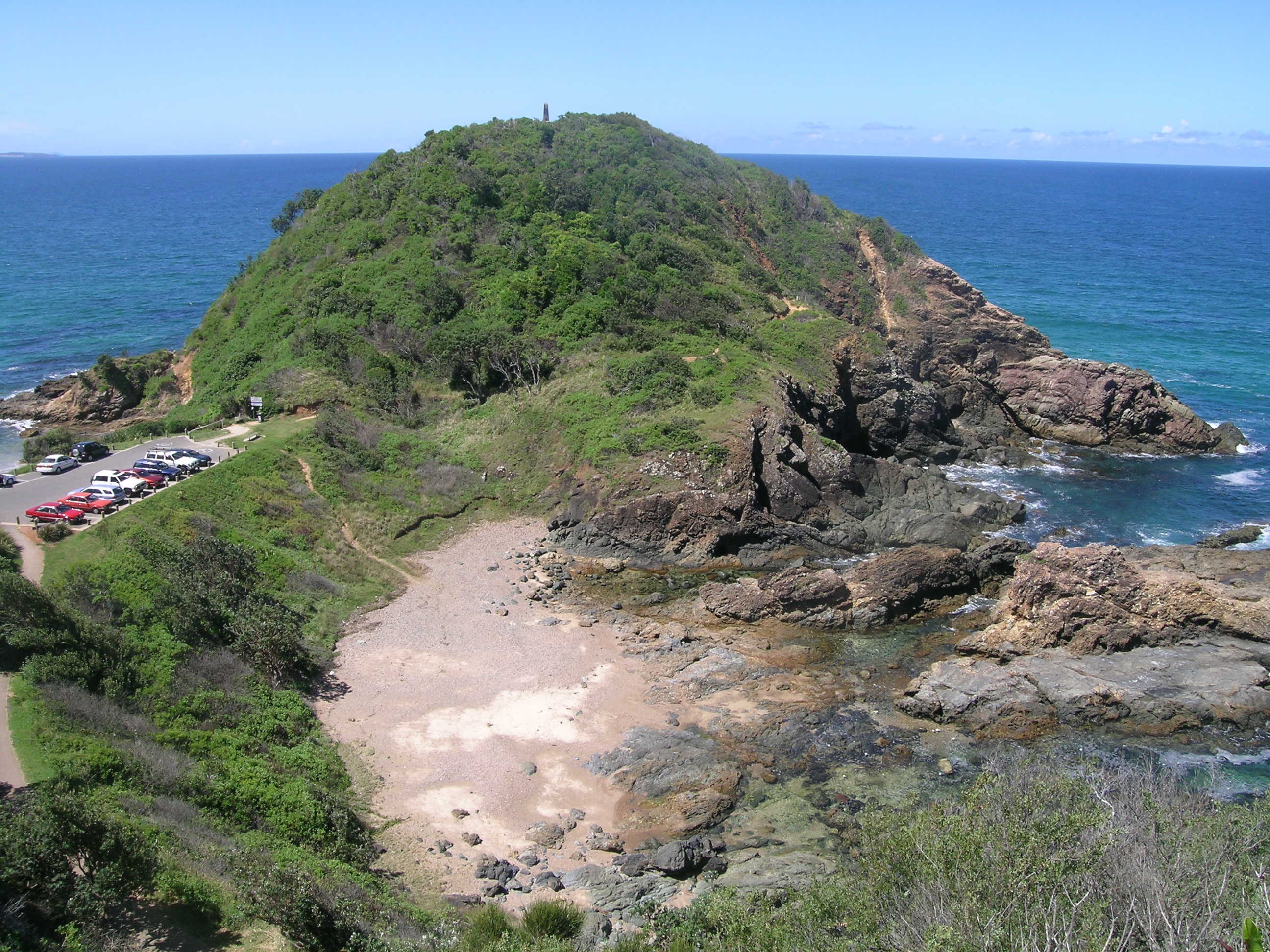
Over 20 shipwrecks occurred in the Tacking Point area before a lighthouse was designed by James Barnet and erected there in 1879 by Shepard and Mortley. Tacking Point Lighthouse is classified by the National Trust of Australia (NSW).
Population
In the 2006 Census the wider area of the Hastings Valley had a total population of 68,429 up 9.5% from the 2001 Census. Port Macquarie is now the fastest growing place in New South Wales. The town is expected to grow from an estimated 43,655 people in 2009 to 58,888 in 2027.[4]
General
Port Macquarie is a retirement destination, known for its extensive beaches and waterways. The town is also known for its koala population, being the home to the Billabong Koala Park, and the Koala Preservation Society's Koala Hospital, caring for koalas injured through bushfire, dog attacks and collisions with vehicles.
In recent times, real estate developments have led to debates with residents, in particular the Rydges Hotel (formerly Four Points by Sheraton) built opposite the Town Green. The Post Office on the Town Green was demolished to make way for a new apartment block, a development that saw the controversial removal of several large fig trees and subsequent debate in the community about the value of public space.
The residential suburbs stretch to Lighthouse Beach in the south, Thrumster to the west and to the north shore, on the north bank of the river. Settlement Point has a new canal development, being one of the most recent real estate developments in the town. More recently, July 2010, Sovereign Hills, has begun development in the west. At present it includes a new school, St Joseph's Regional College, and shortly there be will shopping facilities and residential areas.
To get a first hand impression of life in Port Macquarie, there are plenty of historical documents available for viewing at the Port Macquarie Historical Society.
Suburbs and localities
Transit Hill
Transit Hill is an area in the south of Port Macquarie that provides communication and transport links to the rest of the Port Macquarie Area. The peak of Transit Hill is occupied by telecommunication towers, particularly Optus and Telstra towers.
Transit Hill also features two of Port Macquarie's main arterial roads which provide a direct link between Lighthouse Beach and Port Macquarie CBD. The main intersection of Pacific and Kennedy Drive is situated midway up Transit Hill.
Transit Hill is a mid to high socio-economic community, with houses on Orr Street fetching high sales prices due to its ocean and city views. Transit Hill borders Lighthouse Beach, Dahlsford, Shelley Beach and Waniora.
Beaches
Beaches include (in order from north to south): North Shore, Town Beach, Oxley Beach, Rocky Beach, Flynns Beach, Nobbys Beach, Shelly Beach, Miners Beach and Lighthouse Beach. Only Town, Flynns and Lighthouse Beaches are manned by Surf Life Saving Clubs. Lighthouse beach is only patrolled at the northern end. Dogs can be walked off-leash at Lighthouse Beach, excluding sections at the northern end.
Climate
Port Macquarie has a humid subtropical climate, and is widely regarded as one of the most liveable in Australia.
| Climate data for Port Macquarie | |||||||||||||
|---|---|---|---|---|---|---|---|---|---|---|---|---|---|
| Month | Jan | Feb | Mar | Apr | May | Jun | Jul | Aug | Sep | Oct | Nov | Dec | Year |
| Average high °C (°F) | 27.4 (81.3) |
27.5 (81.5) |
26.3 (79.3) |
24.1 (75.4) |
21.5 (70.7) |
19.5 (67.1) |
18.7 (65.7) |
20.0 (68.0) |
22.4 (72.3) |
24.0 (75.2) |
24.7 (76.5) |
26.6 (79.9) |
23.6 (74.5) |
| Average low °C (°F) | 18.1 (64.6) |
18.3 (64.9) |
16.7 (62.1) |
13.6 (56.5) |
10.5 (50.9) |
7.9 (46.2) |
6.3 (43.3) |
6.7 (44.1) |
9.5 (49.1) |
12.0 (53.6) |
14.9 (58.8) |
16.6 (61.9) |
12.6 (54.7) |
| Precipitation mm (inches) | 136 (5.35) |
155 (6.1) |
165 (6.5) |
124 (4.88) |
118 (4.65) |
113 (4.45) |
76 (2.99) |
66 (2.6) |
66 (2.6) |
73 (2.87) |
147 (5.79) |
98 (3.86) |
1,336 (52.6) |
| Source: Weatherzone [5] | |||||||||||||

Nobby Head, Port Macquarie
Educational facilities
Primary schools
Public schools
- Port Macquarie Public School[6]
- Westport Public School[7]
- Hastings Public School[8]
- Tacking Point Public School[9]
Catholic schools
Other private schools
- Port Macquarie Adventist School[13]
- Heritage Christian School[14]
- St Columba Anglican School (Kindergarten to Year 12)[15]
High schools
Public schools
Private schools
- Heritage Christian School[14]
- St. Joseph's Regional College[18]
- St. Paul's High School[19]
- Newman Senior Technical College (Year 11 & 12)[20]
- Mackillop Senior College (Year 11 & 12)[21]
- St Columba Anglican School (Kindergarten to Year 12)[15]
Tertiary educational facilities
There is also a TAFE campus for further qualifications. Courses are also offered by the University of Newcastle through the TAFE campus. In 2012, Charles Sturt University set up a campus with plans to extend its range of programs. This was in response to significant research designed to retain young people in the area and contribute to the growth of the educational standards for the Hastings region.
Transport links
Port Macquarie is linked by daily air services to Sydney and Brisbane.
Port Macquarie is linked by a 6 Day Shuttle Service called Holiday Coast Connections. The area they service is Port Macquarie, Lake Cathie,Bonny Hills,Laureiton, Kew, Taree, Forster, Bulahdelah, Newcastle Airport, Newcastle Railway, John Hunter Hospital, Mater Hospital and Newcastle Uni.
Road access is via the Pacific and Oxley Highways. The Pacific Highway lies between Port Macquarie and Wauchope, and is the main road for tourists travelling from coastal areas. Improvements to the Oxley and Pacific Highway has seen steady improvements in travel times between Sydney and the mid-north coast region from 6 hours to just 4 hours (from Wahroonga to the Oxley Highway interchange);
The four proposed or in-construction road projects that are underway:
- Karuah to Bulahdelah section 2 and 3 - Under construction[22] (Karuah to Bulahdelah section 1 - Completed December 2006).[23]
- Bulahdelah Bypass - Early works commenced in November 2007.[24][25][26][27][28][29] The Bulahdelah bypass/upgrade will fill the only missing link between Hexham and Port Macquarie once the Karuah to Bulahdelah section(s) 2 and 3 and the Coopernook to Herons Creek upgrades are open in 2010.[30]
- Coopernook to Herons Creek - Under construction.[31][32]
- The Oxley Highway upgrade, from a 2 lane undivided road to a 4-lane divided carriageway, from Wrights Road to the Pacific Highway, Completed.[33]
These four projects are all from the AusLink funding on a 50/50 "joint basis" from the Commonwealth and the state of NSW (50% from Commonwealth Government and the other 50% from the NSW Government.[34]
There is no railway station in Port Macquarie. The closest station providing passenger service is located in Wauchope (19 kilometres (12 mi) inland) on the North Coast Railway Line. A bus transfer service is available from Port Macqaurie to Wauchope station.
Port Macquarie Airport has regular flights to Sydney with QantasLink (5 times daily) and Virgin Australia (twice daily), and also to Lord Howe Island with QantasLink and Brisbane with Virgin Australia.
Annual events
- Mountain Bike Festival of Australia - Port Macquarie (First weekend of June)
- Festival of the Sun (December)
- Sundowner BREAM Classic (November)
- Pacific Coast Slam (January)
- Ironman
- ORARC’s Annual Field Day Weekend
Oxley Region Amateur Radio Club Field Day (Queens Birthday Long Weekend) [Radio direction Finding (Fox Hunting) Radio Swap meet (Ham Radio/Amateur Radio) VK4-ICE Communications]
Sat-Sun 9th & 10th June 2012 (during the Queens Birthday Weekend) Tacking Point Surf Life Saving Club Hall Matthew Flinders Drive, Lighthouse Beach, Port Macquarie.
See also
References
- ^ "3218.0 - Regional Population Growth, Australia, 2009-10: Population Estimates by Statistical District, 2001 to 2010". Australian Bureau of Statistics. 31 March 2011. http://www.abs.gov.au/AUSSTATS/abs@.nsf/DetailsPage/3218.02009-10?OpenDocument. Retrieved 23 August 2011. Estimated resident population (ERP) at 30 June 2010.
- ^ Hughes, Robert, The Fatal Shore, London, Pan, 1988. (ISBN 0-330-29892-5)
- ^ Donald, J.Kay, Exploring the North Coast and New England, Kangaroo Press, Kenthurst, 1978, ISBN 0-86417-121-8
- ^ "We're the State's Boom Town". Portnews.com.au. 2009-07-03. http://www.portnews.com.au/news/local/news/general/were-the-states-boom-town/1557576.aspx. Retrieved 2010-09-08.
- ^ "Weatherzone: Port Macquarie, New South Wales Records and Averages". Weatherzone. http://www.weatheone.com.au. Retrieved 22 Nov 2011.
- ^ "Port Macquarie Public School | Home". Portmac-p.schools.nsw.edu.au. http://www.portmac-p.schools.nsw.edu.au/sws/view/home.node. Retrieved 2010-09-08.
- ^ "Westport Public School". westport-p.schools.nsw.edu.au. http://www.westport-p.schools.nsw.edu.au/. Retrieved 21 November 2010.
- ^ "Hastings Public School | Home". Hastings-p.schools.nsw.edu.au. http://www.hastings-p.schools.nsw.edu.au/sws/view/home.node. Retrieved 2010-09-08.
- ^ "Tacking Point Public School, Home Page". Tackingpt-p.schools.nsw.edu.au. http://www.tackingpt-p.schools.nsw.edu.au/. Retrieved 2010-09-08.
- ^ "St Joseph's Primary School, Port Macquarie - Home". Pmacjlism.catholic.edu.au. 2008-01-20. http://www.pmacjlism.catholic.edu.au/. Retrieved 2010-09-08.
- ^ "St Peter's Primary School, Port Macquarie - Home". Pmacplism.catholic.edu.au. 2008-01-20. http://www.pmacplism.catholic.edu.au/. Retrieved 2010-09-08.
- ^ "St Agnes' Primary School, Port Macquarie - Home". Pmacalism.catholic.edu.au. 2008-01-20. http://www.pmacalism.catholic.edu.au/. Retrieved 2010-09-08.
- ^ "Port Macquarie Adventist School - Home". Portmacquarie.adventist.edu.au. http://www.portmacquarie.adventist.edu.au/. Retrieved 2010-09-08.
- ^ a b "Welcome to Heritage Christian School". Heritage.nsw.edu.au. 2010-03-03. http://www.heritage.nsw.edu.au/. Retrieved 2010-09-08.
- ^ a b "Welcome to St Columba Anglican School". scas.nsw.edu.au. http://www.scas.nsw.edu.au/.
- ^ "Port Macquarie High School". Portmac-h.schools.nsw.edu.au. http://www.portmac-h.schools.nsw.edu.au/. Retrieved 2010-09-08.
- ^ "home". Westport-h.schools.nsw.edu.au. http://www.westport-h.schools.nsw.edu.au/. Retrieved 2010-09-08.
- ^ "?". http://www.pmreglism.catholic.edu.au/. http://www.pmreglism.catholic.edu.au//.
- ^ "St. Pauls Campus". Intranet.pmstp.lism.catholic.edu.au. http://intranet.pmstp.lism.catholic.edu.au/. Retrieved 2010-09-08.
- ^ "Newman Senior Technical College". Newman.nsw.edu.au. http://www.newman.nsw.edu.au/. Retrieved 2010-09-08.
- ^ "Mackillop Senior Campus". Intranet.pmmac.lism.catholic.edu.au. http://intranet.pmmac.lism.catholic.edu.au/. Retrieved 2010-09-08.
- ^ "Karuah to Bulahdelah sections 2 and 3". K2b.abigroup.com.au. http://www.k2b.abigroup.com.au/. Retrieved 2010-09-08.
- ^ "?". bh.com.au. http://www.bh.com.au/k2b1/.
- ^ "$123 million Bulahdelah highway bypass approved". taree.yourguide.com.au. http://taree.yourguide.com.au/detail.asp?class=news&subclass=general&story_id=1027551&category=general.
- ^ "?". myallcoast.yourguide.com. http://myallcoast.yourguide.com.au/detail.asp?class=news&subclass=general&story_id=1047686&category=general.
- ^ "?". myallcoast.yourguide.com.au. http://myallcoast.yourguide.com.au/detail.asp?story_id=1037321.
- ^ "Bulahdelah upgrade". rta.nsw.gov.au. 2010-05-04. http://www.rta.nsw.gov.au/constructionmaintenance/majorconstructionprojectsregional/pacifichighwayupgrade/bulahdelah/index.html. Retrieved 2010-09-08.
- ^ "?". tarre.yourguide.com.au. http://taree.yourguide.com.au/detail.asp?story_id=1027551.
- ^ "Project Details". auslink.gov.au. http://www.auslink.gov.au/projects/ProjectDetails.aspx?Project_id=NSWUA0007. Retrieved 2010-09-08.
- ^ "Bulahdelah Bypass Funding Approved". New South Wales Department of Local Government, Territories and Roads. 2007-06-21. http://www.ministers.dotars.gov.au/jl/releases/2006/May/l50_2006.htm.
- ^ "Coopernook to Herons Creek website". http://www.c2hc.com.au/index.html.
- ^ "Moorland truck stop's uncertain future". taree.yourguide.com.au. http://taree.yourguide.com.au/detail.asp?class=news&subclass=general&story_id=1040894&category=general.
- ^ "RTA; Oxley Highway Upgrade - Wrights Road to the Pacific Highway Port Macquarie". 163.189.7.150. http://163.189.7.150/constructionmaintenance/majorconstructionprojectsregional/northcoast/oxleyhwy/index.html. Retrieved 2010-09-08.
- ^ "AusLink budget 2007/08 - Pressing ahead with the pacific and hume highways". ministers.dotars.gov.au. http://www.ministers.dotars.gov.au/mv/releases/2007/May/TRS02_budget_2007.htm.
External links
- Port Macquarie-Hastings Council
- Port Macquarie Tourist Information
- Port Macquarie Koala Hospital
- Festival of the Sun
- Port Macquarie Hastings Municipal Band
- Greater Port Macquarie Focus Magazine
- St Columba Anglican School
- Greater Port Macquarie Discover Magazine
- Port Macquarie Holiday Guide
- Port Macquarie.info
- Port News
| ||||||||||||||||||||||||||
| This page uses content from the English language Wikipedia. The original content was at Port Macquarie. The list of authors can be seen in the page history. As with this Familypedia wiki, the content of Wikipedia is available under the Creative Commons License. |