| ||||||||||||||
| Ranga Reddy district రంగా రెడ్డి జిల్లా Rangareddy District, R.R. District |
|
|---|---|
| — District — | |
 |
|

Ranga Reddy district |
|
| Coordinates: Coordinates: | |
| Country | |
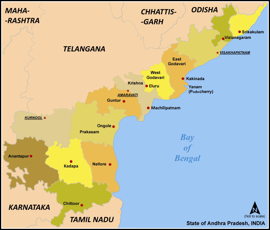
| State | Andhra Pradesh |
| Region | Telangana |
| Government | |
| • Collector & District Magistrate | |
| Population (2001) | |
| • Total | 3,575,064 |
| • Density | 473,000/km2 (1,230,000/sq mi) |
| Languages | |
| • Official | Telugu |
| Time zone | IST (UTC+5:30) |
| PIN | 500 xxx |
| Telephone code | 91- |
| Climate | Aw (Köppen) |
| Precipitation | 603 millimetres (23.7 in) |
| Avg. annual temperature | 26.0 °C (78.8 °F) |
| Avg. summer temperature | 45.9 °C (114.6 °F) |
| Avg. winter temperature | 23.5 °C (74.3 °F) |
| Website | rangareddy.ap.nic.in |
K. V. Ranga Reddy district (Telugu: రంగా రెడ్డి జిల్లా, Urdu: رنگاریڈی ضلع) (sometimes spelled as Ranga Reddy or R.R. District) is a district in the state of Andhra Pradesh, India. Ranga Reddy District was formed in 1978 when it was split from Hyderabad district.[1] The district has an area of 7,493 km², and a population of 3,575,064 of which 54.20% is urban as of 2001.[1] The district encircles the city and district of Hyderabad, and the city of Hyderabad also serves as the administrative center of the district. It is the most populous district of Andhra Pradesh (out of 23).[2]
The district has 1055 villages and grouped in 37 mandals.[3]
History[]
Originally named Hyderabad (Rural) district, it was renamed after Konda Venkata Ranga Reddy, a freedom fighter who fought for the independence of Telangana from the Nizams and who went on to become the deputy chief minister of Andhra Pradesh.
Geography[]
Ranga Reddy District occupies an area of approximately 7,500 square kilometres (2,900 sq mi),[4] comparatively equivalent to Papua New Guinea's New Ireland.[5]
A fresh water reservoir, called Osman Sagar, on the river Musi at Gandipet is the prime drinking water source to the capital city of Hyderabad.
Economy[]
- Medium-scale industries and Cement Corporation Of India (CCI)'s cement factories are established at Tandur.
- Another major company is Hyderabad Chemicals and Fertilizers, established at Moula-Ali in 1942.
In 2006 the Indian government named Ranga Reddy one of the country's 250 most backward districts (out of a total of 640).[6] It is one of the thirteen districts in Andhra Pradesh currently receiving funds from the Backward Regions Grant Fund Programme (BRGF).[6]
Divisions[]
Assembly Constituencies[]
There are 14 assembly constituencies in Ranga Reddy district. They are Medchal, Malkajgiri, Qutbullapur, Kukatpally, Uppal, Ibrahimpatnam, L B Nagar, Maheshwaram, Rajendranagar, Serilingampally, Chevella, Pargi, Vikarabad and Tandur.
Mandals[]
Mandals are third-level administrative areas in India, below states and districts. There are 37 mandals in Ranga Reddy district:
- Balanagar
- Bantwaram
- Basheerabad
- Chevella
- Dharur
- Doma
- Gandeed
- Ghatkesar
- Hayathnagar
- Ibrahimpatnam
- Khandukur
- Keesara
- Kulkacharla
- Maheswaram
- Malkajgiri
- Manchal
- Marpalle
- Medchal
- Moinabad
- Mominpet
- Nawabpet
- Pargi
- Peddemul
- Pudur
- Quthbullapur
- Rajendranagar
- Saroornagar
- Serilingampalle
- Shabad
- Shamirpet
- Shamshabad
- Shankarpalli
- Tandur
- Uppal Kalan
- Vikarabad
- Yacharam
- Yalal
Demographics[]
According to the 2011 census Ranga Reddy District has a population of 5,296,396 ,[2] roughly equal to the nation of Finland[7] or the US state of Minnesota.[8] This gives it a ranking of 17th in India (out of a total of 640).[2] The district has a population density of 707 inhabitants per square kilometre (1,830 /sq mi) .[2] Its population growth rate over the decade 2001-2011 was 48.15 %.[2] Rangareddy has a sex ratio of 955 females for every 1000 males,[2] and a literacy rate of 78.05 %.[2]
Education[]
The Acharya N. G. Ranga Agricultural University has a campus at Rajendranagar in this district.
References[]
- ^ Law, Gwillim (2011-09-25). "Districts of India". Statoids. http://www.statoids.com/yin.html. Retrieved 2011-10-11.
- ^ a b c d e f g "District Census 2011". Census2011.co.in. 2011. http://www.census2011.co.in/district.php. Retrieved 2011-09-30.
- ^ http://rangareddy.nic.in/DPEP/DATA/district%20profile.htm
- ^ Srivastava, Dayawanti et al. (ed.) (2010). "States and Union Territories: Andhra Pradesh: Government". India 2010: A Reference Annual (54th ed.). New Delhi, India: Additional Director General, Publications Division, Ministry of Information and Broadcasting (India), Government of India. pp. 1111–1112. ISBN 978-81-230-1617-7.
- ^ "Island Directory Tables: Islands by Land Area". United Nations Environment Program. 1998-02-18. http://islands.unep.ch/Tiarea.htm. Retrieved 2011-10-11. "New Ireland 7,404km2"
- ^ a b Ministry of Panchayati Raj (September 8, 2009). "A Note on the Backward Regions Grant Fund Programme". National Institute of Rural Development. http://www.nird.org.in/brgf/doc/brgf_BackgroundNote.pdf. Retrieved September 27, 2011.
- ^ US Directorate of Intelligence. "Country Comparison:Population". https://www.cia.gov/library/publications/the-world-factbook/rankorder/2119rank.html. Retrieved 2011-10-01. "Finland 5,259,250 July 2011 est."
- ^ "2010 Resident Population Data". U. S. Census Bureau. http://2010.census.gov/2010census/data/apportionment-pop-text.php. Retrieved 2011-09-30. "Minnesota 5,303,925"
External links[]
- Official website
- Birds of Ananthagiri Hills
- Butterflies of Ananthagiri Hills
- Flora of Ananthagiri Hills

|
Medak district |
| ||
| Gulbarga district, Karnataka | Nalgonda district | |||
 Ranga Reddy district | ||||
| Mahbubnagar district |
| |||||||||||||||||
| This page uses content from the English language Wikipedia. The original content was at Ranga Reddy district. The list of authors can be seen in the page history. As with this Familypedia wiki, the content of Wikipedia is available under the Creative Commons License. |