| Main | Births etc |
|---|
| Texel | |||
|---|---|---|---|
| — Municipality — | |||
 |
|||
|
|||
 |
|||
| Coordinates: | |||
| Country | Netherlands | ||
| Province | North Holland | ||
| Area(2006) | |||
| • Total | 463.28 km2 (178.87 sq mi) | ||
| • Land | 161.96 km2 (62.53 sq mi) | ||
| • Water | 301.32 km2 (116.34 sq mi) | ||
| Population (1 January 2007) | |||
| • Total | 13,617 | ||
| • Density | 84/km2 (220/sq mi) | ||
| Source: CBS, Statline. | |||
| Time zone | CET (UTC+1) | ||
| • Summer (DST) | CEST (UTC+2) | ||
| Website | www.texel.nl | ||


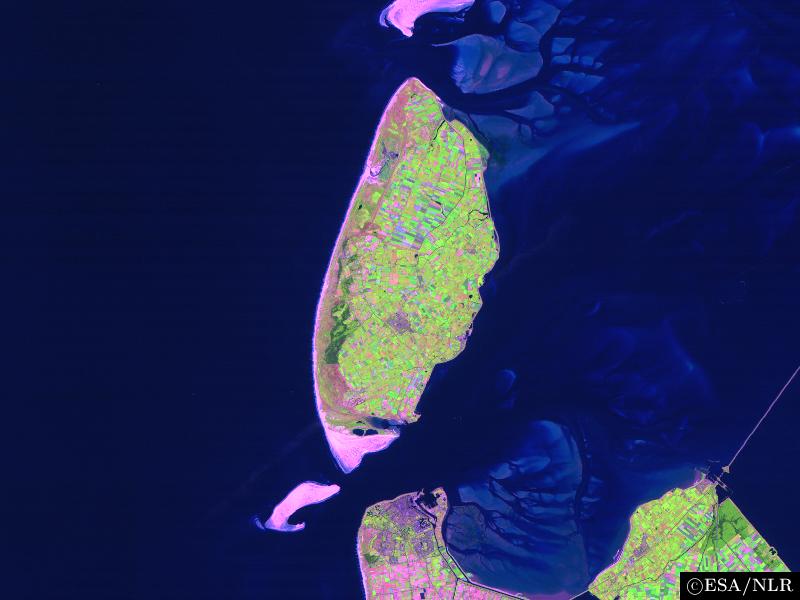
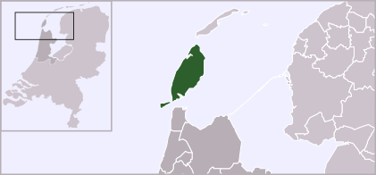
Texel is a municipality and an island in the Netherlands, in the province of North Holland. It is the largest and most populated of the Frisian Islands in the Wadden Sea, and also the westernmost of this archipelago, which extends to Denmark. The next island in the archipelago, to the north of Texel, is Vlieland.
The name Texel is Frisian, but because of historical sound-changes in Dutch, where all -x- sounds have been replaced with -s- sounds (compare for instance English Fox, Frisian Fokse, German Fuchs with Dutch Vos), the name is typically pronounced Tessel in Dutch.[1]
Geography[]
The island includes the seven villages De Cocksdorp, De Koog, De Waal, Den Burg, Den Hoorn, Oosterend, and Oudeschild, and the small townships of Bargen, De Nes, Dijkmanshuizen, Driehuizen, Harkebuurt, 't Horntje, Midden-Eierland, Molenbuurt, Nieuweschild, Noorderbuurt, Ongeren, Oost, Spang, Spijkdorp, Tienhoven, Westermient, Zevenhuizen, and Zuid-Eierland.
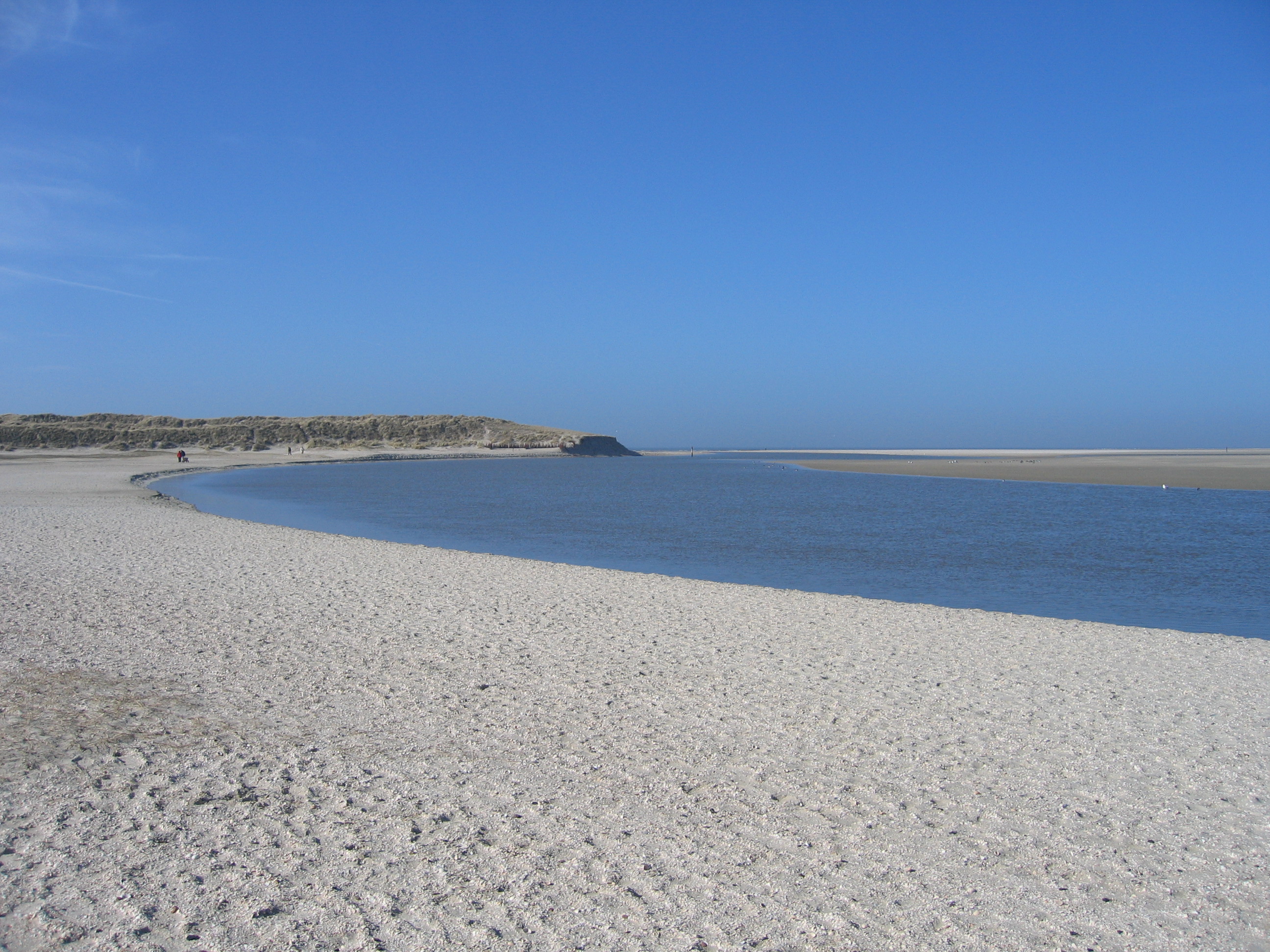

The Slufter
The municipality also includes the uninhabited sand bar of Noorderhaaks. The island of Texel, which received city rights in 1415, originally was made up of two islands, Texel proper to the south and Eierland to the northwest, which were connected by shoals. In the seventeenth century, the islands were poldered together. Today, Texel forms the largest natural barrier between the North Sea and the Wadden Sea.
The dune landscape on Texel is a unique habitat for wildlife. Texel is known for its wildlife, particularly in winter, when birds of prey and geese take up residence. About one third of Texel is a protected nature reserve.
Transport[]
Transport around the island is typically by bicycle, bus (Connexxion) or car. Texel has an extensive cycle path network. Transport to Texel is usually by ferry (Royal TESO), from Den Helder, or by air via Texel International Airport.


New 2005 Ferry "Dokter Wagemaker" from Den Helder to Texel
History[]
In the early Middle Ages and before, Texel and Wieringen may have been much bigger and met each other as opposite banks of the Marsdiep, which was then a river with banks of permanent land: see here.
Notable battles involving Texel:
- 1653 Battle of Scheveningen - During the First Anglo-Dutch War.
- 1673 Battle of Texel - During the Third Anglo-Dutch War.
- 1797 Battle of Camperdown - During the Napoleonic wars.
- 1914 Battle off Texel - During the First World War
- 1945 Georgian Uprising of Texel - During the Second World War
Texel is also famous in military history as the only place that a navy was defeated on horseback. Occupying Holland in January 1795, the French continental army learned that the mighty Dutch navy had been frozen into the ice around Texel Island, so Commandant Louis Joseph Lahure and 128 men simply rode up to it and demanded surrender. No shots were fired.
During the American Revolution, Texel was used as a haven port for the USS Bonhomme Richard before it sank off the coast of Flamborough Head in Britain in September 1779. In that final action, John Paul Jones defeated and captured the British ship HMS Serapis, which he sailed to Texel for desperately needed repairs. This event further complicated Anglo-Dutch relations.
On the night of 31 August 1940, the sea to the northwest of Texel was the scene of the sinking of two British destroyers and the severe damage of a third by German mines in what became known as the Texel Disaster.
Tourism[]
The tourism industry forms a substantial part of the economy in Texel. Approximately 70% of activities on Texel are in some way related to tourism. Popular forms of tourism on Texel include cycling, walking, swimming and horse riding.


A tourist's bicycle with a long stretch of lonely beach in the background on Texel
Local government[]
The municipal council of Texel consists of 15 seats, which are divided as follows [as per April 2010]:
- PvdA - 3 seats
- Texel 2010 - 3 seats
- VVD - 2 seats
- CDA - 2 seats
- Texels Belang - 2 seats
- D66 - 2 seats
- GroenLinks - 1 seat
Climate[]
| Climate data for Texel | |||||||||||||
|---|---|---|---|---|---|---|---|---|---|---|---|---|---|
| Month | Jan | Feb | Mar | Apr | May | Jun | Jul | Aug | Sep | Oct | Nov | Dec | Year |
| Average high °C (°F) | 4 (39) |
7 (45) |
9 (48) |
11 (52) |
16 (61) |
18 (64) |
19 (66) |
23 (73) |
18 (64) |
14 (57) |
9 (48) |
7 (45) |
12.9 (55.3) |
| Average low °C (°F) | 0 (32) |
4 (39) |
5 (41) |
5 (41) |
9 (48) |
12 (54) |
13 (55) |
16 (61) |
13 (55) |
9 (48) |
6 (43) |
4 (39) |
0 (46.4) |
| Precipitation mm (inches) | 30 (1.18) |
68 (2.68) |
35 (1.38) |
28 (1.1) |
64 (2.52) |
67 (2.64) |
80 (3.15) |
59 (2.32) |
56 (2.2) |
245 (9.65) |
99 (3.9) |
165 (6.5) |
996 (39.21) |
| Mean monthly sunshine hours | 50 | 90 | 125 | 170 | 225 | 210 | 215 | 210 | 140 | 100 | 55 | 40 | 1,630 |
| Source: [2] | |||||||||||||
See also[]
- Texel (sheep), a breed of sheep from Texel
References[]
- ^ Donaldson, BC: Dutch: A Linguistic History of Holland and Belgium, page 151, Martinus Nijhoff, 1983
- ^ "Het Weer in Texel. Bekijk Weersverwachting van Texel | Zoover". Zoover.nl. http://www.zoover.nl/nederland/waddeneilanden/texel/weer. Retrieved 2011-02-12.
- "Statistics". SDU Staatscourant. http://www.sdu.nl/staatscourant/gemeentes/gem465nh.htm.
External links[]
| |||||||||||

Template:Frisian Islands
| |||||||||||
| This page uses content from the English language Wikipedia. The original content was at Texel. The list of authors can be seen in the page history. As with this Familypedia wiki, the content of Wikipedia is available under the Creative Commons License. |