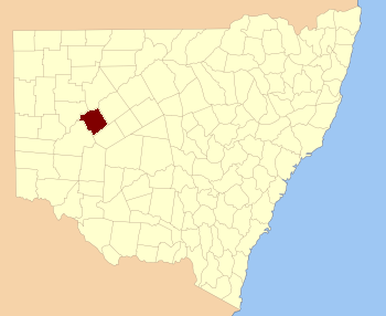
Werunda County is one of the 141 Cadastral divisions of New South Wales . The Darling River is the north-western boundary. It includes Poopelloe Lake , and the area to the east and south-east of Wilcannia .
The name Werunda is believed to be derived from a local Aboriginal word.[1]
Parishes within this county [ ] A full list of parishes found within this county; their current LGA and mapping coordinates to the approximate centre of each location is as follows:
Parish
LGA
Coordinates
Calcoo Central Darling Shire 31°39′10″S 143°35′22″E / -31.65278 , 143.58944 (Calcoo )
Caltigeenaa Central Darling Shire 31°34′55″S 143°52′00″E / -31.58194 , 143.8666667 (Caltigeenaa )
Chance Central Darling Shire 31°30′13″S 144°04′53″E / -31.50361 , 144.08139 (Chance )
Chirnside Central Darling Shire 31°57′38″S 143°45′13″E / -31.96056 , 143.75361 (Chirnside )
Coolmara Central Darling Shire 32°05′22″S 143°49′30″E / -32.08944 , 143.825 (Coolmara )
Coonavittra Central Darling Shire 31°43′05″S 144°18′23″E / -31.71806 , 144.30639 (Coonavittra )
Coonoolcra Central Darling Shire 31°47′18″S 143°35′16″E / -31.78833 , 143.58778 (Coonoolcra )
Cowary
Central Darling Shire unknown
Cultowa Central Darling Shire 31°53′50″S 144°05′40″E / -31.89722 , 144.09444 (Cultowa )
Curranyale
Central Darling Shire unknown
Donald Cobar Shire 31°50′34″S 144°20′34″E / -31.84278 , 144.34278 (Donald )
Dunoon Central Darling Shire 31°31′41″S 143°37′36″E / -31.52806 , 143.62667 (Dunoon )
Goonalgaa Central Darling Shire 31°45′50″S 143°41′28″E / -31.76389 , 143.69111 (Goonalgaa )
Greenough Central Darling Shire 31°34′29″S 144°13′15″E / -31.57472 , 144.22083 (Greenough )
Gunyulka Central Darling Shire 31°41′55″S 143°29′55″E / -31.69861 , 143.49861 (Gunyulka )
Keiss Central Darling Shire 31°30′51″S 143°44′26″E / -31.51417 , 143.74056 (Keiss )
Manara Central Darling Shire 32°11′23″S 143°50′39″E / -32.18972 , 143.84417 (Manara )
Merry Central Darling Shire 31°25′16″S 144°01′55″E / -31.42111 , 144.03194 (Merry )
Moira Central Darling Shire 31°52′54″S 143°54′57″E / -31.88167 , 143.91583 (Moira )
Murtee Central Darling Shire 31°36′34″S 143°31′26″E / -31.60944 , 143.52389 (Murtee )
Paradise Central Darling Shire 31°59′18″S 143°51′37″E / -31.98833 , 143.86028 (Paradise )
Poopelloe Central Darling Shire 31°40′14″S 144°09′22″E / -31.67056 , 144.15611 (Poopelloe )
Ringrose Central Darling Shire 32°02′43″S 144°01′15″E / -32.04528 , 144.02083 (Ringrose )
Talyawalka Central Darling Shire 31°35′48″S 143°41′28″E / -31.59667 , 143.69111 (Talyawalka )
Warwick Cobar Shire 31°56′19″S 144°01′33″E / -31.93861 , 144.02583 (Warwick )
Weatherley Central Darling Shire 31°45′37″S 143°51′16″E / -31.76028 , 143.85444 (Weatherley )
Weeyoola Central Darling Shire 31°46′05″S 144°09′13″E / -31.76806 , 144.15361 (Weeyoola )
Werunda Central Darling Shire 31°29′34″S 143°50′56″E / -31.49278 , 143.84889 (Werunda )
Wilcannia South Central Darling Shire 31°36′12″S 143°23′41″E / -31.60333 , 143.39472 (Wilcannia South )
Wongolarroo Central Darling Shire 31°39′11″S 143°57′20″E / -31.65306 , 143.95556 (Wongolarroo )
Woore
Cobar Shire unknown
Woytchugga Central Darling Shire 31°43′17″S 143°23′13″E / -31.72139 , 143.38694 (Woytchugga )
Yoree Central Darling Shire 31°44′13″S 144°01′56″E / -31.73694 , 144.03222 (Yoree )
References [ ]